East Lynn Lake Shelters
Day-use shelters are open and reservable Friday through Sunday. Check-in is 8:00 AM and check-out is 9:00 PM the same day. No overnight camping is permitted at this facility.
Flood Watch issued October 11 at 10:46AM EDT until October 11 at 9:00PM EDT by NWS Charleston WV
* WHAT...Flash flooding caused by excessive rainfall is possible. * WHERE...Portions of northeast Kentucky, including the following counties, Boyd, Carter, Greenup and Lawrence, southeast Ohio, including the following counties, Gallia, Lawrence OH, Meigs and Washington, and West Virginia, including the following counties, Boone, Braxton, Cabell, Calhoun, Clay, Doddridge, Gilmer, Jackson WV, Kanawha, Lewis, Lincoln, Logan, Mason, Mingo, Pleasants, Putnam, Ritchie, Roane, Tyler, Wayne, Wirt and Wood. * WHEN...Until 9 PM EDT this evening. * IMPACTS...Area creeks and streams are running high and could flood with more heavy rain. * ADDITIONAL DETAILS... - Slow moving heavy showers and thunderstorms associated with the remnant circulation of Isaias are expected to move into the region this afternoon. Some areas have already seen 2 to 3 inches of rainfall and could flood quickly with additional localized heavy rain. - http://www.weather.gov/safety/flood
About
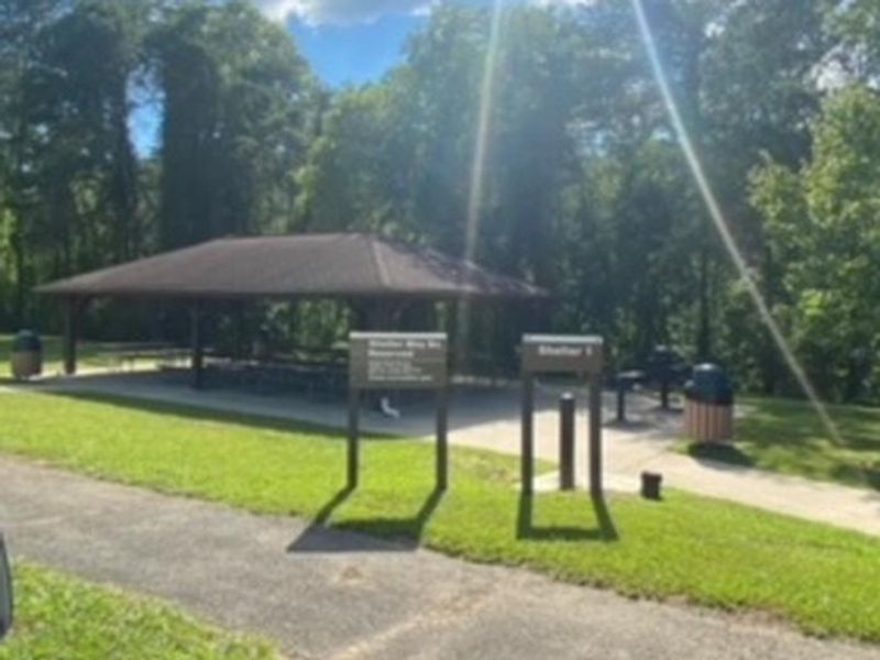
East Lynn Lake Shelters provides four reservable picnic pavilions situated along the northern shore of East Lynn Lake, a 12-mile-long reservoir created by the Army Corps of Engineers in 1970 as part of the Ohio River Basin flood management program. Located 19 miles south of Wayne on State Route 37, the shelters offer distinct settings: Shelters 1 and 2 feature scenic overlooks at the dam with basketball courts and playground access, Shelter 3 occupies a peaceful creek-front location, and Shelter 4 sits directly on the lake with convenient boat ramp access. Each shelter accommodates up to 100 people with parking for 20 vehicles, full shade coverage, and paved driveways. The facilities have water and electric hookups for event use. The surrounding East Lynn Lake offers excellent recreation including boating, water skiing, fishing for bass, crappie, musky, and walleye, plus hiking trails through the adjacent 25,000-acre East Lynn Lake Wildlife Management Area. These are day-use facilities only, not overnight campgrounds. For overnight camping at East Lynn Lake, the separate East Fork Campground offers 167 sites with hookups.
Directions
East Lynn Lake is 19 miles south of Wayne on State Route 37. The shelters are located near 13253-13243 E Lynn Rd, East Lynn, WV 25512.
Nearby Campgrounds
Amenities
| Water | Yes |
| Fires Allowed | — |
| Toilets | — |
| Dump Station | No |
| Wifi | — |
| Pets Allowed | — |
| Showers | — |
| Electric Hookups | — |
| Water Hookups | — |
| Sewer Hookups | — |
| Camp Store | — |
| Price | $40 |
Vehicle
| Max RV Length | — |
| Max Trailer Length | — |
| Big Rig Friendly | — |
| Pull Through Sites | No |
Contact
| Phone | +1 (304) 849-2355 |
Cell Service
| AT&T | None |
| Verizon | None |
| T-Mobile | None |
Availability
Photos

Community Posts
No posts yet. Be the first to share your experience!