Dripping Springs Campground

Open

The campground is open. Campsites 10-13 are currently closed. Fire use restrictions are in effect through July 31, 2026; campfires are not allowed when elevated fire restrictions are in effect. Current fire danger is moderate. Maximum vehicle length is 27 feet.

Air Quality Alert issued May 20 at 5:44PM PDT by NWS San Diego CA

5:44 PM — May 21st, 5:45 PM

* WHAT...The South Coast AQMD has issued an air quality alert due to increased fine particle pollution from wildfire smoke. Visit https://www.aqmd.gov/alertinfo to check current and forecasted air quality levels. * WHERE...in portions of Riverside, San Bernardino, and Los Angeles Counties. Levels of particle pollution can vary by time and location depending on fire activity and local weather conditions. * WHEN...until Thursday at 10:00 PM. * IMPACTS...Particles in wildfire smoke can get deep into the lungs and cause serious health problems such as heart attacks, strokes, asthma attacks, and difficulty breathing. Everyone can be affected, but people with lung or heart disease, older adults, people who are pregnant, children, and those who spend a lot of time outdoors are at greater risk.

National Forest System Roads

Follow California Vehicle Code on National Forest System Roads

Fireworks and Explosives are always Prohibited

Fireworks and explosives (including explosive targets) are always prohibited on national forest lands. The prohibition of fireworks and exploding targets on national forest system lands is part of a set of permanent fire safety regulations in the Code of Federal Regulations (CFR), listed below.…

Orosco Ridge Closures

Forest Order details the implementation for temporary closures of Orosco Road, Boden Canyon Road, and Santa Ysabel Road to protect arroyo toads and their habitat during sensitive seasonal conditions. These closures will be implemented based on hydrologic and temperature triggers and will remain in…

Fire Use Restrictions

Campfire, charcoal fire restrictions. Smoking area restrictions.

Forest Truck Trail and Road Closures

For additional updated conditions, visit Forest Truck Trail and Road Closures.Contact Information: Cleveland National Forest Supervisor’s Office (phone: 858-673-6180)Forest and road closures change frequently depending on the fire hazard level, weather, and various other unforeseen elements. This…

Prescribed Fires Begin on the Cleveland

The Cleveland National Forest is planning prescribed fire operations this fall & winter. Work will continue through the spring as weather conditions allow. We use prescribed fires to help reduce overgrown vegetation to help protect local communities, infrastructure and natural resources from…

Water Unavailable at Penny Pines Trailhead Spigot

Attention Hikers: There is currently NO WATER available at the Penny Pines Trailhead. The water spigot pump is broken and there is no estimated time of repair at this time. Be prepared to bring or seek out alternative water sources.

Airport Fire Burned Area Closure

The Cleveland NF has closed the Airport Fire burned area perimeter on the Trabuco Ranger District of the Cleveland National Forest. This closure prohibits going into or being upon any National Forest System lands, roads, and trails within the boundaries of the closure. The closure will be in effect…

Camping Stay Limits

This order prohibits extended camping in developed campgrounds, undeveloped areas, and maximum annual camping durations. The purpose of this order is to provide for the protection of natural resources by prohibiting long-term or semi-permanent occupancy of National Forest System lands within the…

Cedar Creek Falls Forest Orders

Forest Order No. 02-23-02 closes the cliffs surrounding the falls, 02-23-03 requires visitors to have a permit to access the falls, 02-23-04 prohibits alcohol along the entirety of the trail system.

Air Quality Alert issued May 19 at 9:42PM PDT by NWS San Diego CA

May 19th, 9:42 PM — 9:45 PM

* WHAT...The South Coast AQMD has issued an air quality alert due to increased fine particle pollution from wildfire smoke. Visit https://www.aqmd.gov/alertinfo to check current and forecasted air quality levels. * WHERE...in portions of Riverside, San Bernardino, and Los Angeles Counties. Levels of particle pollution can vary by time and location depending on fire activity and local weather conditions. * WHEN...until Wednesday at 4:30 PM. * IMPACTS...Particles in wildfire smoke can get deep into the lungs and cause serious health problems such as heart attacks, strokes, asthma attacks, and difficulty breathing. Everyone can be affected, but people with lung or heart disease, older adults, people who are pregnant, children, and those who spend a lot of time outdoors are at greater risk.

Air Quality Alert issued May 19 at 9:37PM PDT by NWS San Diego CA

May 19th, 9:37 PM — 9:45 PM

* WHAT...The South Coast AQMD has issued an air quality alert due to increased fine particle pollution from wildfire smoke. Visit https://www.aqmd.gov/alertinfo to check current and forecasted air quality levels. * WHERE...in portions of Riverside, San Bernardino, and Los Angeles Counties. Levels of particle pollution can vary by time and location depending on fire activity and local weather conditions. * WHEN...until Tuesday evening. * IMPACTS...Particles in wildfire smoke can get deep into the lungs and cause serious health problems such as heart attacks, strokes, asthma attacks, and difficulty breathing. Everyone can be affected, but people with lung or heart disease, older adults, people who are pregnant, children, and those who spend a lot of time outdoors are at greater risk.

About

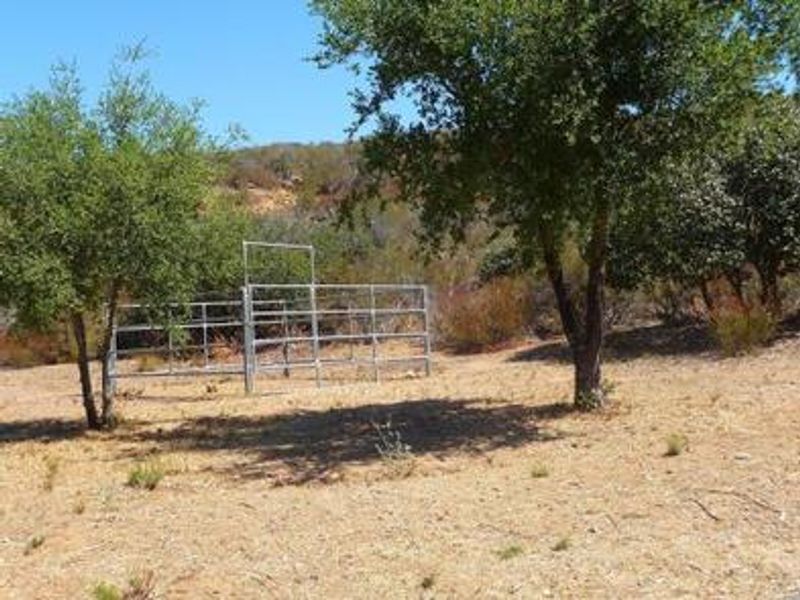
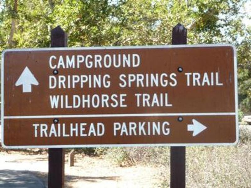
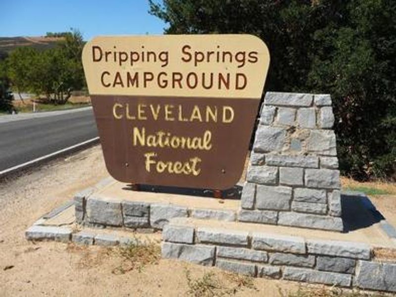
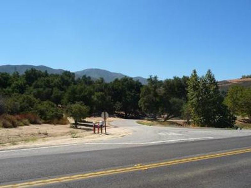
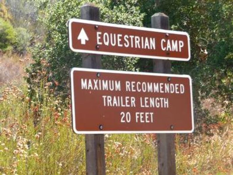
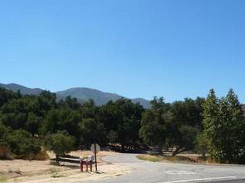
Dripping Springs Campground provides access to the Agua Tibia Wilderness in the Palomar Mountains of Cleveland National Forest. The campground features 34 single campsites and 9 dedicated equestrian sites with two horse corrals, catering to hikers, backpackers, and equestrians. The surrounding hills are covered in Southern California chaparral, while coniferous forest lines the mountain tops above. The campground sits adjacent to sensitive riparian habitat that supports the endangered arroyo toad. Over 30 miles of local trails are accessible via the Wildhorse and Dripping Springs trailheads, with connections to Palomar-Magee and Cutca trails for extended day hikes or multi-day loops through the 20-mile wilderness circuit. Facilities include vault toilets and potable water. The campground is located 11 miles east of Temecula off Highway 79, placing it within easy reach of Temecula Wine Country while still offering a backcountry experience.

Directions

From Temecula, drive 11 miles east on Highway 79. The campground is at 38441 Hwy 79, Temecula, CA 92592.

Amenities

Water Yes
Fires Allowed
Toilets Yes
Dump Station No
Wifi No
Pets Allowed
Showers No
Electric Hookups
Water Hookups
Sewer Hookups
Camp Store No
Price $25

Vehicle

Max RV Length 25ft
Max Trailer Length 27ft
Big Rig Friendly No
Pull Through Sites No

Contact

Email SM.FS.PalomarRD@usda.gov
Phone +1 (760) 788-0250

Cell Service

AT&T Yes
Verizon Yes
T-Mobile Yes

Availability

Photos

Dripping Springs signs
Dripping Springs view

Community Posts

No posts yet. Be the first to share your experience!