Coles Point
This is a day-use area only with no overnight camping. The facility operates seasonally from Memorial Day Weekend through Labor Day Weekend. Picnic shelters are reservable; day-use fee is $5 per vehicle.
About
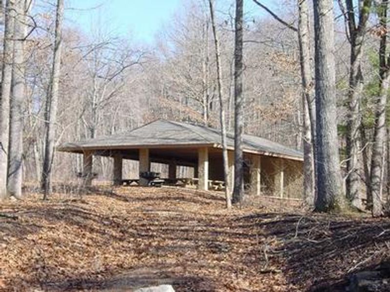
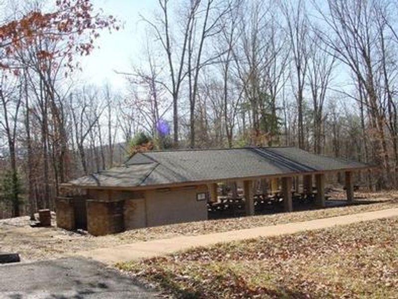
Coles Point Day Use Area occupies a scenic peninsula on Lake Moomaw's south shore in Alleghany County, Virginia. The 2,530-acre reservoir on the Jackson River offers 43 miles of wooded shoreline and excellent fishing for largemouth and smallmouth bass, brown trout, bluegill, crappie, and catfish. The facility features two group picnic shelters, each accommodating up to 50 people and 20 vehicles, equipped with eight picnic tables, two large barbecue grills, an electrical outlet, potable water, and flush toilets. A swimming beach with bathhouse, two boat ramps, and two fishing docks provide lake access. The 1-mile Morris Hill Bike Trail and 3-mile Fortney Loop Trail offer hiking opportunities. This is a day-use area only with no overnight camping permitted. Campers should look to nearby Morris Hill Campground, located about a half-mile away overlooking the lake.
Directions
From I-64 at Exit 16A in Covington, follow signs to US Highway 220 and travel north about 5.5 miles. Turn left on State Road 687/Jackson River Road and travel about 3.2 miles. Turn left on State Road 641/Indian Draft Road, which becomes State Road 666. Travel about 4.2 miles to a 3-way intersection. Turn right on State Road 605 and travel 4.5 miles past Morris Hill Campground entrance and across Gathright Dam.
Nearby Campgrounds
Amenities
| Water | Yes |
| Fires Allowed | No |
| Toilets | Yes |
| Dump Station | No |
| Wifi | — |
| Pets Allowed | Yes |
| Showers | Yes |
| Electric Hookups | — |
| Water Hookups | — |
| Sewer Hookups | — |
| Camp Store | No |
| Price | $85 |
Vehicle
| Max RV Length | — |
| Max Trailer Length | — |
| Big Rig Friendly | — |
| Pull Through Sites | No |
Contact
| Phone | +1 (540) 279-4144 |
Cell Service
| AT&T | None |
| Verizon | None |
| T-Mobile | None |
Availability
Photos
Community Posts
No posts yet. Be the first to share your experience!