Yuba River
Open

Open for the 2026 season. The campground operates from mid-April through mid-October. Some sites are first-come-first-served while others are reservable through Recreation.gov. Fire restrictions may apply seasonally.

National Forest System Roads

Follow California Vehicle Code on National Forest System Roads

Fireworks and Explosives are always Prohibited

Fireworks and explosives (including explosive targets) are always prohibited on national forest lands. The prohibition of fireworks and exploding targets on national forest system lands is part of a set of permanent fire safety regulations in the Code of Federal Regulations (CFR), listed below.…

Downieville Downhill Closure Order

Closure of identified forest roads and trails for Downieville Downhill.

Big Chief Sale Closure

This order closes forest system roads and trails within the Big Chief project area. This closure is to provide for public safety while 675 acres of forest are treated to enhance wildfire defense in the area.

Woodchopper Timber Sale Closure

Closure of the Woodchopper project area to allow for timber removal and wildfire risk reduction work.

Boca Stewardship Agreement Closure

Closure of the Boca Stewardship Agreement project area to allow for wildfire risk reduction work.

Cabin Creek Closure

Closure for the Cabin Creek Project area to allow for wildfire risk reduction work.

Rattlesnake Road Closure

Closure of Rattlesnake Road to allow for PG&E to complete the Lake Fordyce Dam Seepage Mitigation Project.

Alpine Meadows Stewardship Agreement Closure

This order closes the Alpine Meadows Project area to allow forest restoration work to take place.

Alder 89 Timber Sale Closure

Closure of Alder 89 WUI Timber Sale area.

Sugar Pine Roadside Fuel Break Project

Tahoe National Forest contractors are conducting fuels reduction work in the Sugar Pine Reservoir area. Contractors will be masticating ladder fuels to reduce wildfire risk adjacent to North Brimstone Rd (24) between Sugar Pine Rd and Big Reservoir Rd. There may be unexpected hazards such as flying…

Parking Restrictions

Parking or leaving a vehicle is prohibited on Tahoe National Forest where posted.

14-day Camping Occupancy Restrictions

Camping on the Tahoe National Forest is limited to 14 days in a calendar year.

PRESCRIBED FIRE NOTICE: McNair & Quail Landings - 59 acres

Tahoe National Forest is planning to conduct a prescribed burn in the Calpine area, conditions permitting. Smoke will be visible from Calpine, Sierraville, Loyalton and surrounding areas.  Smoke may settle overnight in valleys, drainages, and throughout the surrounding communities.  Smoke will…

Snow Grooming Updates

Grooming operations have ceased pending new storms. Conditions are more like late April/May than March. Expect running water and thin snow coverage. Trailhead location for Little Truckee Summit staging is currently at the Perazzo turnoff. GROOMING PROGRAM: Snowmobile trail grooming is funded by…

Sierraville Ranger District Trail Closure

Forest Trail 16E87 (Boca-Loyalton Trail) is closed for public health and safety.

Camping and Campfire Restrictions-Truckee and Sierraville Districts

Pursuant to 16 U.S.C. § 551 and 36 C.F.R. § 261.50(a) and (b), and to provide for public safety and toprotect natural resources, the following acts are prohibited within the Truckee and Sierraville RangerDistricts of the Tahoe National Forest. This Order is effective from July 1, 2025, through…

Highway 20 Area Camping Restrictions

To provide for public safety and to protect natural resources, the following acts are prohibited within the Tahoe National Forest.

14-day Camping Occupancy Restrictions

Camping on the Tahoe National Forest is limited to 14 days in a calendar year.

Hoke Valley- Forest Road 860-07 (17E11 Trail) Closed

Forest Road 860 -01 (17E11 Trail) in the Hoke Valley area has been closed to allow for Hoke Valley Meadow restoration.

About

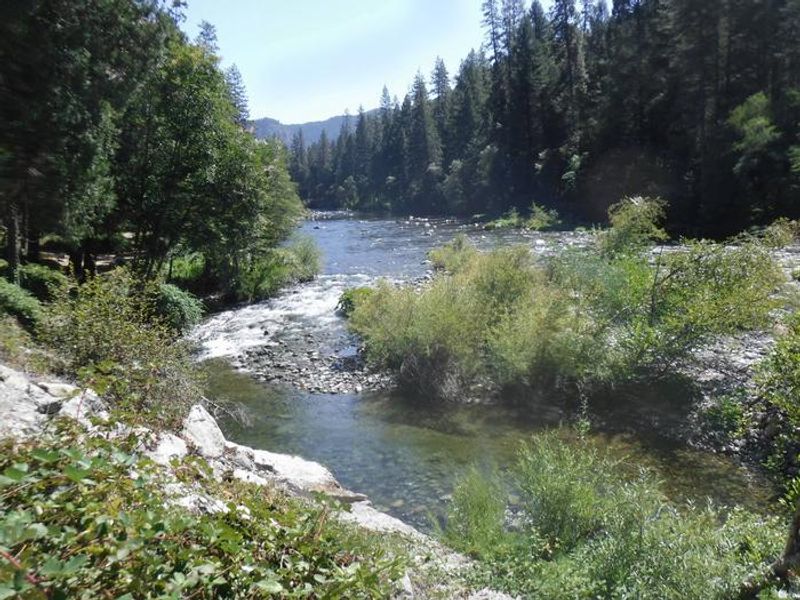
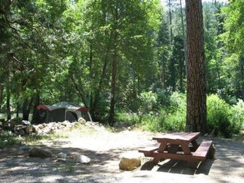
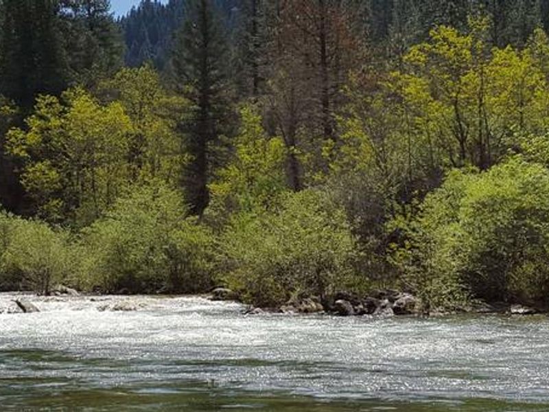
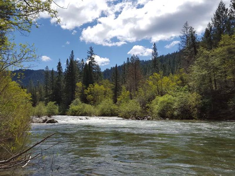
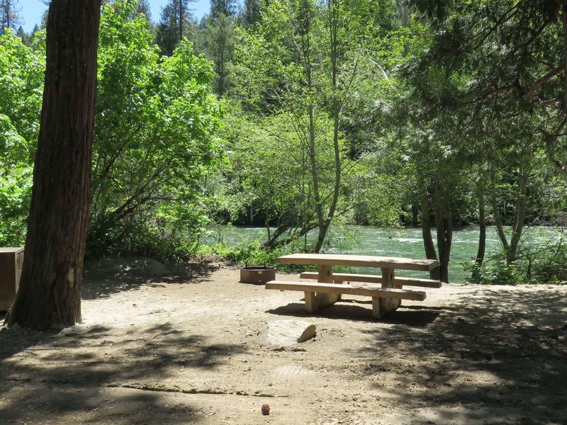
Carlton Flat Campground occupies a scenic stretch along the North Yuba River in the Tahoe National Forest, accessible directly from Highway 49 about 13 miles south of Downieville. At 2,200 feet elevation, the 17 campsites sit beneath stands of cedar, ponderosa pine, and oak trees that provide welcome shade during warm summer afternoons. Each site includes a fire ring and picnic table, with vault toilets and piped drinking water available throughout the campground. The North Yuba River is the main attraction here, offering swimming holes, wading areas, and rainbow trout fishing directly from camp. Seasonal rafting and kayaking draw paddlers when water levels permit. The nearby Rocky Rest trailhead provides access to the North Yuba River Trail for hiking and mountain biking, while OHV trails thread through the surrounding forest. Bear activity is present in the area, so proper food storage in approved containers is required. The campground operates under a mixed reservation and first-come-first-served system through Recreation.gov.

Directions

From Downieville, travel south on Highway 49 for 13 miles; the campground is on the left. From Camptonville, drive 9 miles northeast on Highway 49.

Amenities

Water Yes
Fires Allowed Yes
Toilets Yes
Dump Station No
Wifi No
Pets Allowed
Showers No
Electric Hookups
Water Hookups
Sewer Hookups
Camp Store No
Price $24

Vehicle

Max RV Length
Max Trailer Length
Big Rig Friendly
Pull Through Sites No

Contact

Phone +1 (530) 478-6253

Cell Service

AT&T None
Verizon None
T-Mobile None

Availability

Photos

Yuba River
Carlton Campground
North Fork Yuba River at Carlton
Campsite Carlton

Community Posts

No posts yet. Be the first to share your experience!