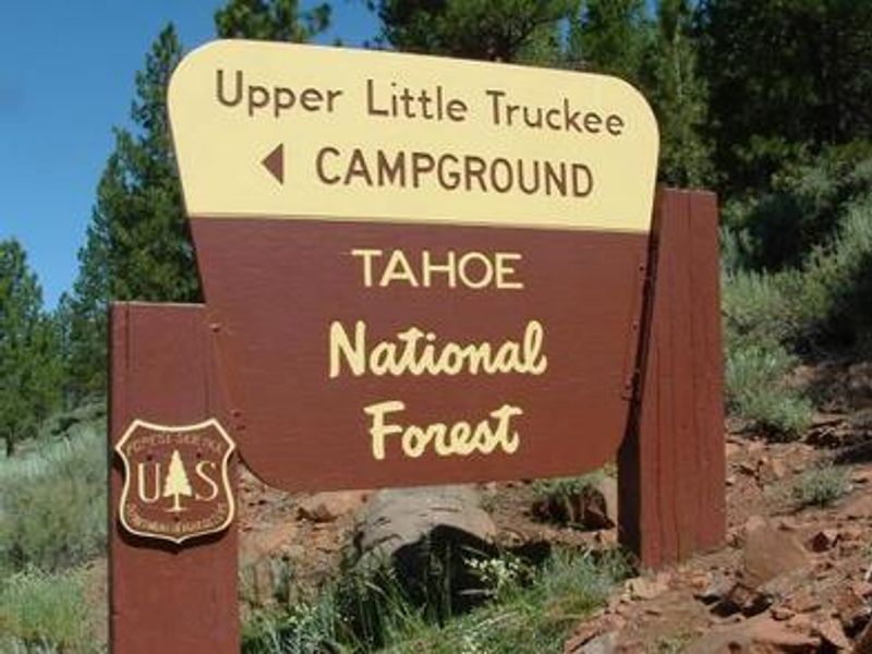
Upper Little Truckee
Open for the season. Sites are available through Recreation.gov and first-come-first-served. Check-in at 2:00 PM, check-out at 12:00 PM. Fire restrictions may be imposed during hot, dry conditions.
National Forest System Roads
Follow California Vehicle Code on National Forest System Roads
Fireworks and Explosives are always Prohibited
Fireworks and explosives (including explosive targets) are always prohibited on national forest lands. The prohibition of fireworks and exploding targets on national forest system lands is part of a set of permanent fire safety regulations in the Code of Federal Regulations (CFR), listed below.…
Downieville Downhill Closure Order
Closure of identified forest roads and trails for Downieville Downhill.
About
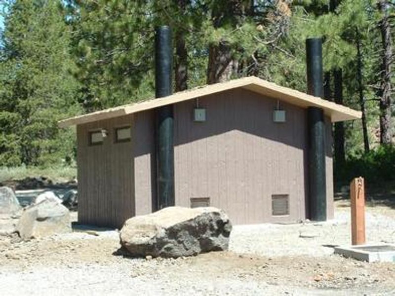
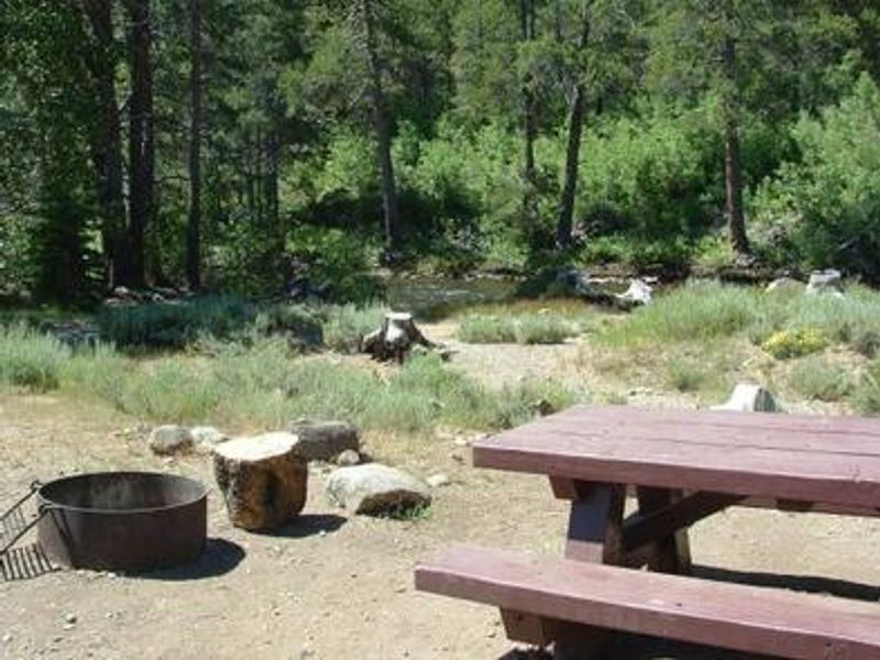
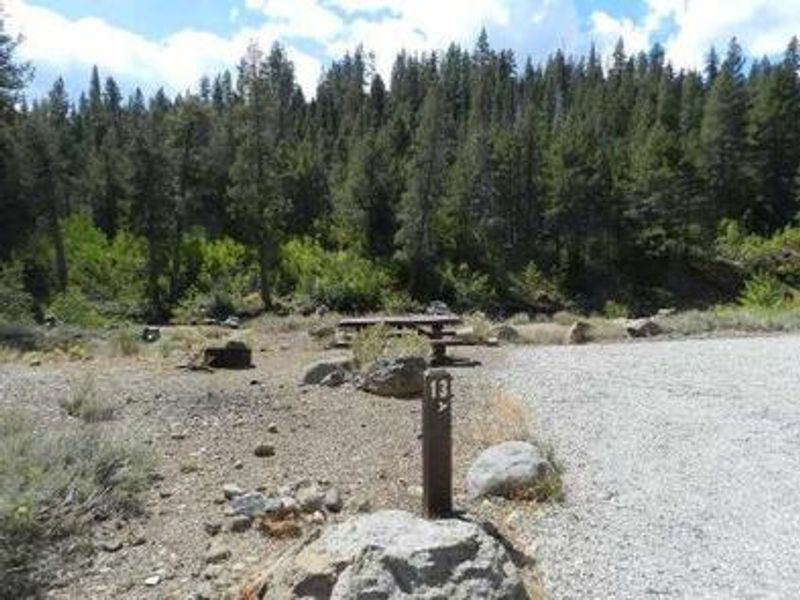
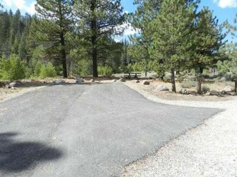
Upper Little Truckee Campground occupies a scenic stretch along the Little Truckee River in the Tahoe National Forest, approximately 12 miles north of Truckee via Highway 89. At 6,200 feet elevation, the campground is forested with lodgepole pine, aspen, and juniper trees that provide partial shade, with several sites offering river views. The 22 sites include 21 standard single-family sites and one group site accommodating up to 25 people. Each site features a picnic table and campfire ring, with vault toilets and drinking water available throughout the campground. Fishing for rainbow and brown trout in the Little Truckee River draws many visitors, and the surrounding national forest provides hiking and mountain biking opportunities. The town of Truckee is a 10-minute drive south for supplies, restaurants, and services. Lake Tahoe, Stampede Reservoir, and the Sardine Lakes are all within reasonable driving distance for day trips. Bears are active in the area, requiring proper food storage in approved containers or vehicle trunks. Fire restrictions may be imposed during dry conditions. Sites accommodate RVs and trailers, with one pull-through site available for rigs up to 60 feet.
Directions
From Truckee: Drive 13.5 miles north on Highway 89. Campground is on the left along the Little Truckee River. From Sierraville: Drive 11.5 miles south on Highway 89. Campground is on the right.
Amenities
| Water | Yes |
| Fires Allowed | Yes |
| Toilets | Yes |
| Dump Station | No |
| Wifi | No |
| Pets Allowed | Yes |
| Showers | No |
| Electric Hookups | — |
| Water Hookups | — |
| Sewer Hookups | — |
| Camp Store | No |
| Price | $22 - $66 |
Vehicle
| Max RV Length | 70ft |
| Max Trailer Length | 60ft |
| Big Rig Friendly | No |
| Pull Through Sites | No |
Contact
| Phone | +1 (530) 994-3401 |
Cell Service
| AT&T | None |
| Verizon | None |
| T-Mobile | None |
Availability
Photos

Community Posts
No posts yet. Be the first to share your experience!