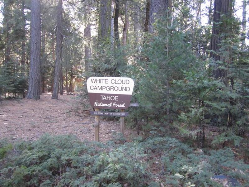
White Cloud
Currently closed for the season. Tentative opening around May 15, 2026, with the typical season running through mid-October. There will be no potable water at the campground for the summer 2026 season; campers must bring their own water supply.
From Recreation.gov
There will be no water at White Cloud Campground for the summer 2026 season. Please plan ahead and bring your own water. We apologize for any inconvenience.
National Forest System Roads
Follow California Vehicle Code on National Forest System Roads
Fireworks and Explosives are always Prohibited
Fireworks and explosives (including explosive targets) are always prohibited on national forest lands. The prohibition of fireworks and exploding targets on national forest system lands is part of a set of permanent fire safety regulations in the Code of Federal Regulations (CFR), listed below.…
About
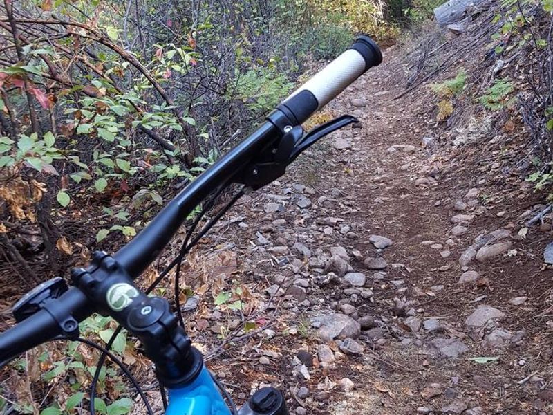
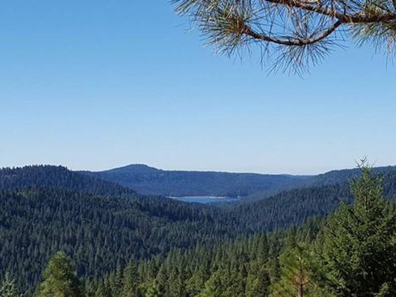
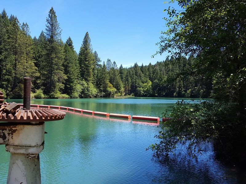
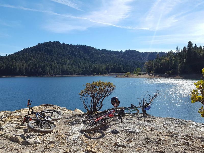
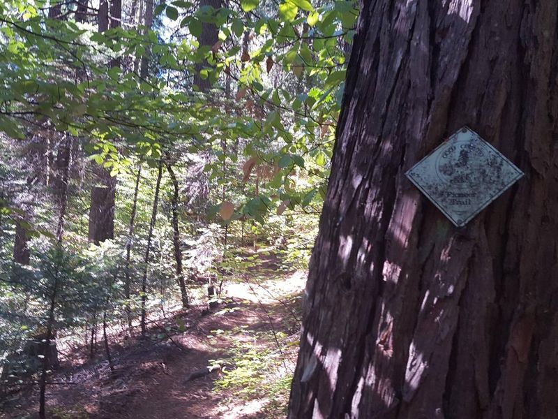
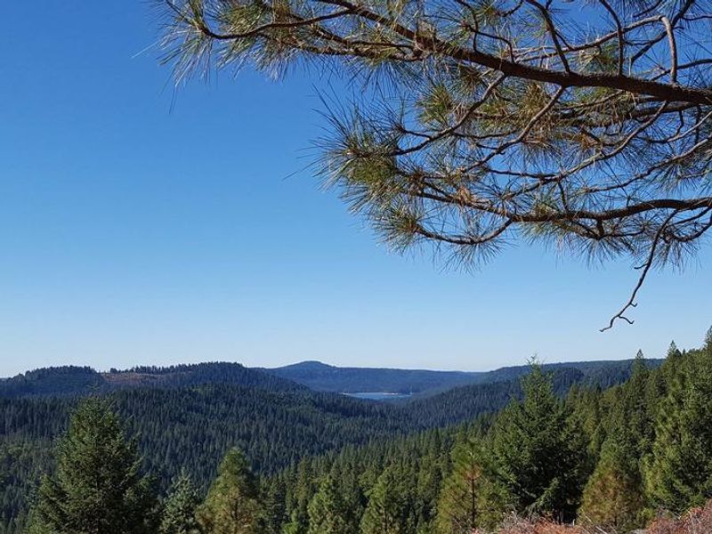
White Cloud Campground is located in the Tahoe National Forest along Highway 20, approximately 12 miles east of Nevada City. Situated at 4,200 feet elevation in a shaded forest of cedar, pine, and Douglas fir trees, the campground provides a peaceful escape from urban life with easy highway access. The campground features 46 sites across two loops, including single-family standard nonelectric sites, tent-only sites, and one double site. Each site includes a fire ring and picnic table, with vault toilets and trash service available. Sites accommodate tents, trailers, and RVs up to 34 feet. The Pioneer Trail stretches 25 miles through the Tahoe National Forest and can be accessed directly from the campground. Designated a National Recreation Trail in 2003, it supports hiking, mountain biking, horseback riding, and cross-country skiing. Nearby attractions include Scotts Flat Reservoir (6 miles), the South Yuba River, and the historic mining town of Nevada City with restaurants, lodging, and supplies.
Directions
From Nevada City, drive 12 miles east on Highway 20 toward Truckee. Turn right into White Cloud and take the right fork to the campground. From I-80, take the Highway 20 exit and drive 14 miles west toward Nevada City. Turn left into White Cloud and take the right fork to the campground.
Amenities
| Water | No |
| Fires Allowed | Yes |
| Toilets | Yes |
| Dump Station | — |
| Wifi | — |
| Pets Allowed | Yes |
| Showers | No |
| Electric Hookups | — |
| Water Hookups | — |
| Sewer Hookups | — |
| Camp Store | — |
| Price | $24 - $48 |
Vehicle
| Max RV Length | 40ft |
| Max Trailer Length | 34ft |
| Big Rig Friendly | No |
| Pull Through Sites | No |
Contact
| Phone | +1 (530) 265-4531 |
Cell Service
| AT&T | None |
| Verizon | Yes |
| T-Mobile | Yes |
Availability
Photos
Community Posts
No posts yet. Be the first to share your experience!