Van Vleck Bunkhouse
Currently closed during the seasonal transition period. Winter ski-in access runs January 1 through mid-May; summer vehicle access typically begins July 1 through October 1. Reservations through Recreation.gov; contact Placerville Ranger District at least 7 days before arrival to arrange permit and access codes.
National Forest System Roads
Follow California Vehicle Code on National Forest System Roads
Fireworks and Explosives are always Prohibited
Fireworks and explosives (including explosive targets) are always prohibited on national forest lands. The prohibition of fireworks and exploding targets on national forest system lands is part of a set of permanent fire safety regulations in the Code of Federal Regulations (CFR), listed below.…
Fire Restrictions are in Effect Forest Wide
Fire Restrictions are in effect forest wide. No campfires except in existing stoves, charcoal grills, or fire rings provided in the Recreation Sites listed in Exhibit A in the Forest Order and actively serviced by a camp host.No charcoal firesCamp stoves, lanterns and propane fire rings are…
About
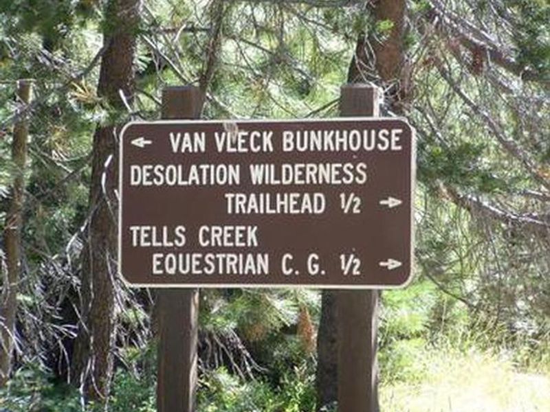
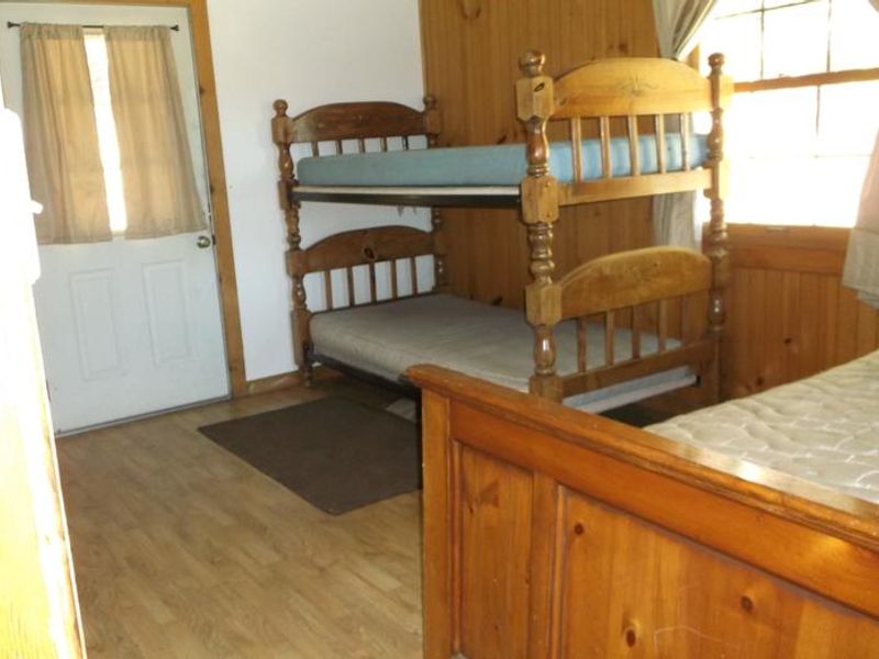
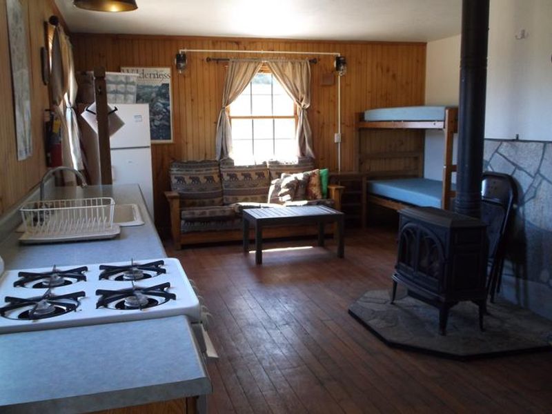
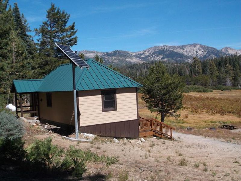
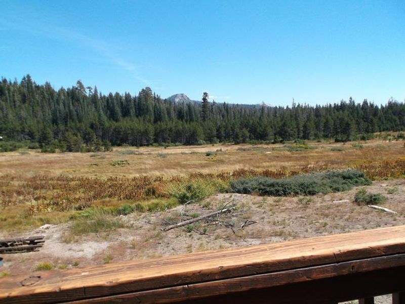
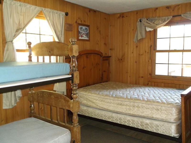
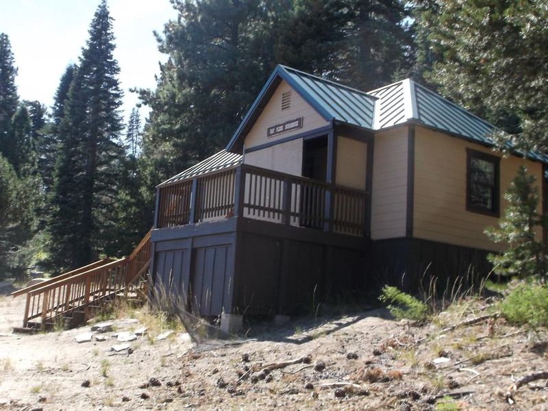
Van Vleck Bunkhouse sits halfway up a small Sierra Nevada peak at 6,000 feet elevation, about a half-mile from Cheese Camp Creek. The front deck overlooks a 40-acre meadow with views of the Tells Peak portion of the Crystal Range. Built in 1957, this is the last remaining building from the Van Vleck Ranch, which operated as a cattle ranch from the 1860s to the 1960s. The bunkhouse features two rooms with a queen-size bed, two bunk beds, and a sleeper sofa accommodating up to 6 people. Amenities include an indoor bathroom with flush toilet, shower, and sink, plus an outside vault toilet. The kitchen has a propane cook stove/oven, and a gas log stove provides heat. There is no electricity. Summer guests have well water available, but the water system is shut down in winter, requiring guests to bring their own water or melt snow. Summer activities include mountain biking, hiking, backpacking into Desolation Wilderness via the Tells Creek Primitive Equestrian Trail, stream fishing in Cheese Camp Creek, horseback riding, and bird watching. Winter access requires a challenging 6-mile trek with 1,300 feet of elevation gain, marked by blue reflective diamonds, suitable only for intermediate to advanced backcountry skiers or snowshoers.
Directions
From Placerville, drive 21 miles on Highway 50, then turn left on Ice House Riverton Road. Go 23 miles north and turn right on Tells Creek Road. Drive 5 miles east and turn left on the gated dirt/gravel road to the bunkhouse, which is 0.5 miles ahead on the left. Check-in is done in person at the Placerville Ranger Station at 4260 Eight Mile Rd, Camino, CA 95709. Winter access is from the Loon Lake parking area via a 6-mile ski/snowshoe route.
Amenities
| Water | Yes |
| Fires Allowed | Yes |
| Toilets | Yes |
| Dump Station | No |
| Wifi | No |
| Pets Allowed | — |
| Showers | Yes |
| Electric Hookups | — |
| Water Hookups | — |
| Sewer Hookups | — |
| Camp Store | No |
| Price | $75 |
Vehicle
| Max RV Length | — |
| Max Trailer Length | — |
| Big Rig Friendly | No |
| Pull Through Sites | No |
Contact
| Phone | +1 (530) 644-5324 |
Cell Service
| AT&T | None |
| Verizon | None |
| T-Mobile | None |
Availability
Photos

Community Posts
No posts yet. Be the first to share your experience!