Upper Oso Campground
Currently closed due to storm damage as part of Santa Barbara Ranger District storm damage recovery. No reopening date announced. When operational, approximately 10 sites are first-come-first-served and 14 additional sites (mostly equestrian) require reservations via Recreation.gov.
Heat Advisory issued July 20 at 12:26PM PDT until July 27 at 8:00PM PDT by NWS Los Angeles/Oxnard CA
* WHAT...Temperatures up to 105 expected. * WHERE...Cuyama Valley, Santa Barbara County Interior Mountains, Santa Ynez Mountains Eastern Range, Santa Ynez Mountains Western Range, and Santa Ynez Valley. * WHEN...From 10 AM Wednesday to 8 PM PDT Monday. * IMPACTS...There is a high risk for heat illness for sensitive populations including the very young, the very old, those without air conditioning, and those active outdoors.
National Forest System Roads
Follow California Vehicle Code on National Forest System Roads
Fireworks and Explosives are always Prohibited
Fireworks and explosives (including explosive targets) are always prohibited on national forest lands. The prohibition of fireworks and exploding targets on national forest system lands is part of a set of permanent fire safety regulations in the Code of Federal Regulations (CFR), listed below.…
About
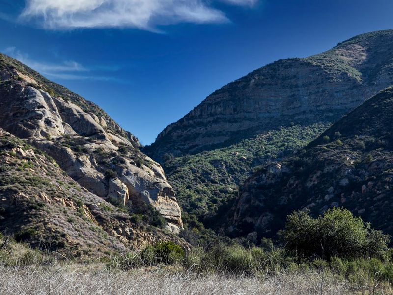
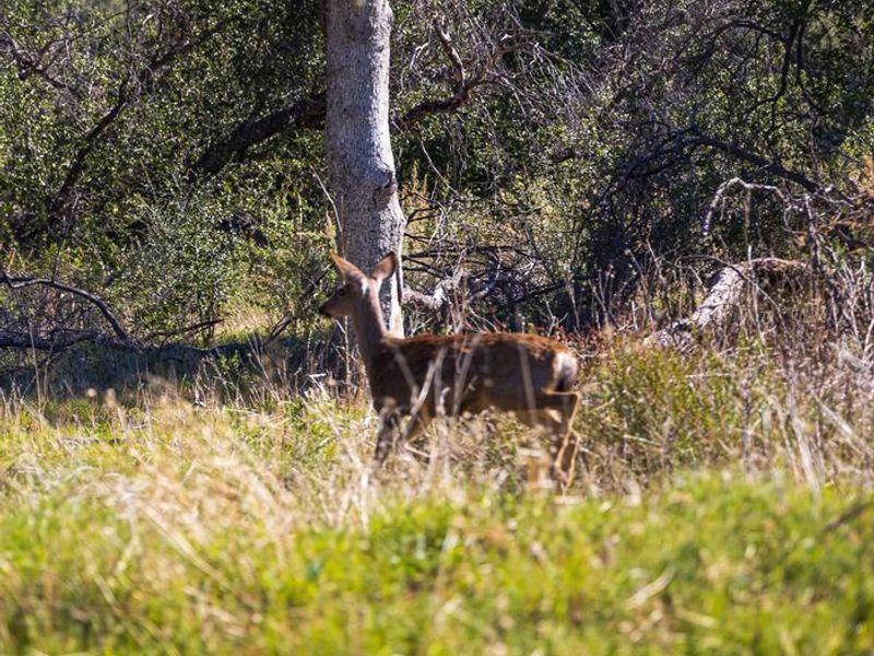
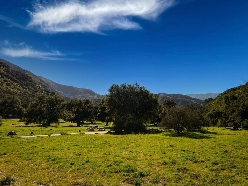
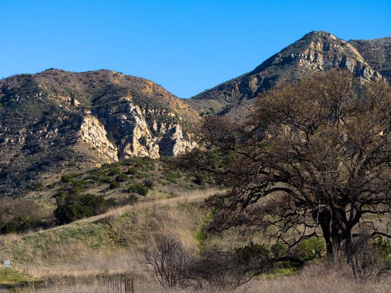
Upper Oso Campground is located in the lower Santa Ynez Recreation Area of Los Padres National Forest, approximately 25 miles north of Santa Barbara. The campground sits at an elevation of 1,040 feet alongside a seasonal creek, with large sites scattered among plentiful oak trees that provide shade. Approximately 10 sites are equipped with horse corrals and extra-long paved parking spurs for equestrian use. A variety of recreational opportunities exist in and around the campground. The Santa Cruz Trail begins nearby and traverses 18 miles north to the San Rafael Wilderness. The 2.5-mile Aliso National Recreation Trail leads to a group campsite. Off-road vehicle enthusiasts can access the Camuesa OHV Route, which loops about 10 miles through the surrounding forest. Fishing and swimming are available at White Rock Day-Use Area, less than two miles from the campground. The Santa Ynez River is stocked with trout in springtime. Cachuma Lake Recreation Area, about 10 miles northwest, offers boating, fishing, and kayaking with no body contact permitted in the reservoir.
Directions
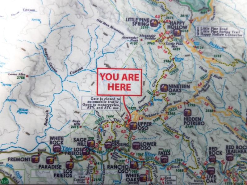
From Santa Barbara, travel north on Highway 101. Exit onto Highway 154 and continue northwest for about 10 miles. Turn east onto Paradise Road and travel approximately 5.5 miles. Turn north onto Forest Route 5N15 and continue 1.5 miles to the campground.
Amenities
| Water | Yes |
| Fires Allowed | Yes |
| Toilets | Yes |
| Dump Station | No |
| Wifi | No |
| Pets Allowed | Yes |
| Showers | No |
| Electric Hookups | — |
| Water Hookups | — |
| Sewer Hookups | — |
| Camp Store | No |
| Price | $40 |
Vehicle
| Max RV Length | 32ft |
| Max Trailer Length | 32ft |
| Big Rig Friendly | No |
| Pull Through Sites | No |
Contact
| customerservice@pmcparks.com | |
| Phone | +1 (805) 434-1996 |
Cell Service
| AT&T | None |
| Verizon | Yes |
| T-Mobile | None |
Availability
Photos
Community Posts
No posts yet. Be the first to share your experience!