Tuttletown Recreation Area
The campground is currently closed. As of March 2026, all campgrounds in Tuttletown Recreation Area are closed and unavailable for reservations. The Bureau of Reclamation directs visitors to book at Glory Hole Recreation Area instead. No reopening date has been announced.
About
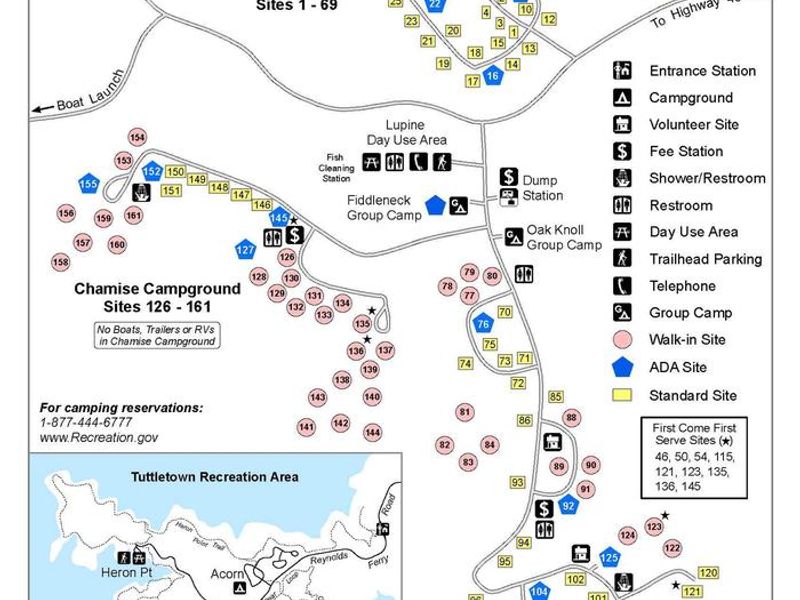
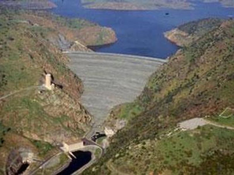
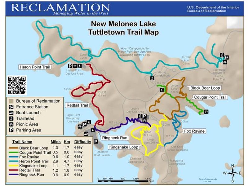
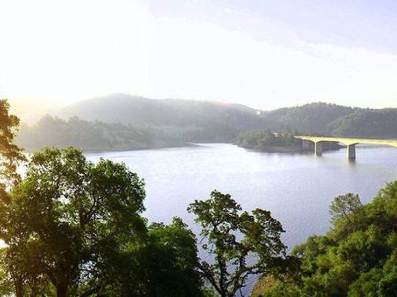
Tuttletown Recreation Area is located at New Melones Lake, the fourth-largest reservoir in California, situated along the historic Mother Lode gold vein between Sonora and Angels Camp. The 12,500-acre lake features over 100 miles of shoreline surrounded by Foothill Oak Woodlands. The campground is managed by the Bureau of Reclamation and reservations are handled through Recreation.gov. The recreation area includes three camping loops: Acorn (sites 1-69), Manzanita (sites 70-125), and Chamise (sites 126-161), plus two group camping areas at Fiddleneck and Oak Knoll. Facilities include flush toilets, hot showers, and water spigots throughout the campground. An RV dump station and fish cleaning station serve campers. Each individual site includes a picnic table and fire ring. Popular activities include fishing for bass and trout, boating, waterskiing, wakeboarding, jet skiing, sailing, swimming, kayaking, and wildlife viewing. Nearby attractions include Natural Bridges (a marble cave with hiking trail), Table Mountain Trail, Columbia State Historic Park, and Stanislaus National Forest. Check-in is at 3:00 PM and check-out at 2:00 PM, with a 14-day camping limit within any 30-day period.
Directions
From Sacramento, take CA-99 South to CA-88 West and CA-12 East to San Andreas. Continue on CA-49 South for approximately 20 miles. Turn right onto Reynolds Ferry Road and follow for 2 miles to the recreation area. From the Central Valley and Bay Area, take I-80 East to I-580 East to I-205 East to CA-120 East in Manteca, then CA-108 East to CA-49 North. Turn left onto Reynolds Ferry Road and follow for 2 miles.
Nearby Campgrounds
Amenities
| Water | Yes |
| Fires Allowed | Yes |
| Toilets | Yes |
| Dump Station | Yes |
| Wifi | — |
| Pets Allowed | Yes |
| Showers | Yes |
| Electric Hookups | — |
| Water Hookups | — |
| Sewer Hookups | — |
| Camp Store | — |
| Price | $18 - $150 |
Vehicle
| Max RV Length | 25ft |
| Max Trailer Length | 25ft |
| Big Rig Friendly | — |
| Pull Through Sites | No |
Contact
| bor-newmelonesrec@usbr.gov | |
| Phone | +1 (209) 459-7290 |
Cell Service
| AT&T | Yes |
| Verizon | Yes |
| T-Mobile | Yes |
Availability
Photos

Community Posts
No posts yet. Be the first to share your experience!