Transfer Campground
The campground operates May through September. Individual sites are first-come, first-served with some reservable through Recreation.gov. The group site requires reservations.
Flash Flood Warning issued July 21 at 6:40PM MDT until July 21 at 7:45PM MDT by NWS Grand Junction CO
FFWGJT The National Weather Service in Grand Junction has extended the * Flash Flood Warning for... The Ferris burn scar in... Northwestern Dolores County in southwestern Colorado... Northern Montezuma County in southwestern Colorado... West Central San Miguel County in southwestern Colorado... * Until 745 PM MDT. * At 640 PM MDT, Doppler radar indicated thunderstorms producing heavy rain over the Ferris Burn Scar. Between 0.4 and 0.7 inches of rain have fallen across the northwest portion of the Ferris Burn Scar. The expected rainfall rate is 3 to 5 inches in 1 hour. Flash flooding is ongoing or expected to begin shortly. Excessive rainfall over the burn scar will result in debris flows. The debris flow can consist of rock, mud, vegetation and other loose materials. HAZARD...Life threatening flash flooding. Thunderstorms producing flash flooding in and around the Ferris Burn Scar. SOURCE...Radar. IMPACT...Life threatening flash flooding of areas in and around the Ferris Burn Scar. * Some locations that will experience flash flooding include... mainly rural areas of Northwestern Dolores, Northern Montezuma and West Central San Miguel Counties
Flash Flood Warning issued July 21 at 5:13PM MDT until July 21 at 7:00PM MDT by NWS Grand Junction CO
At 513 PM MDT, Doppler radar indicated thunderstorms producing heavy rain. Received reports of flooding across the county roads north of Cortez. Over an inch of rain fell across the area. Flash flooding is already occurring. HAZARD...Life threatening flash flooding. Thunderstorms producing flash flooding. SOURCE...Radar. IMPACT...Life threatening flash flooding of creeks and streams, urban areas, highways, streets and underpasses. Some locations that will experience flash flooding include... Cortez.
Flash Flood Warning issued July 21 at 5:06PM MDT until July 21 at 8:15PM MDT by NWS Grand Junction CO
FFWGJT The National Weather Service in Grand Junction has issued a * Flash Flood Warning for... West Central Dolores County in southwestern Colorado... Northwestern Montezuma County in southwestern Colorado... * Until 815 PM MDT. * At 506 PM MDT, Doppler radar indicated thunderstorms producing heavy rain across the warned area. Between 1 and 2 inches of rain have fallen. The expected rainfall rate is 2 to 4 inches in 1 hour. Flash flooding is ongoing or expected to begin shortly. HAZARD...Life threatening flash flooding. Thunderstorms producing flash flooding. SOURCE...Radar. IMPACT...Life threatening flash flooding of creeks and streams, urban areas, highways, streets and underpasses. * Some locations that will experience flash flooding include... Cahone.
About
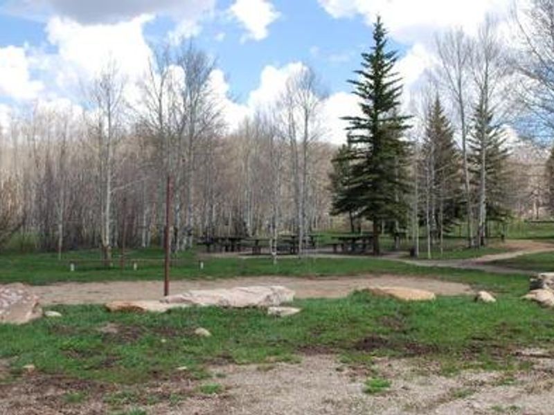
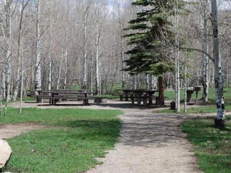
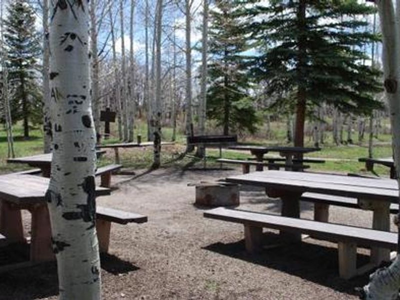
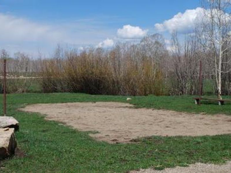
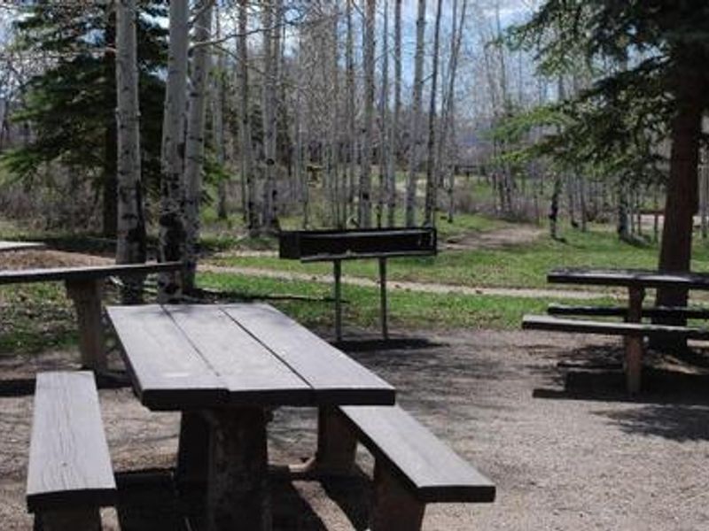
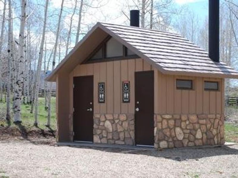
Transfer Campground sits at 8,500 feet elevation in a level aspen grove within the San Juan National Forest, approximately 11 miles north of Mancos, Colorado. The campground features 12 individual campsites (5 reservable), one reservable group site, and 4 horse sites located separately across Forest Road 561 with adjacent corrals. All sites and restrooms are barrier-free and most accommodate RVs up to 45 feet. Recreational opportunities center on motorized and non-motorized trail access. The Aspen Loop Trail for ATVs and motorbikes is just half a mile north. Nearby hiking options include Big Al Interpretive Trail, Rim Trail, Box Canyon Trail, Chicken Creek Trail, Morrison Trail, Gold Run Trail, and West Mancos Trail. Jackson Gulch Reservoir lies six miles south for fishing. Amenities include potable water, vault toilets, trash service, picnic tables, and fire grates at each site. The group site features five double picnic tables, a large serving table, and cooking grills. Livestock is prohibited in the main campground but accommodated at the horse sites across the road.
Directions
From Mancos, CO: Travel 1/4 mile north on Highway 184, then turn right on West Mancos Road (Forest Road 561). Travel 10.5 miles to the campground. Most of the road is unpaved but has a good gravel surface.
Amenities
| Water | Yes |
| Fires Allowed | Yes |
| Toilets | Yes |
| Dump Station | — |
| Wifi | No |
| Pets Allowed | Yes |
| Showers | No |
| Electric Hookups | — |
| Water Hookups | — |
| Sewer Hookups | — |
| Camp Store | No |
| Price | $24 - $75 |
Vehicle
| Max RV Length | 40ft |
| Max Trailer Length | 40ft |
| Big Rig Friendly | Yes |
| Pull Through Sites | No |
Contact
| Phone | +1 (970) 882-7296 |
Cell Service
| AT&T | None |
| Verizon | Yes |
| T-Mobile | None |
Availability
Photos
Community Posts
No posts yet. Be the first to share your experience!