South Fork Group Site
Closed for the season. Opens June 5, 2026 and operates through October 11. Water availability varies at the beginning and end of the season; bring adequate supply. Reservations through Recreation.gov.
Air Quality Alert issued July 1 at 9:10AM MDT by NWS Denver CO
The Colorado Department of Public Health and Environment has issued the following... WHAT...Air Quality Health Advisory for Wildfire Smoke. WHERE...Moffat, Routt, Jackson, Grand, Rio Blanco, Garfield, Eagle, Summit, Gilpin, Clear Creek, Mesa, Pitkin, Lake, Park, Delta, Gunnison, Chaffee, Montrose, Ouray, San Miguel, Dolores, and northern parts of Montezuma and Saguache Counties. Locations include, but are not limited to Craig, Steamboat Springs, Walden, Granby, Hot Sulphur Springs, Kremmling, Meeker, Rangely, Glenwood Springs, Eagle, Vail, Breckenridge, Central City, Georgetown, Grand Junction, Aspen, Leadville, Fairplay, Delta, Gunnison, Buena Vista, Salida, Montrose, Nucla, Ouray, Telluride, Dove Creek, and Saguache. WHEN...900 AM Wednesday July 01 to 900 AM Thursday July 02 IMPACTS...Areas downwind of large fires in southwestern Colorado and southeastern Utah could have periods of moderate to heavy smoke through at least Thursday morning. HEALTH INFORMATION...Public Health Recommendations: If smoke is thick or becomes thick in your neighborhood you may want to remain indoors. This is especially true for those with heart disease, respiratory illnesses, the very young, and older adults. Consider limiting outdoor activity when moderate to heavy smoke is present. Consider relocating temporarily if smoke is present indoors and is making you ill. If visibility is less than 5 miles in smoke in your neighborhood, smoke has reached levels that are unhealthy.
Air Quality Alert issued June 30 at 4:10PM MDT by NWS Denver CO
The Colorado Department of Public Health and Environment has issued the following... WHAT...Air Quality Health Advisory for Wildfire Smoke. WHERE...Moffat, Routt, Jackson, Grand, Rio Blanco, Garfield, Eagle, Summit, Gilpin, Clear Creek, Mesa, Pitkin, Lake, Park, Delta, Gunnison, Chaffee, Montrose, Ouray, San Miguel, Dolores, and northern parts of Montezuma and Saguache Counties. Locations include, but are not limited to Craig, Steamboat Springs, Walden, Granby, Hot Sulphur Springs, Kremmling, Meeker, Rangely, Glenwood Springs, Eagle, Vail, Breckenridge, Central City, Georgetown, Grand Junction, Aspen, Leadville, Fairplay, Delta, Gunnison, Buena Vista, Salida, Montrose, Nucla, Ouray, Telluride, Dove Creek, and Saguache. WHEN...900 AM Tuesday June 30 to 900 AM Wednesday July 01 IMPACTS...Areas downwind of large fires in southwestern Colorado and southeastern Utah could have periods of moderate to heavy smoke through at least Wednesday morning. HEALTH INFORMATION...Public Health Recommendations: If smoke is thick or becomes thick in your neighborhood you may want to remain indoors. This is especially true for those with heart disease, respiratory illnesses, the very young, and older adults. Consider limiting outdoor activity when moderate to heavy smoke is present. Consider relocating temporarily if smoke is present indoors and is making you ill. If visibility is less than 5 miles in smoke in your neighborhood, smoke has reached levels that are unhealthy.
Wheeled Vehicles in Wilderness
This order describes the prohibition of wheeled vehicles in all National Forest Wilderness Areas of the Rocky Mountain Region and any exceptions thereof.
About
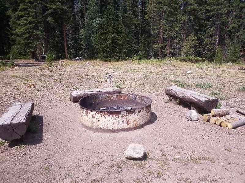
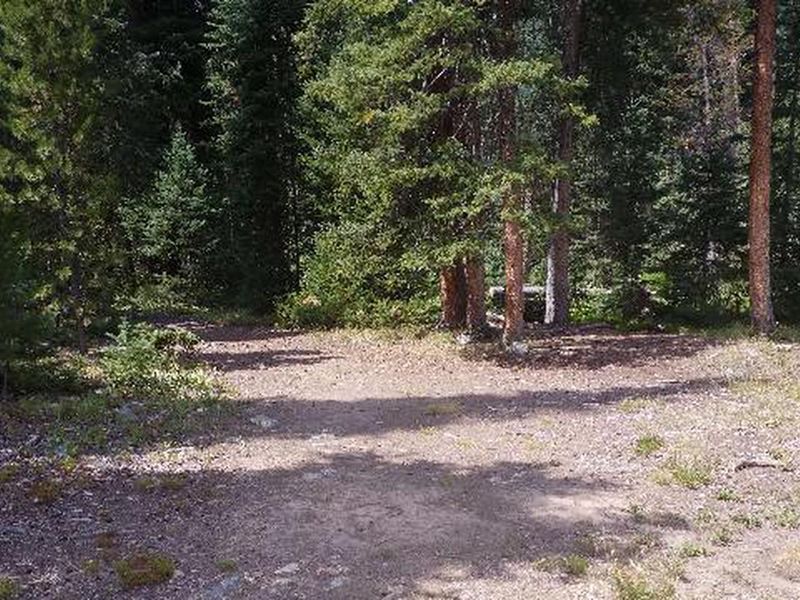
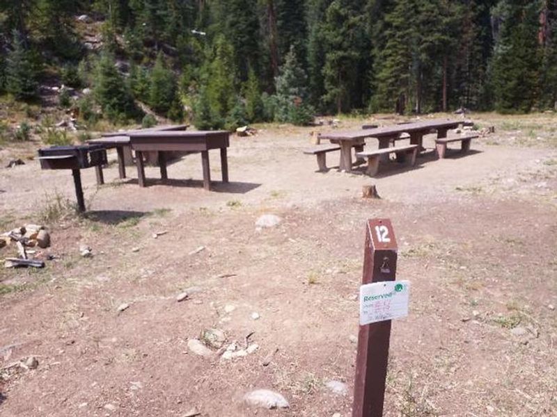
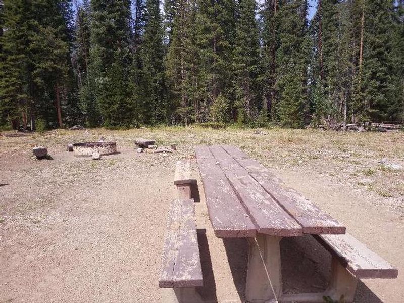
South Fork Group Site sits at 8,962 feet in the Williams Fork Valley of the Arapaho National Forest, next to South Fork Creek. This is a single reservable group site within the larger South Fork Campground area, capable of hosting up to 25 people with parking for up to 6 vehicles. The site is notable as the only horse-camping-designated facility on the Sulphur Ranger District, with a small corral accommodating one or two horses (no water troughs provided). The South Fork Trail begins directly at the campground, making it a prime basecamp for backcountry exploration. This 26-mile loop is open to hiking and horseback riding, connecting to Ptarmigan Pass, Ute Peak, and Jones Pass trails, with access to the Byers Peak Wilderness nearby. The surrounding Williams Fork Valley offers excellent trout fishing on South Fork Creek and numerous other mountain streams. Amenities include vault toilets, potable water from a hand pump, a picnic table, tent pad, and fire grate. Due to pine beetle infestation and hazardous tree removal, shade has been reduced throughout the campground. Expect a cool mountain climate with frequent afternoon thunderstorms.
Directions
From Granby, take State Highway 40 west toward Parshall. Two miles before Parshall, turn left on County Road 3. Go approximately 18 miles on County Road 3. Turn south onto County Road 30 and travel 12 miles. Drive through a large culvert. Continue south for a half-mile and turn right into the campground.
Amenities
| Water | Yes |
| Fires Allowed | Yes |
| Toilets | Yes |
| Dump Station | No |
| Wifi | No |
| Pets Allowed | Yes |
| Showers | No |
| Electric Hookups | — |
| Water Hookups | — |
| Sewer Hookups | — |
| Camp Store | No |
| Price | $70 |
Vehicle
| Max RV Length | 30ft |
| Max Trailer Length | 30ft |
| Big Rig Friendly | No |
| Pull Through Sites | No |
Contact
| Phone | +1 (877) 444-6777 |
Cell Service
| AT&T | None |
| Verizon | None |
| T-Mobile | None |
Availability
Photos
Community Posts
No posts yet. Be the first to share your experience!