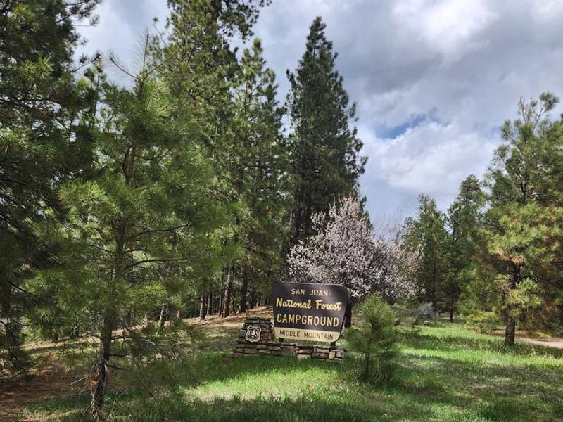
Middle Mountain
Currently closed for the season. Typically opens late May and operates through September. All sites are first-come, first-served with on-site payment via Recreation.gov Scan and Pay.
Flood Watch issued July 22 at 1:17AM MDT until July 23 at 3:00AM MDT by NWS Grand Junction CO
* WHAT...Flash flooding caused by excessive rainfall is possible. * WHERE...All of eastern Utah and western Colorado including several recent burn scars. * WHEN...From 11 AM MDT this morning through late tonight. * IMPACTS...Excessive runoff may result in flooding of rivers, creeks, streams, and other low-lying and flood-prone locations. Flooding may occur in poor drainage and urban areas. Recent burn scars will be especially susceptible to flash flooding and debris flows. * ADDITIONAL DETAILS... - Excessive rainfall causing flash flooding and debris flows. - http://www.weather.gov/safety/flood
Wheeled Vehicles in Wilderness
This order describes the prohibition of wheeled vehicles in all National Forest Wilderness Areas of the Rocky Mountain Region and any exceptions thereof.
Weed Free Forage Products
The purpose of this Order is to prevent the introduction or spread of noxious weeds.
About
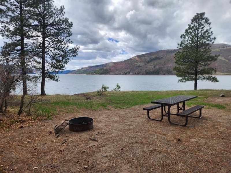
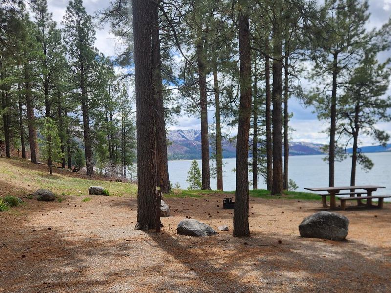
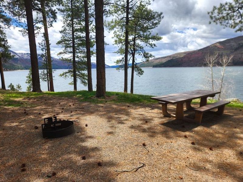
Middle Mountain Campground occupies a prime location on the east side of Vallecito Reservoir in the San Juan National Forest. The 24 sites offer southern exposure and a grassy shoreline with easy access to the water. The campground is notably open and sunny compared to nearby alternatives, with shade provided by scattered ponderosa pines and small aspen groves. Amenities include potable water, three vault toilets, trash service, picnic tables at each site, and fire rings with firewood available for gathering. The campground can accommodate RVs up to 35 feet, though there is no overflow parking. Standard sites run $26 per night with premium sites at $30. Check-in is at 2:00 PM and checkout is noon. Middle Mountain Road (Forest Road 724) departs from the campground area and leads to the upper Bear Creek drainages, Runlett Park, and the historic mining town of Tuckerville, offering additional exploration opportunities for those with high-clearance vehicles.
Directions
From Durango: Travel 17 miles on Florida Road (County Road 240). Turn left onto County Road 501 for approximately 13 miles around the north end of Vallecito Reservoir, then south to the campground entrance on the east side of the reservoir. From Bayfield: Take County Road 501 approximately 22 miles around the north end of Vallecito Reservoir, then south to the campground entrance.
Amenities
| Water | Yes |
| Fires Allowed | Yes |
| Toilets | Yes |
| Dump Station | No |
| Wifi | — |
| Pets Allowed | Yes |
| Showers | No |
| Electric Hookups | — |
| Water Hookups | — |
| Sewer Hookups | — |
| Camp Store | No |
| Price | $32 |
Vehicle
| Max RV Length | 35ft |
| Max Trailer Length | — |
| Big Rig Friendly | No |
| Pull Through Sites | No |
Contact
| Phone | +1 (970) 884-2512 |
Cell Service
| AT&T | Yes |
| Verizon | Yes |
| T-Mobile | None |
Useful Links
| View on Recreation.gov | |
| USFS Middle Mountain Campground |
Availability
Photos
Community Posts
No posts yet. Be the first to share your experience!