Magone Lake
Open year-round on a first-come, first-served basis. Potable water is seasonal and typically available from late May through early October depending on temperatures. Fire restrictions may apply.
Air Quality Alert issued July 20 at 6:03PM PDT by NWS Pendleton OR
Oregon Department of Environmental Quality has issued an Air Quality Advisory until 4 PM PDT Wednesday. For the Smoke Air Quality Advisory, wildfires burning in the region combined with forecasted conditions will cause air quality to reach unhealthy levels. Pollutants in smoke can cause burning eyes, runny nose, aggravate heart and lung diseases, and aggravate other serious health problems. Limit outdoor activities and keep children indoors if it is smoky. Please follow medical advice if you have a heart or lung condition. For additional information...please visit the Web site at http://www.oregon.gov/DEQ
Air Quality Alert issued July 20 at 3:24PM PDT by NWS Pendleton OR
Oregon Department of Environmental Quality has issued an Air Quality Advisory until 4 PM PDT Wednesday. For the Smoke Air Quality Advisory, wildfires burning in the region combined with forecasted conditions will cause air quality to reach unhealthy levels. Pollutants in smoke can cause burning eyes, runny nose, aggravate heart and lung diseases, and aggravate other serious health problems. Limit outdoor activities and keep children indoors if it is smoky. Please follow medical advice if you have a heart or lung condition. For additional information...please visit the Web site at http://www.oregon.gov/DEQ
Air Quality Alert issued July 20 at 1:46PM PDT by NWS Pendleton OR
Oregon Department of Environmental Quality has issued an Air Quality Advisory until 4 PM PDT Wednesday. For the Smoke Air Quality Advisory, wildfires burning in the region combined with forecasted conditions will cause air quality to reach unhealthy levels. Pollutants in smoke can cause burning eyes, runny nose, aggravate heart and lung diseases, and aggravate other serious health problems. Limit outdoor activities and keep children indoors if it is smoky. Please follow medical advice if you have a heart or lung condition. For additional information...please visit the Web site at http://www.oregon.gov/DEQ
About
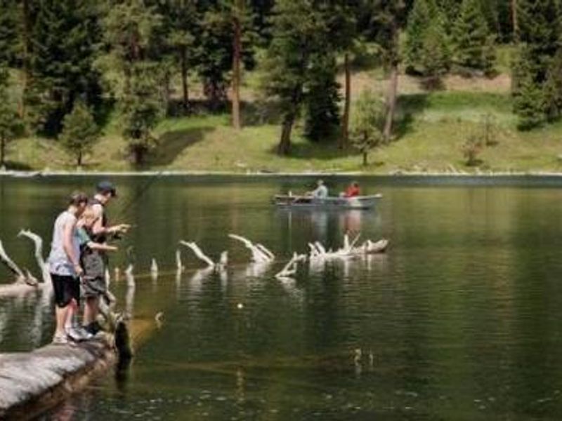
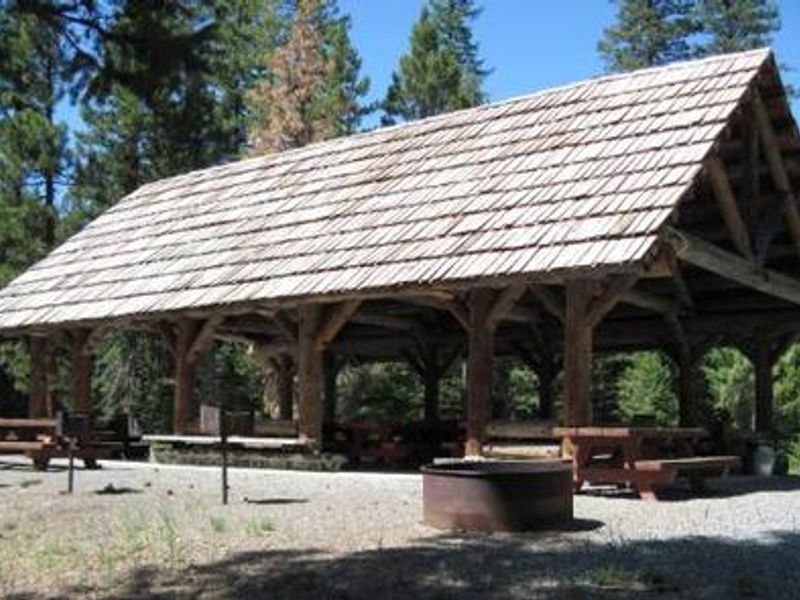
Magone Lake Campground is located in the Blue Mountains of eastern Oregon within Malheur National Forest. The lake itself covers about 50 acres with depths reaching 100 feet, believed to have been formed by a landslide in the early 1800s. The campground provides 21 sites including 17 standard nonelectric sites and 4 tent-only sites, all available on a first-come, first-served basis with a 14-day stay limit. Facilities include vault toilets throughout the recreation area and seasonal potable water available from late May through early October. Each site has a picnic table and campfire ring with grill. This is a pack-in/pack-out facility with no trash service. A reservable group campsite and group picnic shelter each accommodate up to 75 people. Recreation opportunities abound with rainbow and brook trout fishing, swimming at the day-use beach, a boat ramp and dock for canoes and low-horsepower boats (10 HP max, no-wake lake), and a walking trail circling the lake. Mountain biking trails are also accessible from the area. Cell phone coverage is not available.
Directions
From John Day, Oregon, take U.S. Highway 26 east for approximately 9 miles. At the junction of County Road 18, travel north approximately 10 miles. At Forest Road 3620, turn west and drive approximately 1 mile to Forest Road 3618. The campground is about 1 mile from the turnoff.
Amenities
| Water | Yes |
| Fires Allowed | Yes |
| Toilets | Yes |
| Dump Station | No |
| Wifi | No |
| Pets Allowed | — |
| Showers | No |
| Electric Hookups | — |
| Water Hookups | — |
| Sewer Hookups | — |
| Camp Store | No |
| Price | $25 - $60 |
Vehicle
| Max RV Length | 50ft |
| Max Trailer Length | 50ft |
| Big Rig Friendly | — |
| Pull Through Sites | No |
Contact
| Phone | +1 (541) 575-3131 |
Cell Service
| AT&T | None |
| Verizon | None |
| T-Mobile | None |
Availability
Photos
Community Posts
No posts yet. Be the first to share your experience!