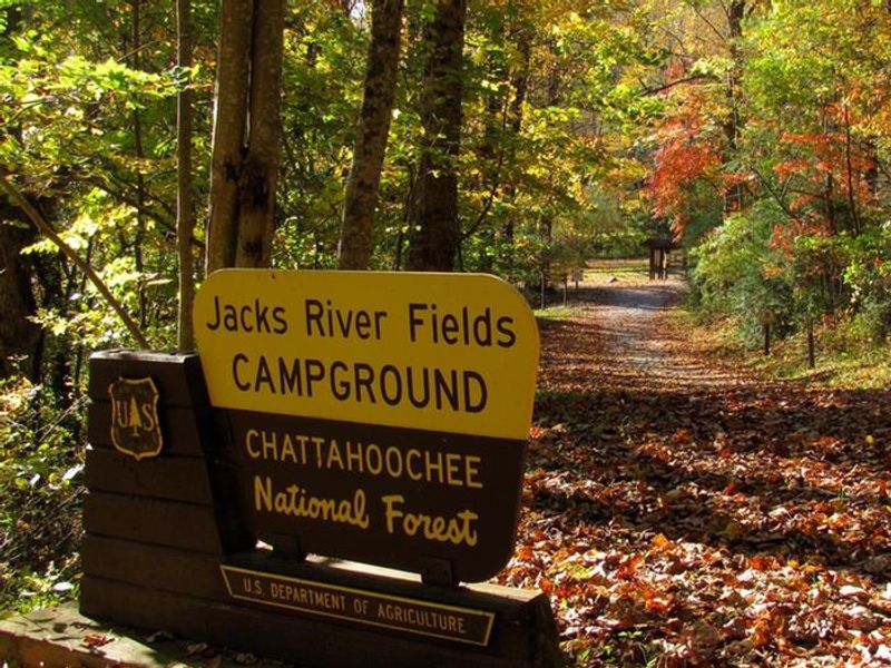
Jacks River Fields Campground
Open year-round on a first-come, first-served basis. January through March, access is only possible from Blue Ridge, GA as Forest Service Road 64 is closed west of the campground. Payment via Recreation.gov mobile app QR code or cash/check in the fee deposit box. 14-day stay limit per 30-day period.
About
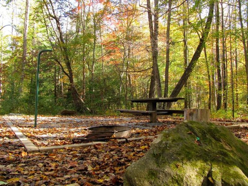
Jacks River Fields Campground sits in a small hollow in the Blue Ridge Mountains of north Georgia, surrounded by mixed hardwood forests of yellow poplar, oak, hickory, and white pine, interspersed with hemlock and rhododendron. The seven primitive campsites rest along the banks of the south fork of the Jacks River, which eventually flows into the biologically diverse Conasauga River watershed. This remote location served as a thriving mountain community in the late 1800s and early 1900s before becoming part of the national forest. The campground is particularly well-suited for equestrians, with horse trailer day-use parking, corrals, and hitching posts available. The South Fork Trail begins just an eighth of a mile from the campground, offering a multi-use route for horses, hikers, and mountain bikers along the river. The nearby 45,000-acre Cohutta Wilderness, the largest congressionally designated wilderness east of the Mississippi, provides extensive backcountry opportunities. Reaching the campground requires navigating over 15 miles of steep, narrow, winding gravel roads. Cell service is extremely limited or nonexistent. Visitors must bring their own drinking water and prepare for a self-sufficient camping experience. Bear-resistant trash receptacles are provided, and vault toilets are available on site.
Directions
From Ellijay, take Boardtown Road 12 miles to Bearden Road. Turn left onto Bearden Road and follow to Chestnut Gap Road. Turn left onto Chestnut Gap Road and travel 2.8 miles to Old Hwy 2. Turn left onto Old 2 and continue 8.1 miles to the junction with Forest Service Road 64. Turn left and follow FSR 64 for 4 miles. Campground will be on your left.
Nearby Campgrounds
Location
Amenities
| Water | No |
| Fires Allowed | Yes |
| Toilets | Yes |
| Dump Station | No |
| Wifi | No |
| Pets Allowed | Yes |
| Showers | No |
| Electric Hookups | — |
| Water Hookups | — |
| Sewer Hookups | — |
| Camp Store | No |
| Price | $5 |
Vehicle
| Max RV Length | 24ft |
| Max Trailer Length | 25ft |
| Big Rig Friendly | No |
| Pull Through Sites | No |
Contact
| Phone | +1 (706) 695-6736 |
Cell Service
| AT&T | None |
| Verizon | None |
| T-Mobile | None |
Availability
Photos

Community Posts
No posts yet. Be the first to share your experience!