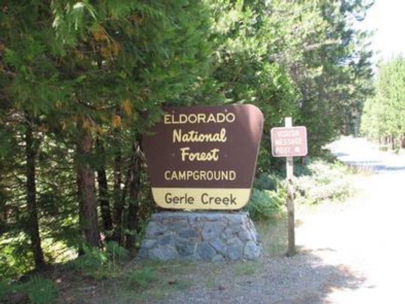
Gerle Creek
Currently closed for the season. Potential opening date is May 22, 2026. The campground operates June through September with reservations available via Recreation.gov. Check-in is 2 PM, check-out is 1 PM. Maximum stay is 14 days per district per year.
National Forest System Roads
Follow California Vehicle Code on National Forest System Roads
Fireworks and Explosives are always Prohibited
Fireworks and explosives (including explosive targets) are always prohibited on national forest lands. The prohibition of fireworks and exploding targets on national forest system lands is part of a set of permanent fire safety regulations in the Code of Federal Regulations (CFR), listed below.…
Fire Restrictions are in Effect Forest Wide
Fire Restrictions are in effect forest wide. No campfires except in existing stoves, charcoal grills, or fire rings provided in the Recreation Sites listed in Exhibit A in the Forest Order and actively serviced by a camp host.No charcoal firesCamp stoves, lanterns and propane fire rings are…
About
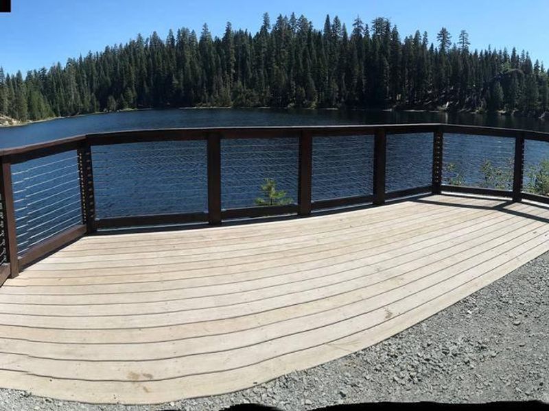
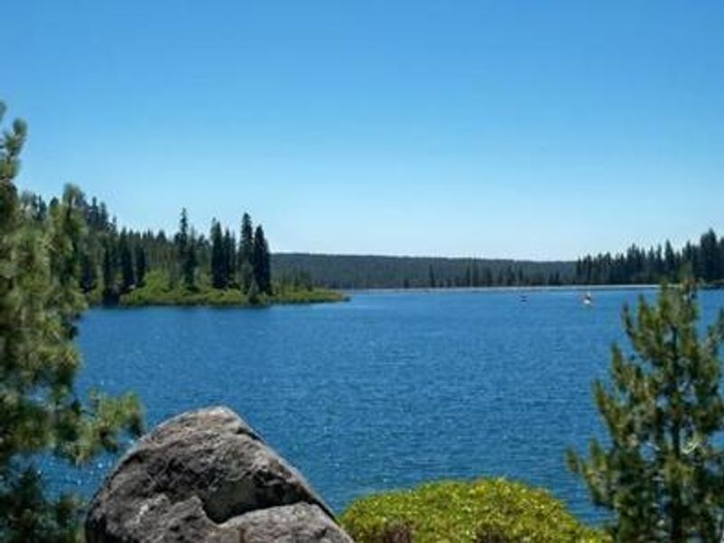
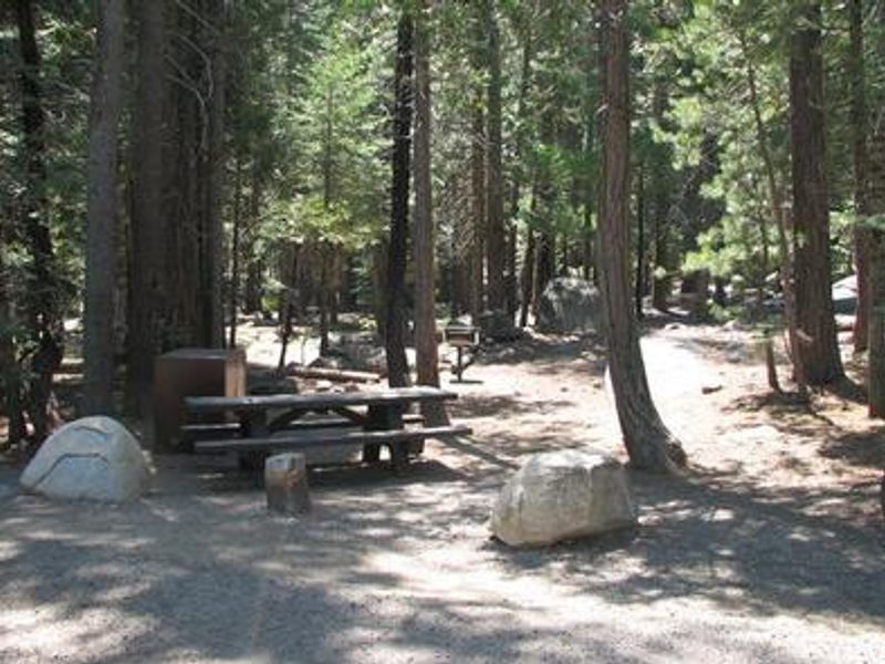
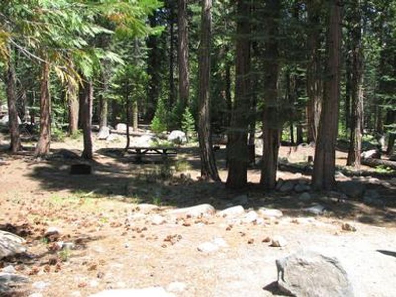
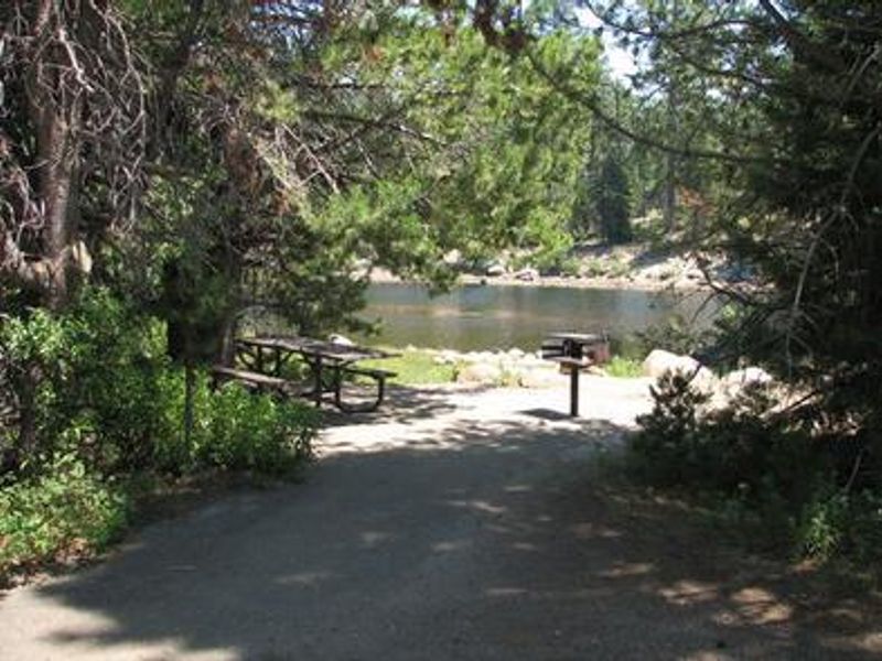
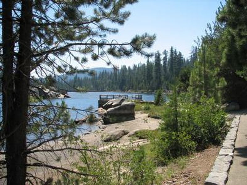
Gerle Creek Campground is nestled on the banks of the Gerle Creek Fork among a lush forest of hardwoods within the Eldorado National Forest. Located upstream of Gerle Creek Divide Reservoir on the Georgetown Divide at 5,300 feet elevation, the campground provides a scenic base for water recreation and forest exploration. The area was named for two brothers who were early settlers and farmers in the region. The campground offers 50 sites including single and double-family options. Sites feature picnic tables, fire rings, and access to bear boxes for food storage. Amenities include vault toilets, potable water from faucets, and trash service. An accessible fishing dock and the fully accessible Gerle Creek Interpretive Trail provide opportunities for all visitors. Swimming, canoeing, kayaking, and fishing for brown and rainbow trout are popular activities. Union Valley Reservoir and Loon Lake are nearby for additional recreation. Reservations are available through Recreation.gov, with some sites available first-come, first-served. The campground operates seasonally from June through September with a 14-day maximum stay limit per district per year.
Directions
From Placerville, drive 21 miles east on Highway 50 to the Icehouse Road turnoff. Turn left and go 28 miles north on Ice House Road (Forest Road 3). Take the left fork 3 miles to the campground.
Amenities
| Water | Yes |
| Fires Allowed | Yes |
| Toilets | Yes |
| Dump Station | No |
| Wifi | No |
| Pets Allowed | Yes |
| Showers | No |
| Electric Hookups | — |
| Water Hookups | — |
| Sewer Hookups | — |
| Camp Store | No |
| Price | $36 - $72 |
Vehicle
| Max RV Length | 50ft |
| Max Trailer Length | 50ft |
| Big Rig Friendly | Yes |
| Pull Through Sites | No |
Contact
| info@royalelkparkmanagement.com | |
| Phone | +1 (831) 245-6891 |
Cell Service
| AT&T | None |
| Verizon | None |
| T-Mobile | None |
Availability
Photos


Community Posts
No posts yet. Be the first to share your experience!