Desoto Falls Recreation Area
Open year-round. Peak season runs April 1 through October 31 with full services including potable water and showers. Non-peak season (November 1 through March 31) has reduced fees but no water. Reservations via Recreation.gov. 14-day stay limit.
Flood Watch issued July 22 at 11:19AM EDT until July 25 at 12:00AM EDT by NWS Peachtree City GA
* WHAT...Flooding caused by excessive rainfall is possible. * WHERE...Portions of north central, northeast, and northwest Georgia, including the following counties, in north central Georgia, Cherokee, Dawson, Fannin, Forsyth, Gilmer, Hall, Lumpkin, Pickens and Union. In northeast Georgia, Banks, Towns and White. In northwest Georgia, Bartow, Catoosa, Chattooga, Dade, Floyd, Gordon, Murray, Polk, Walker and Whitfield. * WHEN...From 8 PM EDT this evening through late Friday evening. * IMPACTS...Excessive runoff may result in flooding of rivers, creeks, streams, and other low-lying and flood-prone locations. Flooding may occur in poor drainage and urban areas. * ADDITIONAL DETAILS... - Repeated rounds of rainfall along a stalled frontal boundary are likely through late week. An anomalously moist environment over Georgia will support high rain rates and increased chances for flash flooding. Widespread rainfall of 2 to 4 inches will be possible with locally higher amounts of 5 inches or more. Urban areas, and areas with poor drainage, will be the most susceptible to flash flooding. - http://www.weather.gov/safety/flood
About
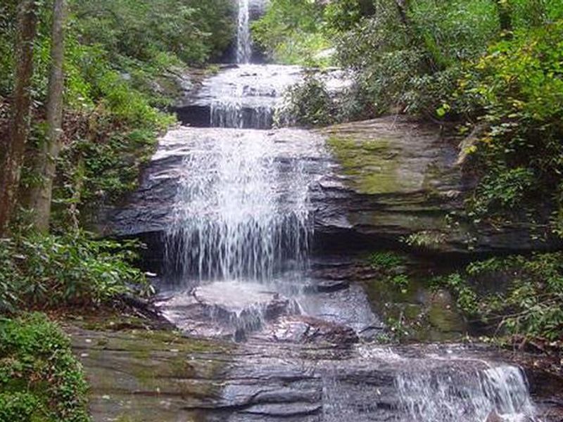
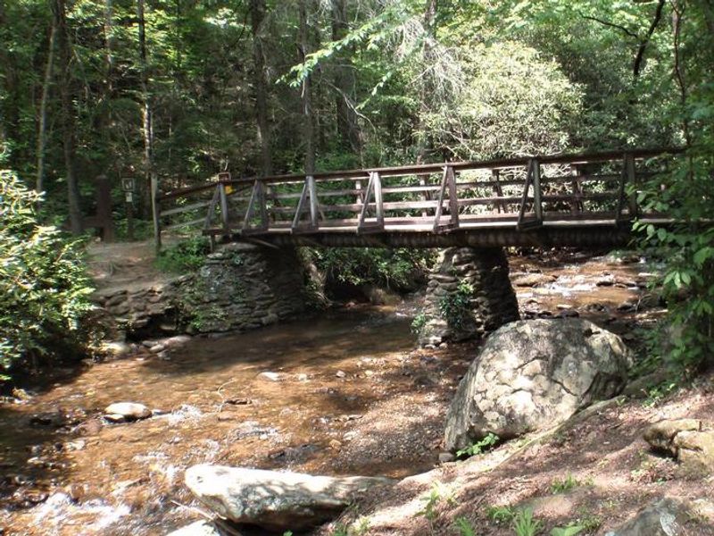
Desoto Falls Recreation Area sits within a 650-acre designated scenic area in the Chattahoochee National Forest, about two hours north of Atlanta. The campground occupies a forested valley along Frogtown Creek at an elevation of 2,080 feet. Twenty-three campsites are spread across upper and lower loops, with several creekside options. Each site includes a picnic table and fire ring. The lower loop has a warm-water outdoor shower facility connected to flush restrooms; the upper loop is served by vault toilets. The primary draw is the DeSoto Falls Trail, which departs from a wooden bridge near the host site. The 0.25-mile lower falls trail and 0.75-mile upper falls trail pass through rhododendron thickets and old-growth pines before reaching observation decks at each cascade. Frogtown Creek also offers trout fishing. Wildlife in the area includes deer, turkey, and black bear. Neels Gap and the Appalachian Trail lie 1.5 miles north on US-19/129. Other nearby attractions include Helton Creek Falls, Dukes Creek Falls, Raven Cliff Falls, and Brasstown Bald, Georgia's highest point at 4,784 feet with views into four states. The towns of Blairsville, Helen, and Dahlonega are all a short drive away.
Directions
From Blairsville, take US-19/129 south 17 miles; the entrance is on the right. From Dahlonega, take Highway 19 north 18 miles; entrance on left. From Cleveland, take US-19/129 north 16 miles; entrance on left.
Nearby Campgrounds
Amenities
| Water | Yes |
| Fires Allowed | Yes |
| Toilets | Yes |
| Dump Station | No |
| Wifi | — |
| Pets Allowed | Yes |
| Showers | Yes |
| Electric Hookups | — |
| Water Hookups | — |
| Sewer Hookups | — |
| Camp Store | — |
| Price | $20 |
Vehicle
| Max RV Length | 40ft |
| Max Trailer Length | 30ft |
| Big Rig Friendly | No |
| Pull Through Sites | No |
Contact
| Phone | +1 (706) 745-6928 |
Cell Service
| AT&T | Yes |
| Verizon | None |
| T-Mobile | None |
Availability
Photos
Community Posts
No posts yet. Be the first to share your experience!