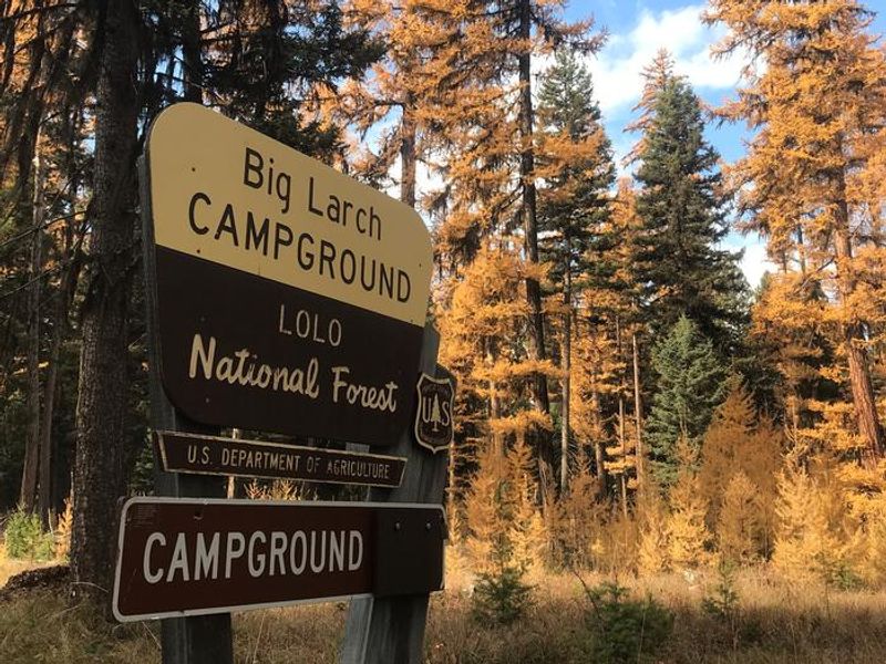
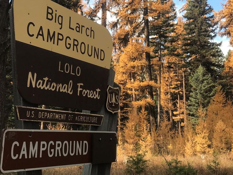
Big Larch Campground Complex
Loops 1 and 4 are open year-round, weather and snow conditions permitting. Loops 2 and 3 open the Friday before Memorial Day through Labor Day. Day-use facilities operate year-round from 6 a.m. to 10 p.m. Reservable sites book through Recreation.gov during peak season; first-come-first-serve sites available via QR code payment. Winter access is limited to the boat launch area only when roads are not plowed.
Northern Region Camping & Target Restrictions, Pallet Prohibition
This order defines the maximum length of occupation at a single location or cumulatively at any number of locations within a calendar year, within the states of Montana, North Dakota, South Dakota, and Idaho
Weed Free Forage & Mulch Products Order for the Northern Region
It is illegal to possess, store or transport straw, hay, grain, seed or other forage or mulch products on Forest Service lands without documentation that the product is certified as “weed free” by a state certification process that meets or exceeds the North American Weed Free Forage standards.
R1-2023-02 - NCDE Food and Wildlife Attractant Storage Order
Northern Continental Divide Ecosystem Food/Wildlife Attractant Storage Order for the Flathead, Lolo, Kootenai, Helena-Lewis and Clark, and Beaverhead-Deerlodge National Forests within the Northern Continental Divide Ecosystem.
About
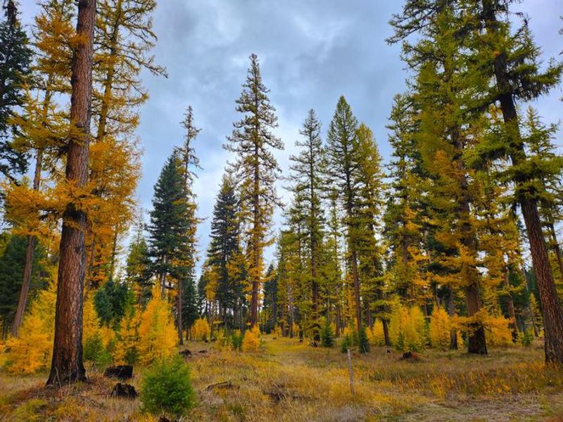
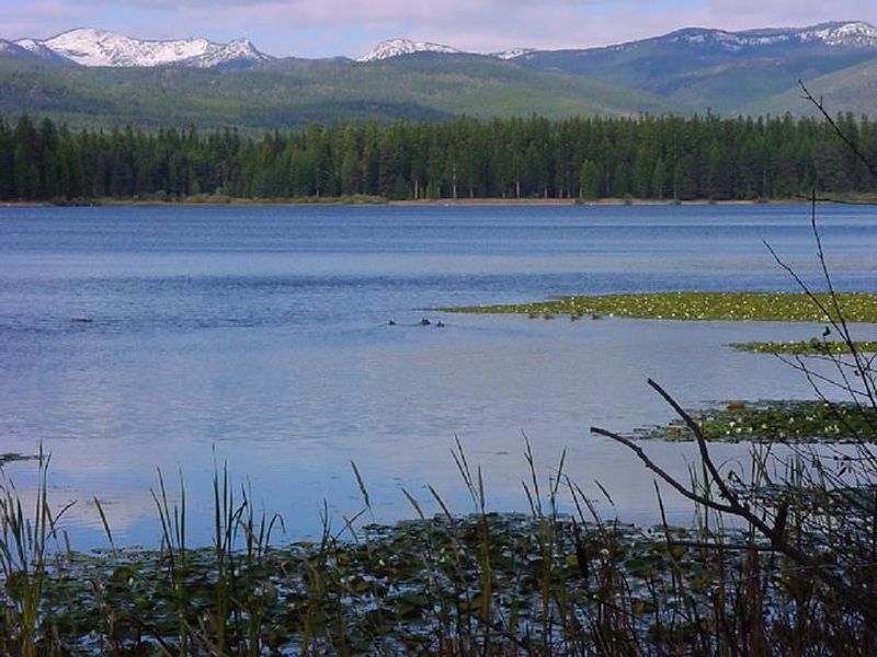
Big Larch Campground occupies a prime location on the east shoreline of Seeley Lake within the Lolo National Forest. The 1,025-acre glacial lake is part of Montana's Chain of Lakes through which the Clearwater River flows. At roughly 4,000 feet elevation, summer temperatures remain pleasant, and the mixed conifer forest of larch and pine provides ample shade, though minimal understory limits site privacy. The campground offers diverse recreation opportunities including a roped swimming beach, concrete boat launch with trailer parking, and an interpretive nature trail. Anglers target kokanee salmon, bass, northern pike, whitefish, and several trout species. The nearby Clearwater Canoe Trail provides 3.5 miles of flatwater paddling through wildlife habitat, while Morrell Falls National Recreation Trail offers an excellent day hike to a large waterfall. Wildlife is abundant, including white-tailed deer, elk, moose, and both grizzly and black bears. Food storage in locked vehicles or bear-resistant containers is mandatory. The town of Seeley Lake is just a mile south, offering boat rentals, guide services, groceries, gas, and restaurants.
Directions
From I-90, take exit 109 for MT-200 E and travel 32.3 miles. Turn left onto MT-83 N and continue 14 miles to Seeley Lake. Continue north on Highway 83 for 1 mile. The campground entrance is on the west side of the highway.
Amenities
| Water | Yes |
| Fires Allowed | Yes |
| Toilets | Yes |
| Dump Station | No |
| Wifi | No |
| Pets Allowed | Yes |
| Showers | No |
| Electric Hookups | — |
| Water Hookups | — |
| Sewer Hookups | — |
| Camp Store | No |
| Price | $20 - $50 |
Vehicle
| Max RV Length | 51ft |
| Max Trailer Length | 51ft |
| Big Rig Friendly | — |
| Pull Through Sites | No |
Contact
| Phone | +1 (406) 677-2233 |
Cell Service
| AT&T | Yes |
| Verizon | Yes |
| T-Mobile | Yes |
Availability
Photos
Community Posts
No posts yet. Be the first to share your experience!