Amole Canyon RV Site

Amole Canyon Group Shelter

Open

Open seasonally from late spring through early fall. Reservations required through Recreation.gov. A gate combination code is provided upon booking. No potable water or trash service available.

Fireworks, Explosives and Sparks Restrictions

To prevent fires and for public safety order 03-00-23-001 prohibits to 1) possess, discharge, or use any kind of firework or other pyrotechnic devices; 2) use explosives; or 3) operate an internal or external combustion engine without a spark arresting device in effective working order.

Motor Vehicle Order Road Restrictions

The purpose of this Order is for the protection of public health and safety and prohibits: Using any type of vehicle that does not comply with an applicable state law.Using a road for commercial hauling without a permit or written authorization.Operating a vehicle in violation of speed, load,…

Cannabis Possession Prohibited

Order 03-00-00-21-002 prohibits possessing, storing, or transporting a cannabis plant, any part of a cannabis plant, or any substance derived from a cannabis plant within the Southwestern Region National Forests in the State of New Mexico and the National Grasslands in the states of Texas and…

Office Closures on Memorial Day

All offices will be closed May 25, 2026, in observance of the federal holiday, but national forests and grasslands remain open for your enjoyment.

Water Systems Out of Service at Some Recreation Sites

A list of water systems currently offline at recreation sites for seasonal water testing or longer term repairs.

Seasonal Road Restrictions

Seasonal road designations restrict vehicle use throughout the year on different Forest Service roads for different periods of time to protect wintering and calving habitat for big game as well as protecting soil and watersheds.

Gate Closure: Forest Road 476

The gate for Forest Road 476 off Highway 518 is closed during log hauling operations for the McGaffey Project Timber Harvest. It is expected to reopen in June.

Current Fire Restrictions and Related Prohibitions

A list of temporary fire restrictions subject to daily changes.

Currently Impassable Trails and Trail Sections

A list of trails and trail sections not currently recommended for travel.

Valle Vidal Annual Closures

Annual seasonal closures in the Valle Vidal for the protection of one of New Mexico’s largest elk herds.

Valle Vidal Camping Restrictions

To protect wildlife habitat, camping on or within a half mile of Forest Service roads, or within 100 yards of natural waters or within 300 yards of constructed waters is prohibited in Valle Vidal.

Possession of Domestic Sheep or Goats

To protect bighorn sheep from disease, possessing, storing or transporting any domestic goat or sheep within Wilderness Areas in the Carson NF is prohibited.

Annual Summer Closure of Wheeler Peak, Williams Lake, and Surrounding Area

The following will be closed at a 2026 future date for a week for traditional purposes: Williams Lake (#62), Wheeler Summit (#67), Wheeler Peak (#90) between La Cal Basin and Wheeler Peak, Lost Lake (#91) between Horseshoe Lake and Wheeler Peak.

Timber Harvest in Progress Near Pot Creek, Taos

Practice caution on Forest Roads 115A, 115B, and 476 with ongoing timber harvest and forest restoration activities, including the use of heavy machinery.

Collapsed Bridge on the West Fork Santa Barbara Trail (#25)

A bridge over the Middle Fork Rio Santa Barbara in the Pecos Wilderness has collapsed. It's located on the West Fork Santa Barbara Trail (#25).

Douglas-Fir Tussock Moth Outbreak

Effects of the outbreak are visible to the south of Taos, N.M., especially near Pot Creek and along Forest Road 476. Proceed with caution when around them, contact can cause symptoms.

Capulin Trail and Related Road Access Closed to Vehicles

The Capulin Trail (#494), as well as a portion of Forest Road 10AA, is temporarily closed to vehicles (motorcycles, ATVs and e-bikes, classes 1-3). For background on the closure, read the news release.

Occupancy and Use

Covers stay limits, alcoholic beverages, parking and public nudity.

Fawn Lakes Drained

Heavy spring runoff in 2019 broke the dam and damaged the sidewalk, pullouts and pier. Forest staff are working with partners to identify funding and options for the future of fishing in this area.The adjacent campground remains open for the spring and summer seasons.

About

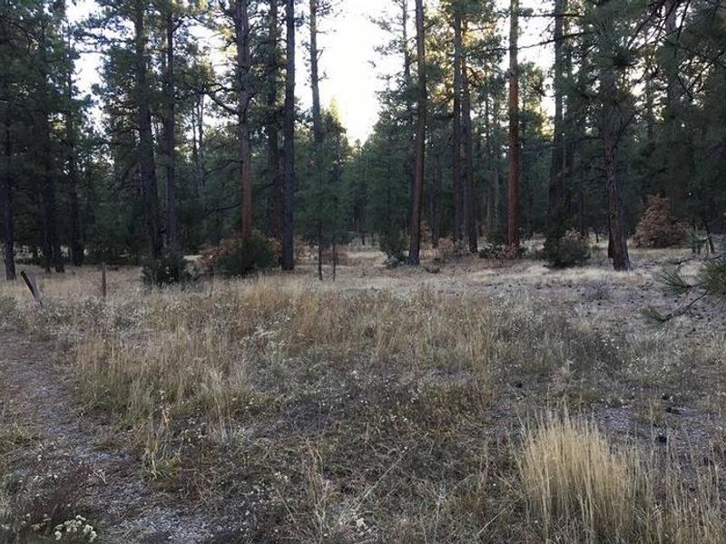
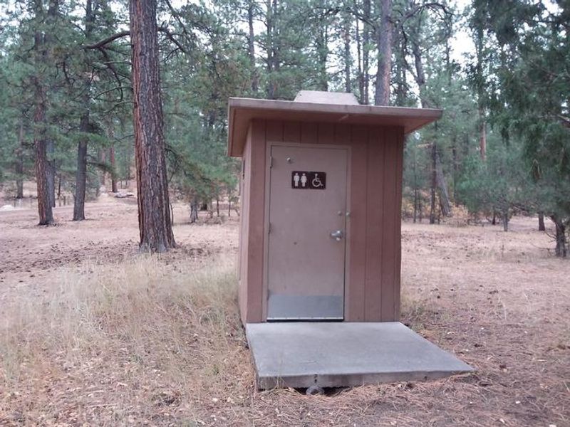
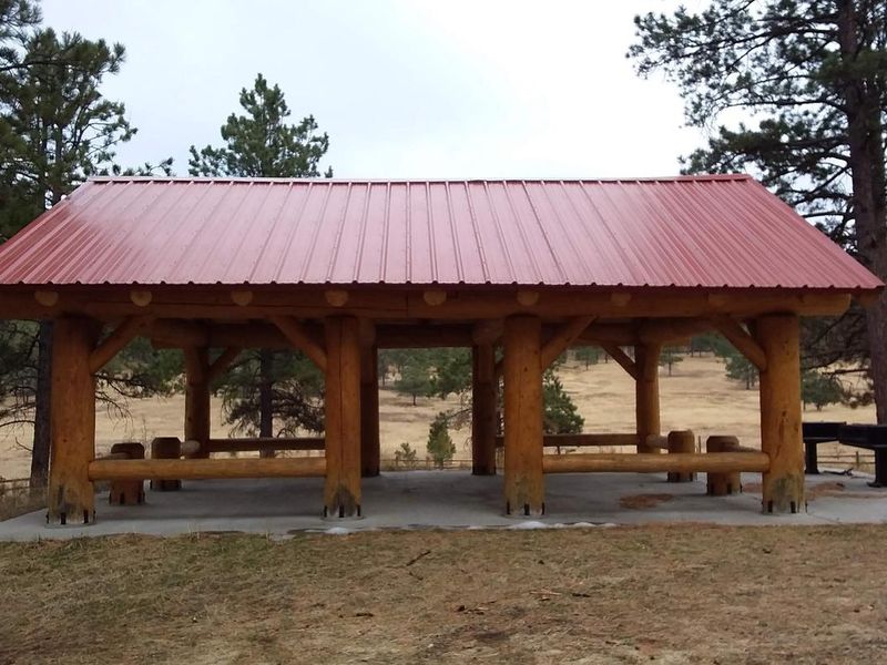
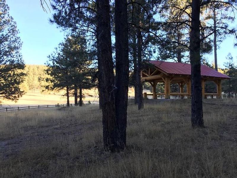
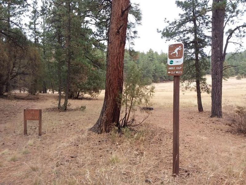
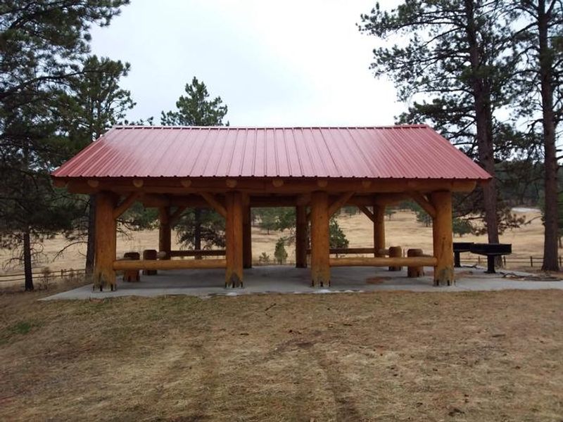
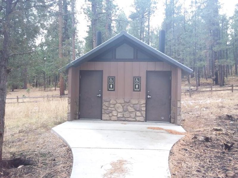
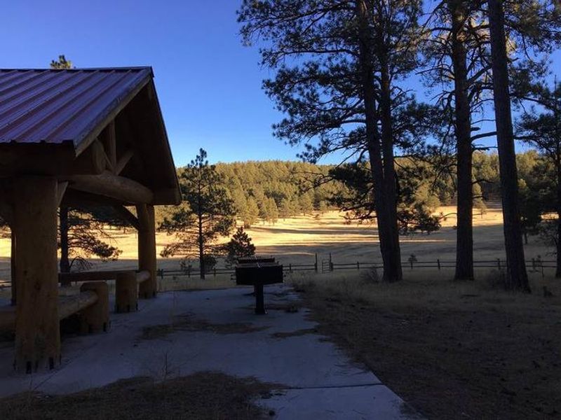
Amole Canyon Group Shelter sits at 8,400 feet elevation in a stand of tall ponderosa pines within Carson National Forest's Camino Real Ranger District. This secluded group facility is the only one in the area, accommodating up to 100 people with gated access via a coded padlock. The shelter overlooks a pristine meadow and provides ample space for large gatherings. Facilities include a covered shelter with picnic tables, twin barbecue grills, and a group-sized fire ring. Accessible twin vault toilets with a paved pathway serve the area. Parking includes 4 paved single-vehicle spots plus gravel pull-through areas for RVs and trailers up to 30 feet. Maximum 20 vehicles are permitted. There is no potable water, trash service, or cell phone service. The adjacent Amole Canyon Day Use Area offers approximately 11 miles of non-motorized trails for hiking, mountain biking, snowshoeing, and cross-country skiing. The South Loop Trail provides views of Rio Pueblo Valley, Bear Mountain, and Penasco Mountain, while the Upper Cutoff Trail offers Picuris Mountain vistas. Access to the motorized trail system is available via Trail 182.

Directions

From State Road 68 in Ranchos de Taos, go south on Highway 518 for 14.2 miles to the junction with Forest Road 703. Turn southeast on FSR 703 and proceed approximately 0.4 mile to a gate locked with a coded padlock. The combination code will be provided via email upon reservation. Unlock the gate and proceed south into the group shelter parking area.

Amenities

Water No
Fires Allowed Yes
Toilets Yes
Dump Station No
Wifi
Pets Allowed Yes
Showers No
Electric Hookups
Water Hookups
Sewer Hookups
Camp Store No
Price $100

Vehicle

Max RV Length 30ft
Max Trailer Length 30ft
Big Rig Friendly No
Pull Through Sites No

Contact

Email pschilke@fs.fed.us
Phone +1 (575) 587-2255

Cell Service

AT&T None
Verizon None
T-Mobile None

Availability

Photos

Amole Canyon RV Site
Amole Canyon Restroom located at the day use trailhead about 1/10 of mile away from the group shelter
Amole Canyon Group Shelter
Amole Shelter with Meadow view
Amole Loop Sign
Amole Canyon Group Shelter
Amole Canyon Restrooms located immediately adjacent to the group shelter.
Amole Canyon Shelter with BBQ grills

Community Posts

No posts yet. Be the first to share your experience!