Arrowhead Campground
Open — Open year-round. The drinking water spigot at the dump station is closed for winter to avoid freezing, but standard drinking water spigots around the campground remain operational.
From Recreation.gov
Drinking water spigot at the dump station is closed for the winter season to avoid freezing. You can still dump wastewater at the dump station and use standard drinking water spigots around the campground, but will be unable to hookup your camper to fill up reserve tanks. Please call Uwharrie Ranger Station @ 910-576-6391 during business hours for more information.
Special Weather Statement issued March 30 at 7:44PM EDT by NWS Raleigh NC
The combination of low relative humidity, gusty winds, and very dry fuels will lead to an increased risk of wildfires today across central North Carolina. Residents and visitors are urged to properly dispose of cigarette butts, matches, and any other flammable items in appropriate containers. Additionally, exercise caution if operating any equipment that could create sparks, and keep vehicles off of dry leaves and grass. Most dry grasses, dead leaves, and other tree litter could easily ignite and spread fire quickly. A statewide burn ban issued by the North Carolina Forest Service is currently in place. Open burning of any kind is illegal.
Temporary Road Closure Alert: Curtis Creek Road
Curtis Creek Road will close starting Monday, March 30, just past the Newberry Creek Road intersection, to build a boulder wall that will stabilize the roadway following Hurricane Helene. The closure is needed to reopen Curtis Creek Campground by mid May.This 6-week repair project is a partnership…
Catawba Falls Partial Closure
A partial closure of Catawba Falls trail will take place this Wednesday and Thursday, March 25 and 26. Due to the ongoing Helene recovery work in partnership with the G5 Trail Collective, the Ridge Trail between the parking lot and upper Catawba Falls will be closed for a period of time this…
Great Lakes Boat Launch- Temporary Closure
The Great Lakes Boat Launch will be closed for the safety of the public and fire crews during Prescribed Burn operations in Jonas County on Tuesday, March 24th.
Elk River Falls Temporary Re-Closure
Temporary Closure: Elk River Falls AreaClosure Order Closure Order MapStarting March 18, the Elk River Falls Area will be temporarily closed on the Pisgah National Forest. This includes closing the Elk River Trail, Elk River Falls and Elk River Road within the closure area in Avery County. The…
Connely Creek Road (NFSR 86) Closure
Connely Creek Road (NFSR 86) on the Nantahala Ranger District will be closed until October 2026 for road improvements. The closure will extend from the intersection of Cowee Bald Road (NFSR 70) to the intersection of Barkers Creek (NFSR 7062). Access to Cowee Bald will only be available from Macon…
Prescribed Burn Croatan National Forest
The Croatan National Forest is conducting a 1,323-acre prescribed burn today, February 24, in Jones County off Holston Creek Rd and Highway 58, approximately 7 miles South of Maysville, NC and 15 miles SW of the Croatan Ranger Station. Smoke may be visible in this area throughout the day.A…
Winter Weather Alert
As North Carolina prepares for Winter Storm Gianna, the U.S. Department of Agriculture’s Forest Service urges the public to use extreme caution when visiting the state’s four national forests.Winter weather conditions can make visiting the forest unpredictable and dangerous, even for…
Cold Springs Road, Pisgah National Forest Traffic Alert
Cold Springs Road (Forest Service Road 148) on the Appalachian Ranger District in Haywood County will have traffic disruptions of up to 3 hours at a time as culvert replacement takes place beginning Monday, September 29. Work will occur Monday-Thursday between the hours of 9 a.m. -3:30 p.m.
Roan Mountain Fire Restrictions
Fire restrictions are now in effect for the Roan Mountain area of Appalachian Ranger District due to heightened fire danger caused by Hurricane Helene. The fire restriction is in effect on all National Forest System land from Hughes Gap to Doll Flats on the Appalachian Trail.This…
Joyce Kilmer Memorial Forest and Jenkins Meadows Trailheads Closed for Parking Lot Repairs
Joyce Kilmer Memorial Forest and Jenkins Meadows trailhead on the Nantahala National Forest will be temporarily closed beginning the evening of July 28, 2025 for roadwork and needed parking lot repairs. Work should take approximately 2-3 days, but could be extended by weather delays. The public…
Pisgah National Forest Driving Safety Alert
Please use caution as you travel in and around the Forest. We have a lot of heavy equipment and repair crews in the area working on roads damaged during Hurricane Helene. Up to 2,000 tons of gravel are being placed EVERY DAY on our Forest Service roads through the summer and fall. That's around 60…
Joyce Kilmer Memorial Forest and Jenkins Meadow trailheads closed
The USDA Forest Service has closed Joyce Kilmer Road (Forest Service Road 416) on the Cheoah Ranger District of the Nantahala National Forest for repairs, impacting access to both the Joyce Kilmer and Jenkins Meadow trailheads. Work should take approximately three to five days but could be extended…
Croatan Ranger's Office Closed
The Croatan Ranger's Office will be closed June 7th and 8th to visitors and staff as work for the I42 Project will begin.
Flooding on Uwharrie National Forest
Moccasin Creek Road (#576) and McLeans Creek Road (#544) are experiencing flooding due to heavy rain on Uwharrie National Forest. Recreation areas and roads remain open, however, access may be limited due to current conditions. Caution is advised.
Paint Rock Closure
Effective through May 1, 2035, certain National Forest System lands in the Paint Rock area, located on the Appalachian Ranger District of Pisgah National Forest and the Unaka Ranger District of Cherokee National Forest, will be closed to protect cultural resources.This closure is intended to…
Appalachian Trail Detour- Iron Mountain Gap
The Iron Mountain Gap detour is now in place to route hikers around the final remaining 6 miles of closed section of the Appalachian Trail from about a mile south of the destroyed Cherry Gap Shelter to about a mile north of Iron Mountain Gap (approx. NOBO mile 360.6 to 365.9). The detour is mapped…
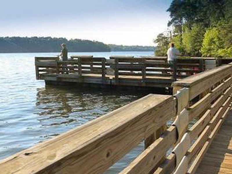
Kings Mountain Point Fishing Pier Closure
The fishing pier at Kings Mountain Point Day Use Area on the Uwharrie National Forest is closed till further notice due to storm damage. The Day Use area remains open and the three smaller accessible fishing platforms are available for public use.
I-40 Corridor Forest Closure
For the protection and public health and safety for the Interstate 40 reconstruction, a closure is in place for National Forest Service lands and roads south of the I-40 corridor in the Appalachian Ranger District. This includes areas south of Slick Rock Branch drainage, the area west of the Pigeon…
Pisgah Camping Limitations
The following act is prohibited within 1000 feet of a road open to public vehicle travel on the Pisgah Ranger District in Buncombe, Haywood, Henderson, and Transylvania Counties in North Carolina.Camping is prohibited in any area not designated as a campsite depicted on the attached map. This…
Max Patch Restrictions
Restrictions on camping, fires, animals, aircraft and bicycles in Max Patch area.
About
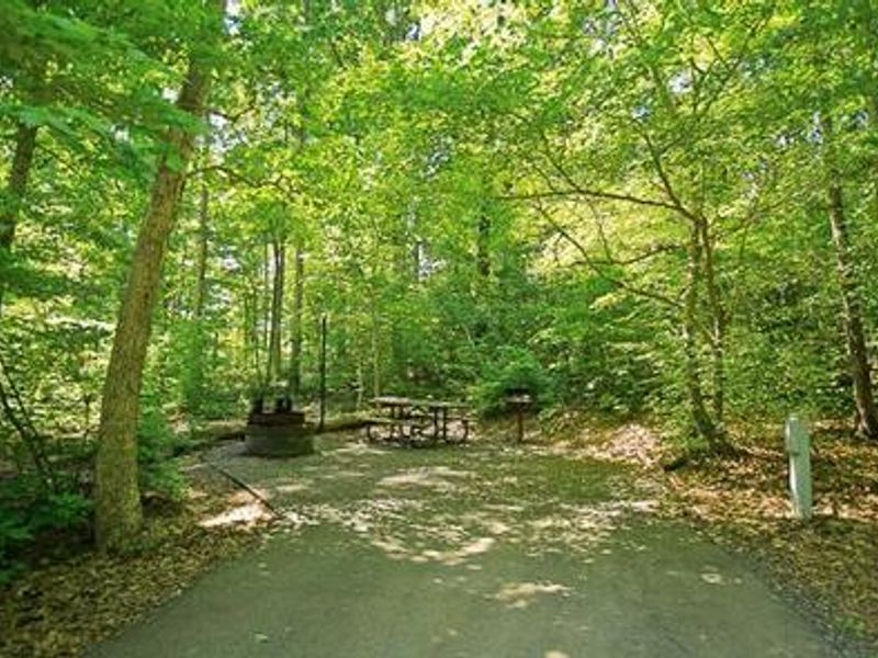
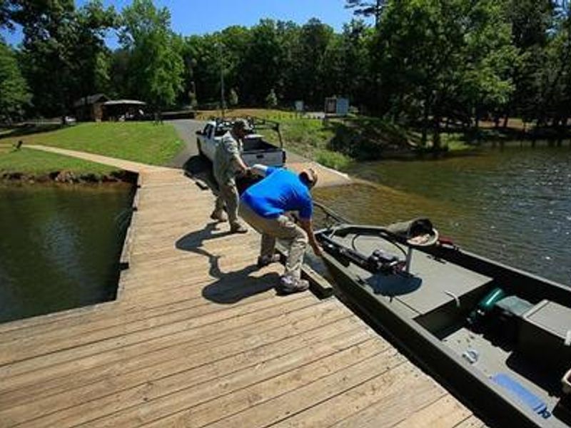
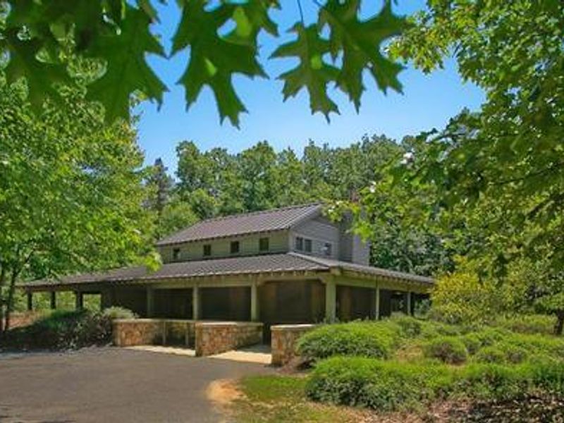
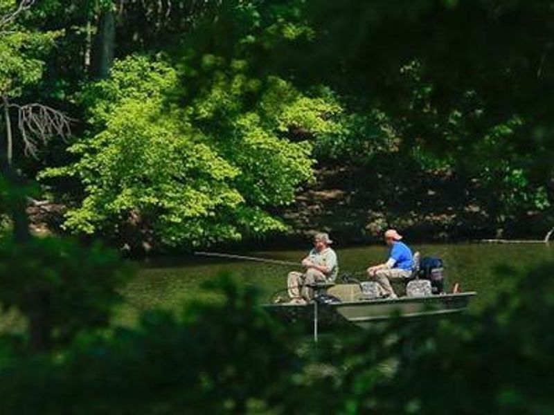
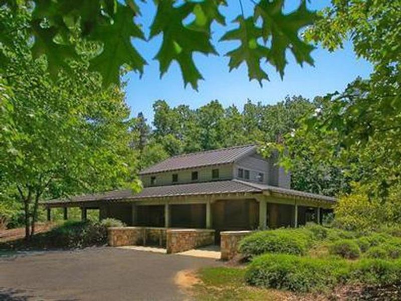
Arrowhead Campground lies in the Badin Lake Recreation Area, a hub for outdoor activities in central North Carolina's Uwharrie National Forest. The campground offers 48 sites nestled in a dense forest of pine, oak and hickory near the shore of 5,000-acre Badin Lake. Sites 46-49 are tent-only, while most other sites accommodate both tents and RVs. Nearly all sites are ADA accessible and include a table, grill, fire ring, lantern post and parking spur. Sites 12-45 offer electric hookups for an additional fee. The campground features a bathhouse with flush toilets, hot showers, and a family restroom for privacy. Six drinking water spigots are located throughout the campground, and a dump station is available near the entrance. A three-quarter-mile paved bicycle and walking path loops around the campground, making it easy to explore the area. Recreation opportunities abound with approximately 40 miles of non-motorized trails for horseback riding, mountain biking and hiking, plus 17 miles of motorized trails for off-road vehicle riding. Badin Lake offers excellent opportunities for swimming, boating, fishing and waterskiing. The surrounding Uwharrie National Forest provides both big and small game hunting. The campground operates year-round with both reservable sites and first-come, first-served availability.
Directions
From Troy, take Highway 109 north to Mullinix Road just past Eldorado Outpost. Turn left onto Mullinix Road and continue past Badin Horse Camp. Turn right on FR 544 (McLeans Creek Road) for 1.8 miles to a stop sign and turn left on FR 597 (Badin Lake Road) for 0.6 miles. Turn right on FR 597B (Cove Road) to the campground entrance on the right.
Nearby Campgrounds
Amenities
| Water | Yes |
| Fires Allowed | Yes |
| Toilets | Yes |
| Dump Station | Yes |
| Wifi | No |
| Pets Allowed | Yes |
| Showers | Yes |
| Electric Hookups | Yes |
| Water Hookups | No |
| Sewer Hookups | No |
| Camp Store | No |
| Price | $20 - $27 |
Vehicle
| Max RV Length | 45ft |
| Max Trailer Length | 45ft |
| Big Rig Friendly | Yes |
| Pull Through Sites | No |
Contact
| uwharrie@usda.gov | |
| Phone | +1 (910) 576-6391 |
Cell Service
| AT&T | None |
| Verizon | Yes |
| T-Mobile | None |
Availability
Photos
Community Posts
No posts yet. Be the first to share your experience!