Tailwater East Campground

Open

Open for the 2026 season from May 1 through October 31. Reservations available through Recreation.gov. The dump station is located just outside West Overlook Campground, a short drive away within the Dam Complex.

Flood Watch issued June 11 at 10:10AM CDT until June 11 at 7:00PM CDT by NWS Quad Cities IA IL

10:10 AM — 7:00 PM

Several rounds of heavy rain producing thunderstorms will be seen across the watch area. Storms may redevelop over the same areas resulting torrential rainfall and possibly several inches of rain. Flash flooding will be possible through this evening. * WHAT...Flooding caused by excessive rainfall continues to be possible. * WHERE...Portions of Illinois, including the following areas, Bureau, Carroll, Hancock, Henderson, Henry IL, Jo Daviess, McDonough, Mercer, Putnam, Rock Island, Stephenson, Warren and Whiteside, Iowa, including the following areas, Benton, Buchanan, Cedar, Clinton, Delaware, Des Moines, Dubuque, Henry IA, Iowa, Jackson, Jefferson, Johnson, Jones, Keokuk, Lee, Linn, Louisa, Muscatine, Scott, Van Buren and Washington, and northeast Missouri, including the following areas, Clark and Scotland. * WHEN...Until 7 PM CDT this evening. * IMPACTS...Excessive runoff may result in flooding of rivers, creeks, streams, and other low-lying and flood-prone locations. Creeks and streams may rise out of their banks.

Flood Warning issued June 11 at 9:52AM CDT until June 13 at 11:43PM CDT by NWS Quad Cities IA IL

9:52 AM — June 12th, 10:00 AM

...The Flood Warning continues for the following rivers in Iowa... Maquoketa River near Maquoketa affecting Jackson County. Cedar River near Conesville affecting Louisa and Muscatine Counties. Iowa River near Lone Tree affecting Louisa, Washington and Johnson Counties. English River at Kalona affecting Washington and Johnson Counties. Skunk River at Augusta affecting Henry IA, Des Moines and Lee Counties. Wapsipinicon River near De Witt 4S affecting Scott and Clinton Counties. ...The Flood Warning is extended for the following rivers in Illinois... Rock River near Joslin affecting Henry IL, Rock Island and Whiteside Counties. Rock River at Moline affecting Henry IL and Rock Island Counties. .Several rounds of heavy rainfall will produce flooding on several tributary rivers. * WHAT...Minor flooding is forecast. * WHERE...English River at Kalona. * WHEN...From late tonight to late Saturday evening. * IMPACTS...At 16.0 feet, Water begins approaching several county roads. Agricultural land near the river is flooding. * ADDITIONAL DETAILS... - At 9:00 AM CDT Thursday the stage was 7.6 feet. - Forecast...The river is expected to rise above flood stage late tonight to a crest of 15.9 feet tomorrow evening. It will then fall below flood stage Saturday afternoon. - Flood stage is 14.0 feet.

Flood Warning issued June 11 at 9:52AM CDT until June 12 at 9:36PM CDT by NWS Quad Cities IA IL

9:52 AM — June 12th, 10:00 AM

...The Flood Warning continues for the following rivers in Iowa... Maquoketa River near Maquoketa affecting Jackson County. Cedar River near Conesville affecting Louisa and Muscatine Counties. Iowa River near Lone Tree affecting Louisa, Washington and Johnson Counties. English River at Kalona affecting Washington and Johnson Counties. Skunk River at Augusta affecting Henry IA, Des Moines and Lee Counties. Wapsipinicon River near De Witt 4S affecting Scott and Clinton Counties. ...The Flood Warning is extended for the following rivers in Illinois... Rock River near Joslin affecting Henry IL, Rock Island and Whiteside Counties. Rock River at Moline affecting Henry IL and Rock Island Counties. .Several rounds of heavy rainfall will produce flooding on several tributary rivers. * WHAT...Minor flooding is forecast. * WHERE...Iowa River near Lone Tree. * WHEN...From Friday morning to late tomorrow evening. * IMPACTS...At 16.0 feet, Flood waters affect parts of Lola Lane and Y Avenue. River Junction Access Park is closed. * ADDITIONAL DETAILS... - At 9:00 AM CDT Thursday the stage was 11.2 feet. - Forecast...The river will rise above flood stage late tomorrow morning to 16.1 feet early tomorrow afternoon. It will then fall below flood stage early tomorrow afternoon to 13.4 feet Saturday morning. It will rise to 13.8 feet early Sunday morning. It will then fall again and remain below flood stage. - Flood stage is 16.0 feet.

Tornado Watch issued June 11 at 7:33AM CDT until June 11 at 3:00PM CDT by NWS Quad Cities IA IL

7:33 AM — 3:00 PM

THE NATIONAL WEATHER SERVICE HAS ISSUED TORNADO WATCH 311 IN EFFECT UNTIL 3 PM CDT THIS AFTERNOON FOR THE FOLLOWING AREAS IN ILLINOIS THIS WATCH INCLUDES 13 COUNTIES IN NORTH CENTRAL ILLINOIS BUREAU PUTNAM IN NORTHWEST ILLINOIS CARROLL HENRY IL JO DAVIESS MERCER ROCK ISLAND STEPHENSON WHITESIDE IN WEST CENTRAL ILLINOIS HANCOCK HENDERSON MCDONOUGH WARREN IN IOWA THIS WATCH INCLUDES 21 COUNTIES IN EAST CENTRAL IOWA BENTON CEDAR CLINTON IOWA JACKSON JOHNSON JONES LINN MUSCATINE SCOTT IN NORTHEAST IOWA BUCHANAN DELAWARE DUBUQUE IN SOUTHEAST IOWA DES MOINES HENRY IA JEFFERSON KEOKUK LEE LOUISA VAN BUREN WASHINGTON IN MISSOURI THIS WATCH INCLUDES 2 COUNTIES IN NORTHEAST MISSOURI CLARK SCOTLAND THIS INCLUDES THE CITIES OF ALEDO, ANAMOSA, BETTENDORF, BURLINGTON, CARTHAGE, CEDAR RAPIDS, CLINTON, CREDIT ISLAND, DAVENPORT, DUBUQUE, FAIRFIELD, FREEPORT, GALENA, GENESEO, HENNEPIN, INDEPENDENCE, IOWA CITY, KAHOKA, KEOKUK, KEOSAUQUA, MACOMB, MANCHESTER, MAQUOKETA, MARENGO, MEMPHIS, MOLINE, MONMOUTH, MOUNT CARROLL, MOUNT PLEASANT, MUSCATINE, OQUAWKA, PRINCETON, ROCK ISLAND, SIGOURNEY, STERLING, TIPTON, VINTON, WAPELLO, AND WASHINGTON.

About

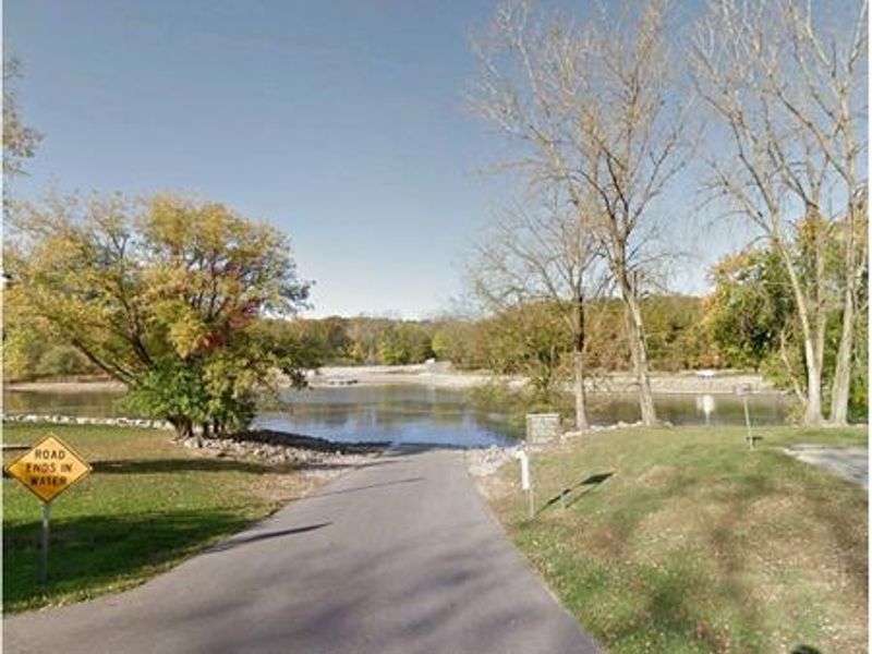
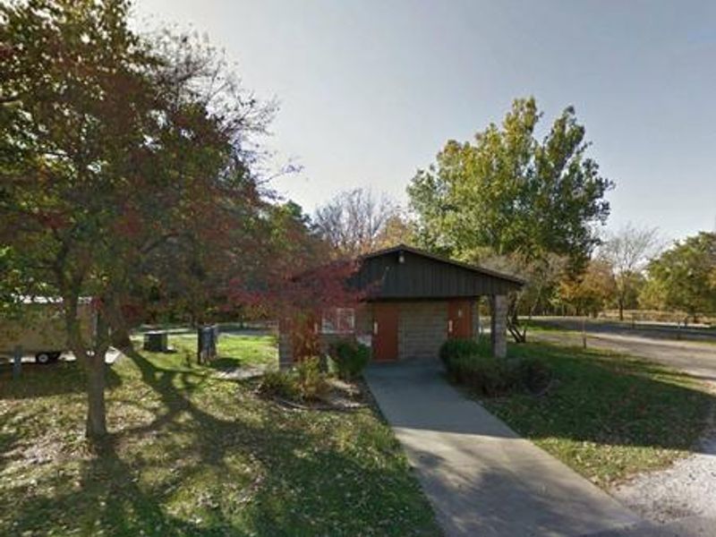
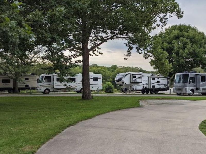
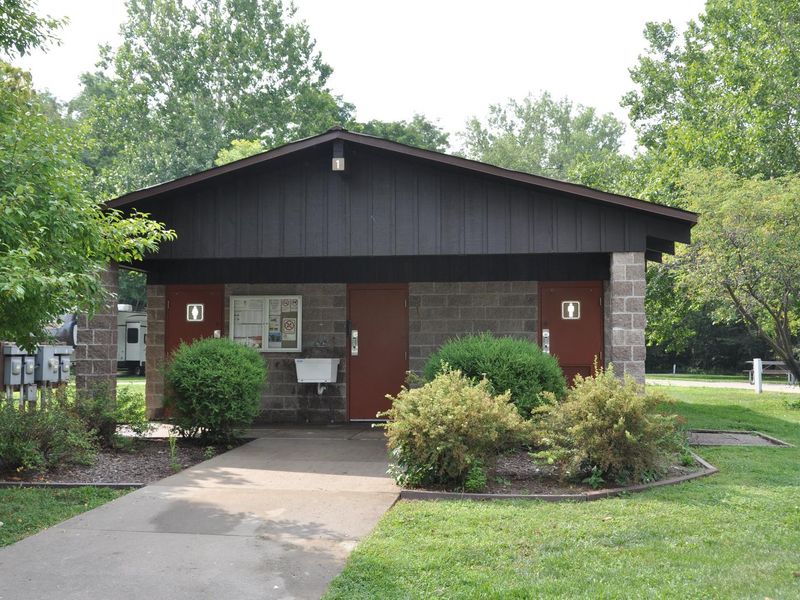
Tailwater East Campground is located within the Dam Complex at the Coralville Lake Project, operated by the U.S. Army Corps of Engineers. The campground occupies a scenic, heavily wooded site on the east bank of the Iowa River, immediately downstream of the dam. With 28 campsites ranging from full hookup to standard electric to non-electric walk-to tent sites, it accommodates a variety of camping styles. Sites feature fire pits, picnic tables, and paved driveways up to 50 feet long. The campground provides a modern restroom and shower facility with flush toilets and hot water, a fish cleaning station, and a boat ramp for direct Iowa River access. The tailwaters below the dam offer excellent fishing for largemouth and smallmouth bass, crappie, walleye, and catfish. Several trails originate nearby, including Squire Point, Woodpecker Trail, Tailwater Riverwalk, and the barrier-free Veterans Trail. Just below the dam lies the Devonian Fossil Gorge, where visitors can explore a 375-million-year-old exposed sea floor with fossil remains of ancient marine life. The Turkey Creek Disc Golf Course offers a 9-hole layout in the Dam Complex. Iowa City and Coralville are minutes away, providing restaurants, shops, and the University of Iowa campus.

Directions

From Interstate 80 (Iowa City), take Exit 244 towards Dubuque St./North Liberty. Travel north on Dubuque St. for 3 miles and turn right onto West Overlook Rd. NE. Travel 1.1 miles and at the second stop sign, turn right onto Prairie Du Chien Rd. NE. Travel east 0.7 miles across the Coralville Lake Dam. The campground entrance is on the right.

Amenities

Water Yes
Fires Allowed Yes
Toilets Yes
Dump Station No
Wifi
Pets Allowed Yes
Showers Yes
Electric Hookups Yes
Water Hookups Yes
Sewer Hookups Yes
Camp Store
Price $24

Vehicle

Max RV Length 50ft
Max Trailer Length 50ft
Big Rig Friendly Yes
Pull Through Sites No

Contact

Email coralville.lake@usace.army.mil
Phone +1 (319) 338-3685

Cell Service

AT&T Yes
Verizon Yes
T-Mobile Yes

Availability

Photos

Tailwater East
Tailwater East
Tailwater East

Community Posts

No posts yet. Be the first to share your experience!