Sugar Bottom Campground

Closed

Currently closed for construction during May 2026. Reservations are unavailable until construction is complete. The campground typically operates May 1 through September 30.

From Recreation.gov

Reservations are currently unavailable for the Sugar Bottom Campground during the month of May due to ongoing construction. Please check back at a later date. Reservations will be available as soon as the construction is complete.

Tornado Watch issued June 11 at 3:16PM CDT until June 11 at 3:00PM CDT by NWS Quad Cities IA IL

3:16 PM — 9:00 PM

THE NATIONAL WEATHER SERVICE HAS ISSUED TORNADO WATCH 313 UNTIL 9 PM CDT THIS EVENING. TORNADO WATCH 311 HAS EXPIRED. THE NEW WATCH IS VALID FOR THE FOLLOWING AREAS IN ILLINOIS THE NEW WATCH INCLUDES 13 COUNTIES IN NORTH CENTRAL ILLINOIS BUREAU PUTNAM IN NORTHWEST ILLINOIS CARROLL HENRY IL JO DAVIESS MERCER ROCK ISLAND STEPHENSON WHITESIDE IN WEST CENTRAL ILLINOIS HANCOCK HENDERSON MCDONOUGH WARREN IN IOWA THE NEW WATCH INCLUDES 17 COUNTIES IN EAST CENTRAL IOWA CEDAR CLINTON IOWA JACKSON JOHNSON JONES LINN MUSCATINE SCOTT IN SOUTHEAST IOWA DES MOINES HENRY IA JEFFERSON KEOKUK LEE LOUISA VAN BUREN WASHINGTON IN MISSOURI THE NEW WATCH INCLUDES 2 COUNTIES IN NORTHEAST MISSOURI CLARK SCOTLAND THIS INCLUDES THE CITIES OF ALEDO, ANAMOSA, BETTENDORF, BURLINGTON, CARTHAGE, CEDAR RAPIDS, CLINTON, CREDIT ISLAND, DAVENPORT, FAIRFIELD, FREEPORT, GALENA, GENESEO, HENNEPIN, IOWA CITY, KAHOKA, KEOKUK, KEOSAUQUA, MACOMB, MAQUOKETA, MARENGO, MEMPHIS, MOLINE, MONMOUTH, MOUNT CARROLL, MOUNT PLEASANT, MUSCATINE, OQUAWKA, PRINCETON, ROCK ISLAND, SIGOURNEY, STERLING, TIPTON, WAPELLO, AND WASHINGTON.

Flood Warning issued June 11 at 9:52AM CDT until June 13 at 11:43PM CDT by NWS Quad Cities IA IL

9:52 AM — June 12th, 10:00 AM

...The Flood Warning continues for the following rivers in Iowa... Maquoketa River near Maquoketa affecting Jackson County. Cedar River near Conesville affecting Louisa and Muscatine Counties. Iowa River near Lone Tree affecting Louisa, Washington and Johnson Counties. English River at Kalona affecting Washington and Johnson Counties. Skunk River at Augusta affecting Henry IA, Des Moines and Lee Counties. Wapsipinicon River near De Witt 4S affecting Scott and Clinton Counties. ...The Flood Warning is extended for the following rivers in Illinois... Rock River near Joslin affecting Henry IL, Rock Island and Whiteside Counties. Rock River at Moline affecting Henry IL and Rock Island Counties. .Several rounds of heavy rainfall will produce flooding on several tributary rivers. * WHAT...Minor flooding is forecast. * WHERE...English River at Kalona. * WHEN...From late tonight to late Saturday evening. * IMPACTS...At 16.0 feet, Water begins approaching several county roads. Agricultural land near the river is flooding. * ADDITIONAL DETAILS... - At 9:00 AM CDT Thursday the stage was 7.6 feet. - Forecast...The river is expected to rise above flood stage late tonight to a crest of 15.9 feet tomorrow evening. It will then fall below flood stage Saturday afternoon. - Flood stage is 14.0 feet.

Flood Warning issued June 11 at 9:52AM CDT until June 12 at 9:36PM CDT by NWS Quad Cities IA IL

9:52 AM — June 12th, 10:00 AM

...The Flood Warning continues for the following rivers in Iowa... Maquoketa River near Maquoketa affecting Jackson County. Cedar River near Conesville affecting Louisa and Muscatine Counties. Iowa River near Lone Tree affecting Louisa, Washington and Johnson Counties. English River at Kalona affecting Washington and Johnson Counties. Skunk River at Augusta affecting Henry IA, Des Moines and Lee Counties. Wapsipinicon River near De Witt 4S affecting Scott and Clinton Counties. ...The Flood Warning is extended for the following rivers in Illinois... Rock River near Joslin affecting Henry IL, Rock Island and Whiteside Counties. Rock River at Moline affecting Henry IL and Rock Island Counties. .Several rounds of heavy rainfall will produce flooding on several tributary rivers. * WHAT...Minor flooding is forecast. * WHERE...Iowa River near Lone Tree. * WHEN...From Friday morning to late tomorrow evening. * IMPACTS...At 16.0 feet, Flood waters affect parts of Lola Lane and Y Avenue. River Junction Access Park is closed. * ADDITIONAL DETAILS... - At 9:00 AM CDT Thursday the stage was 11.2 feet. - Forecast...The river will rise above flood stage late tomorrow morning to 16.1 feet early tomorrow afternoon. It will then fall below flood stage early tomorrow afternoon to 13.4 feet Saturday morning. It will rise to 13.8 feet early Sunday morning. It will then fall again and remain below flood stage. - Flood stage is 16.0 feet.

About

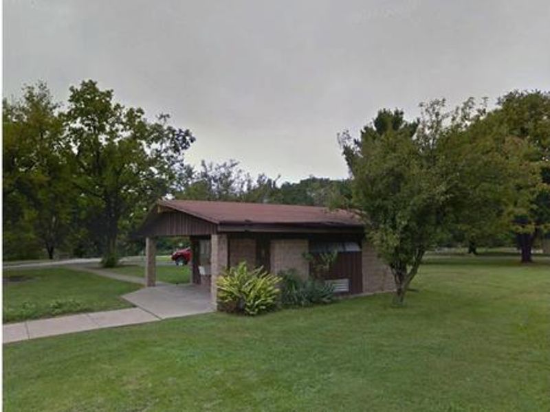
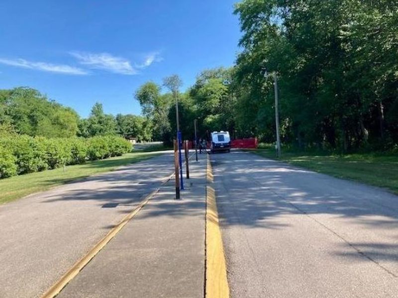
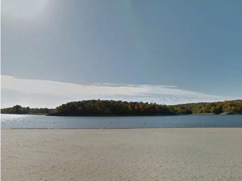
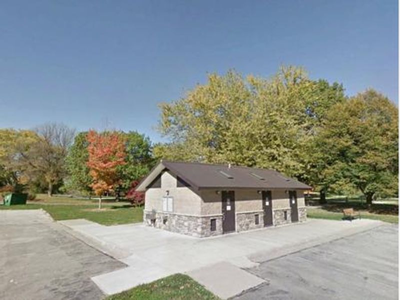
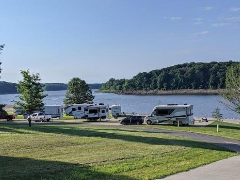
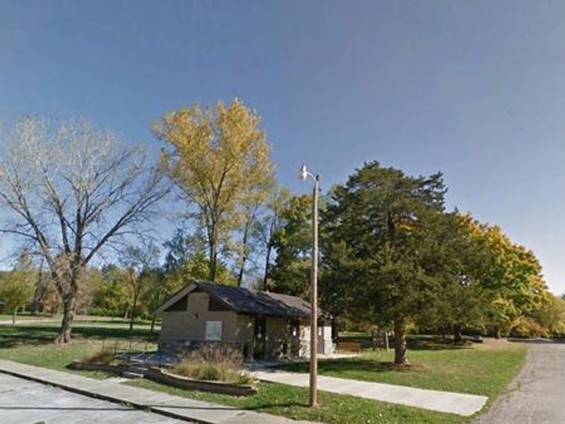
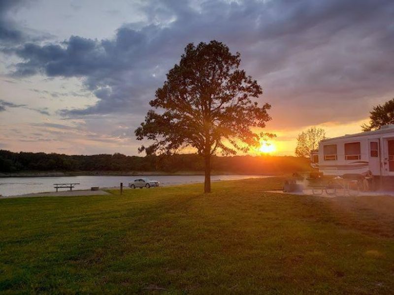
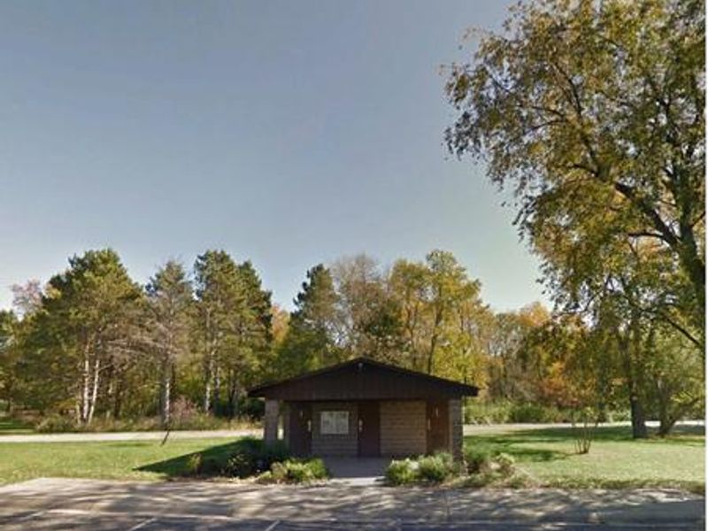
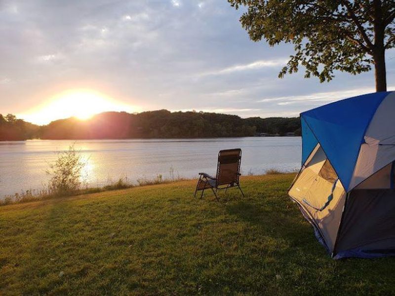
Sugar Bottom Campground is a U.S. Army Corps of Engineers facility located on the east shore of Coralville Lake in the Iowa River Valley. The 232-site campground is nestled in a heavily wooded forest of mixed hardwood species, providing shade and privacy for campers. Site types range from non-electric walk-to tent sites to full-service RV sites with 20/30/50-amp electric, water, and sewer hookups. Standard electric sites with 30-amp service are also available. Coralville Lake offers excellent fishing opportunities for largemouth and smallmouth bass, crappie, walleye, and catfish. The campground provides direct access to a beach and boat ramp. On land, campers can explore the Sugar Bottom Mountain Bike Trail system, which features beginner to expert routes, or walk the barrier-free asphalt trail. The Cedar Valley Nature Trail also passes through the area. An 18-hole disc golf course is located in the adjacent day-use area. Facilities include modern restrooms with flush toilets and showers, vault toilets throughout the campground, a dump station, and potable water. Each site includes a fire ring and picnic table. The campground typically operates from May 1 through September 30. Reservations are made through Recreation.gov.

Directions

From Interstate 380 (North Liberty, Iowa), take Exit 4 towards North Liberty. Travel east on W. Penn St. for 2.2 miles. At the four-way stop, turn left onto N. Front St./Mehaffey Bridge Rd. NE. Continue 2.9 miles. After crossing Mehaffey Bridge, turn right onto Sugar Bottom Campground Access Rd. and continue 1.1 miles to the entrance.

Amenities

Water Yes
Fires Allowed Yes
Toilets Yes
Dump Station Yes
Wifi
Pets Allowed Yes
Showers Yes
Electric Hookups Yes
Water Hookups Yes
Sewer Hookups Yes
Camp Store
Price $14 - $80

Vehicle

Max RV Length 62ft
Max Trailer Length 66ft
Big Rig Friendly Yes
Pull Through Sites No

Contact

Email kathryn.s.atkinson@usace.army.mil
Phone +1 (319) 624-2102

Cell Service

AT&T Yes
Verizon Yes
T-Mobile None

Availability

Photos

Dump Station
170's Loop
Campsite 176
Campground Fee Booth
Campsite 176
Tent campsite 103

Community Posts

No posts yet. Be the first to share your experience!