Spring Mill State Park
Open for camping. Reservations available via camp.IN.gov up to 6 months in advance. Standard season with full services runs late April through early November. Lower rates Sunday through Wednesday. 14-night maximum stay.
Flood Warning issued May 22 at 11:56AM EDT until May 31 at 5:36AM EDT by NWS Indianapolis IN
...The Flood Warning is extended for the following rivers in Indiana... East Fork White River near Rivervale, Seymour, Bedford, Williams. .Multiple rounds of heavy rainfall over the last few days has brought minor to moderate flooding to the East Fork White. The crest on the East Fork is slightly past Seymour. Flooding along the lower East Fork is expected to last through most of next week. More rounds of rainfall the next few days, mainly Friday and Friday night, could make the flooding last longer and bring higher crests for downriver points. * WHAT...Minor flooding is forecast. * WHERE...East Fork White River near Bedford. * WHEN...From this evening to Sunday, May 31. * IMPACTS...At 25.0 feet, Extensive lowland flooding is in progress. Bedford boat club is accessed by boat only. Some local residents walk to their homes. Several roads are closed including SR 450 east of Williams and Stumphole Bridge Rd. in Western Lawrence County. * ADDITIONAL DETAILS... - At 8:00 AM EDT Friday the stage was 18.6 feet. - Forecast...The river is expected to rise above flood stage late this evening to a crest of 24.9 feet early Monday afternoon. It will then fall below flood stage Saturday, May 30. - Flood stage is 20.0 feet. - http://www.weather.gov/safety/flood
Flood Warning issued May 22 at 11:56AM EDT until June 1 at 1:00AM EDT by NWS Indianapolis IN
...The Flood Warning is extended for the following rivers in Indiana... East Fork White River near Rivervale, Seymour, Bedford, Williams. .Multiple rounds of heavy rainfall over the last few days has brought minor to moderate flooding to the East Fork White. The crest on the East Fork is slightly past Seymour. Flooding along the lower East Fork is expected to last through most of next week. More rounds of rainfall the next few days, mainly Friday and Friday night, could make the flooding last longer and bring higher crests for downriver points. * WHAT...Minor flooding is occurring and minor flooding is forecast. * WHERE...East Fork White River near Rivervale. * WHEN...Until Monday, June 01. * IMPACTS...At 28.0 feet, Extensive river flooding in progress. Residential areas near the river begin to flood. The county bridge locally known as the Buddha bypass bridge becomes inaccessible. Several local roads are flooded including Duncan Rd/Tunnelton Rd, Fort Ritner at the underpass and post office, Old Buddha Rd, Tunnelton Rd at the railroad crossing and West Sparksville Bridge Rd. * ADDITIONAL DETAILS... - At 11:30 AM EDT Friday the stage was 21.3 feet. - Recent Activity...The maximum river stage in the 24 hours ending at 11:30 AM EDT Friday was 21.3 feet. - Forecast...The river is expected to rise to a crest of 27.4 feet early Monday morning. It will then fall below flood stage Sunday, May 31. - Flood stage is 20.0 feet. - http://www.weather.gov/safety/flood
Flood Warning issued May 22 at 11:56AM EDT until May 31 at 10:00AM EDT by NWS Indianapolis IN
...The Flood Warning is extended for the following rivers in Indiana... East Fork White River near Rivervale, Seymour, Bedford, Williams. .Multiple rounds of heavy rainfall over the last few days has brought minor to moderate flooding to the East Fork White. The crest on the East Fork is slightly past Seymour. Flooding along the lower East Fork is expected to last through most of next week. More rounds of rainfall the next few days, mainly Friday and Friday night, could make the flooding last longer and bring higher crests for downriver points. * WHAT...Minor flooding is forecast. * WHERE...East Fork White River at Williams. * WHEN...From late tonight to Sunday, May 31. * IMPACTS...At 12.0 feet, River begins to be noticeable as water backs up in local streams. State Road 450 closes in several locations. Higher campgrounds flood. Most roads in the flood plain are impassable above this level. Huron-Williams Road begins to flood south of Port Williams Road. * ADDITIONAL DETAILS... - There is no current observed data. - Forecast...The river is expected to rise above flood stage late tonight to a crest of 11.8 feet early Monday afternoon. It will then fall below flood stage Saturday, May 30. - Flood stage is 8.0 feet. - http://www.weather.gov/safety/flood
Flood Warning issued May 22 at 11:56AM EDT until May 27 at 4:40PM EDT by NWS Indianapolis IN
...The Flood Warning is extended for the following rivers in Indiana... East Fork White River near Rivervale, Seymour, Bedford, Williams. .Multiple rounds of heavy rainfall over the last few days has brought minor to moderate flooding to the East Fork White. The crest on the East Fork is slightly past Seymour. Flooding along the lower East Fork is expected to last through most of next week. More rounds of rainfall the next few days, mainly Friday and Friday night, could make the flooding last longer and bring higher crests for downriver points. * WHAT...Moderate flooding is occurring and moderate flooding is forecast. * WHERE...East Fork White River at Seymour. * WHEN...Until Wednesday afternoon. * IMPACTS...At 17.5 feet, Extensive agricultural flooding in progress. CR 850 S and SR 11 begin to flood in southern Bartholomew County. During August 2009, SR 11 closed between Southern Crossing and Bartholomew CR 550 S. Columbus gage height was 9 feet. * ADDITIONAL DETAILS... - At 10:45 AM EDT Friday the stage was 17.3 feet. - Recent Activity...The maximum river stage in the 24 hours ending at 10:45 AM EDT Friday was 18.0 feet. - Forecast...The river is expected to fall below flood stage early Wednesday morning and continue falling and remain below flood stage. - Flood stage is 12.0 feet. - http://www.weather.gov/safety/flood
About
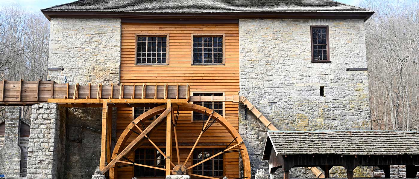
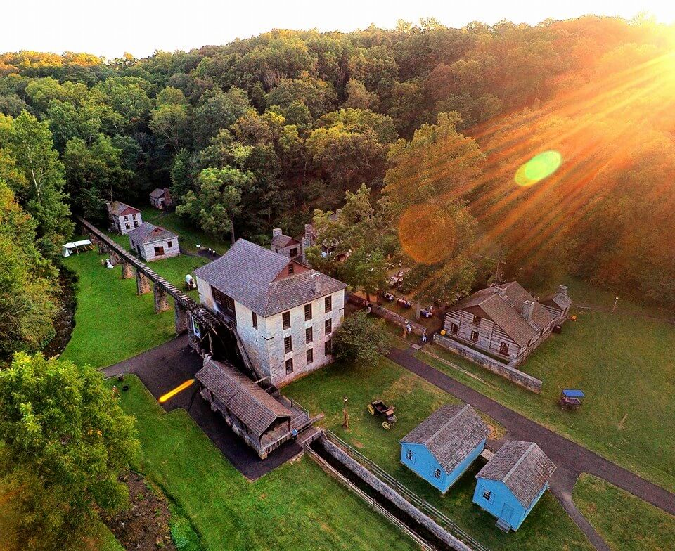
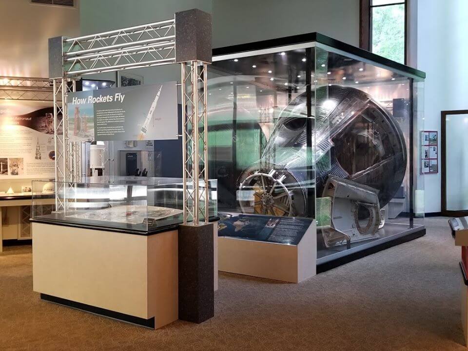
Spring Mill State Park sits on 1,319 acres in Lawrence County and centers on a restored 1800s pioneer village complete with a working water-powered gristmill, distillery, apothecary, and other historic buildings. Cave tours take visitors through the park's karst landscape, where underground streams and sinkholes define the geology. The Virgil I. Grissom Memorial honors the Indiana-born astronaut who flew on the Mercury and Gemini missions. The campground spreads across rolling, forested terrain with 229 sites. Most are electric (30 amp), and 44 offer full hookups with water and sewer. Comfort stations with flush toilets and showers serve the loops, and a dump station is available. A camp store near the entrance sells firewood, ice, and supplies. The Olympic-size swimming pool with bathhouse operates seasonally from late May through early September. Spring Mill Inn, located within the park, offers a restaurant open to day visitors and campers alike. Hiking trails range from easy strolls around the village to moderate routes through upland forest and along creek bottoms. Fishing is available at the park lake, and nature programs run throughout the season. The park is open year-round, though some facilities and the pool operate seasonally.
Directions
From State Road 37 in Mitchell, take State Road 60 east approximately 3 miles. The park entrance is on the left.
Amenities
| Water | Yes |
| Fires Allowed | Yes |
| Toilets | Yes |
| Dump Station | Yes |
| Wifi | — |
| Pets Allowed | Yes |
| Showers | Yes |
| Electric Hookups | Yes |
| Water Hookups | Yes |
| Sewer Hookups | Yes |
| Camp Store | Yes |
| Price | $20 - $75 |
Vehicle
| Max RV Length | 109ft |
| Max Trailer Length | — |
| Big Rig Friendly | Yes |
| Pull Through Sites | Yes |
Contact
| Phone | +1 (812) 849-3534 |
Cell Service
| AT&T | Yes |
| Verizon | Yes |
| T-Mobile | None |
Availability
Photos
Community Posts
No posts yet. Be the first to share your experience!