Sandy Beach Campground

Sandy Beach Camp

Open

Open for the 2026 season. The campground operates May 1 through September 30. All 58 sites are reservable through Recreation.gov.

Flood Watch issued June 11 at 6:43PM CDT until June 11 at 7:00PM CDT by NWS Quad Cities IA IL

6:43 PM — 7:45 PM

The Flood Watch will expire for portions of Illinois, including the following areas, Bureau, Carroll, Hancock, Henderson, Henry IL, Jo Daviess, McDonough, Mercer, Putnam, Rock Island, Stephenson, Warren and Whiteside, Iowa, including the following areas, Benton, Buchanan, Cedar, Clinton, Delaware, Des Moines, Dubuque, Henry IA, Iowa, Jackson, Jefferson, Johnson, Jones, Keokuk, Lee, Linn, Louisa, Muscatine, Scott, Van Buren and Washington, and northeast Missouri, including the following areas, Clark and Scotland. The heavy rain and additional flooding threat has ended. Therefore, the Flood Watch will be allowed to expire at 7 PM CDT this evening.

Tornado Watch issued June 11 at 3:16PM CDT until June 11 at 3:00PM CDT by NWS Quad Cities IA IL

3:16 PM — 9:00 PM

THE NATIONAL WEATHER SERVICE HAS ISSUED TORNADO WATCH 313 UNTIL 9 PM CDT THIS EVENING. TORNADO WATCH 311 HAS EXPIRED. THE NEW WATCH IS VALID FOR THE FOLLOWING AREAS IN ILLINOIS THE NEW WATCH INCLUDES 13 COUNTIES IN NORTH CENTRAL ILLINOIS BUREAU PUTNAM IN NORTHWEST ILLINOIS CARROLL HENRY IL JO DAVIESS MERCER ROCK ISLAND STEPHENSON WHITESIDE IN WEST CENTRAL ILLINOIS HANCOCK HENDERSON MCDONOUGH WARREN IN IOWA THE NEW WATCH INCLUDES 17 COUNTIES IN EAST CENTRAL IOWA CEDAR CLINTON IOWA JACKSON JOHNSON JONES LINN MUSCATINE SCOTT IN SOUTHEAST IOWA DES MOINES HENRY IA JEFFERSON KEOKUK LEE LOUISA VAN BUREN WASHINGTON IN MISSOURI THE NEW WATCH INCLUDES 2 COUNTIES IN NORTHEAST MISSOURI CLARK SCOTLAND THIS INCLUDES THE CITIES OF ALEDO, ANAMOSA, BETTENDORF, BURLINGTON, CARTHAGE, CEDAR RAPIDS, CLINTON, CREDIT ISLAND, DAVENPORT, FAIRFIELD, FREEPORT, GALENA, GENESEO, HENNEPIN, IOWA CITY, KAHOKA, KEOKUK, KEOSAUQUA, MACOMB, MAQUOKETA, MARENGO, MEMPHIS, MOLINE, MONMOUTH, MOUNT CARROLL, MOUNT PLEASANT, MUSCATINE, OQUAWKA, PRINCETON, ROCK ISLAND, SIGOURNEY, STERLING, TIPTON, WAPELLO, AND WASHINGTON.

Flood Warning issued June 11 at 9:52AM CDT until June 13 at 11:43PM CDT by NWS Quad Cities IA IL

9:52 AM — June 12th, 10:00 AM

...The Flood Warning continues for the following rivers in Iowa... Maquoketa River near Maquoketa affecting Jackson County. Cedar River near Conesville affecting Louisa and Muscatine Counties. Iowa River near Lone Tree affecting Louisa, Washington and Johnson Counties. English River at Kalona affecting Washington and Johnson Counties. Skunk River at Augusta affecting Henry IA, Des Moines and Lee Counties. Wapsipinicon River near De Witt 4S affecting Scott and Clinton Counties. ...The Flood Warning is extended for the following rivers in Illinois... Rock River near Joslin affecting Henry IL, Rock Island and Whiteside Counties. Rock River at Moline affecting Henry IL and Rock Island Counties. .Several rounds of heavy rainfall will produce flooding on several tributary rivers. * WHAT...Minor flooding is forecast. * WHERE...English River at Kalona. * WHEN...From late tonight to late Saturday evening. * IMPACTS...At 16.0 feet, Water begins approaching several county roads. Agricultural land near the river is flooding. * ADDITIONAL DETAILS... - At 9:00 AM CDT Thursday the stage was 7.6 feet. - Forecast...The river is expected to rise above flood stage late tonight to a crest of 15.9 feet tomorrow evening. It will then fall below flood stage Saturday afternoon. - Flood stage is 14.0 feet.

Flood Warning issued June 11 at 9:52AM CDT until June 12 at 9:36PM CDT by NWS Quad Cities IA IL

9:52 AM — June 12th, 10:00 AM

...The Flood Warning continues for the following rivers in Iowa... Maquoketa River near Maquoketa affecting Jackson County. Cedar River near Conesville affecting Louisa and Muscatine Counties. Iowa River near Lone Tree affecting Louisa, Washington and Johnson Counties. English River at Kalona affecting Washington and Johnson Counties. Skunk River at Augusta affecting Henry IA, Des Moines and Lee Counties. Wapsipinicon River near De Witt 4S affecting Scott and Clinton Counties. ...The Flood Warning is extended for the following rivers in Illinois... Rock River near Joslin affecting Henry IL, Rock Island and Whiteside Counties. Rock River at Moline affecting Henry IL and Rock Island Counties. .Several rounds of heavy rainfall will produce flooding on several tributary rivers. * WHAT...Minor flooding is forecast. * WHERE...Iowa River near Lone Tree. * WHEN...From Friday morning to late tomorrow evening. * IMPACTS...At 16.0 feet, Flood waters affect parts of Lola Lane and Y Avenue. River Junction Access Park is closed. * ADDITIONAL DETAILS... - At 9:00 AM CDT Thursday the stage was 11.2 feet. - Forecast...The river will rise above flood stage late tomorrow morning to 16.1 feet early tomorrow afternoon. It will then fall below flood stage early tomorrow afternoon to 13.4 feet Saturday morning. It will rise to 13.8 feet early Sunday morning. It will then fall again and remain below flood stage. - Flood stage is 16.0 feet.

About

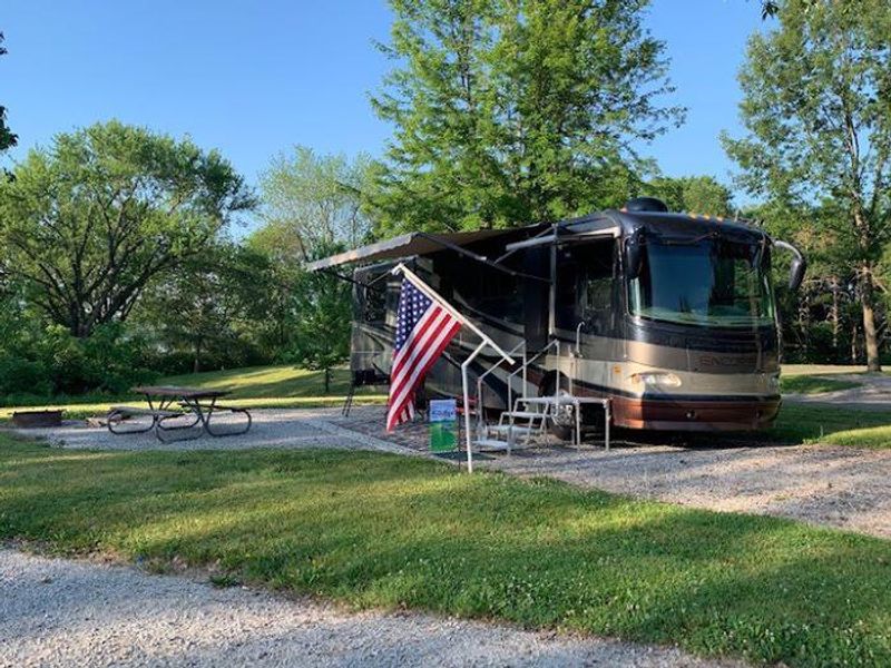
Sandy Beach Campground occupies a prime location on the northern shores of Coralville Lake, nestled among heavily wooded mixed hardwood forest. Managed by the U.S. Army Corps of Engineers, the campground provides 58 sites ranging from full hookup RV sites with water and electric to standard electric sites (20/30 amp) and primitive walk-to tent sites for those seeking a more rustic experience. The campground features modern flush restrooms with shower facilities, a dump station, and potable water. Each site includes a fire ring and picnic table. Sites accommodate RVs up to 44-48 feet depending on location. The adjacent Sandy Beach Day Use Area offers a boat ramp, fish cleaning station, large group picnic shelter, sand volleyball, and direct lake access for swimming. Coralville Lake supports excellent fishing for largemouth and smallmouth bass, crappie, walleye, and catfish. The surrounding area features mountain bike and hiking trails, hunting opportunities, and the unique Devonian Fossil Gorge below the dam where visitors can explore a 375-million-year-old sea floor.

Directions

From Interstate 380 at Shueyville, take Exit 10 east on 120th St NW for 1.2 miles. Turn right onto NE Curtis Bridge Rd and travel south 1.1 miles. Turn left onto Sandy Beach Rd NE and continue east 1.9 miles to the campground entrance on the right.

Amenities

Water Yes
Fires Allowed Yes
Toilets Yes
Dump Station Yes
Wifi
Pets Allowed Yes
Showers Yes
Electric Hookups Yes
Water Hookups Yes
Sewer Hookups No
Camp Store
Price $14 - $28

Vehicle

Max RV Length 48ft
Max Trailer Length 48ft
Big Rig Friendly Yes
Pull Through Sites No

Contact

Email kathryn.s.atkinson@usace.army.mil
Phone +1 (319) 848-4400

Cell Service

AT&T Yes
Verizon Yes
T-Mobile None

Availability

Photos

Sandy Beach Campground
Aerial

Community Posts

No posts yet. Be the first to share your experience!