Pine Mountain Lookout
Open seasonally from May through October. Reservations required via Recreation.gov with a 2-night minimum stay. No water or trash service; pack in all supplies and pack out all garbage. Forest roads require high-clearance vehicles. Past fire events have left hazard trees that may fall during storms, potentially blocking access roads.
National Forest System Roads
Follow California Vehicle Code on National Forest System Roads
Fireworks and Explosives are always Prohibited
Fireworks and explosives (including explosive targets) are always prohibited on national forest lands. The prohibition of fireworks and exploding targets on national forest system lands is part of a set of permanent fire safety regulations in the Code of Federal Regulations (CFR), listed below.…
No water at Letts Lake Campground
Please be advised there is no water available at Letts Lake Campground. There is water available in the Fouts area. We apologize for the inconvenience, and staff are working to resolve this as soon as possible.
About
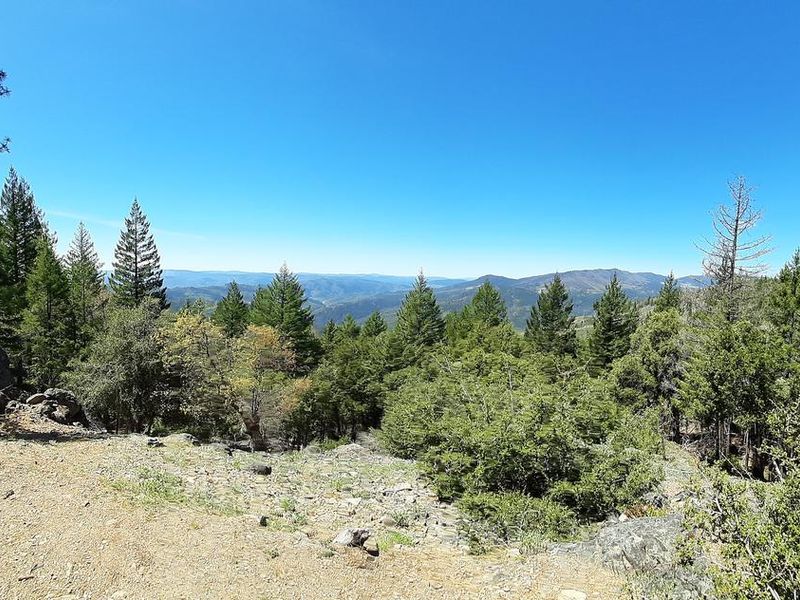
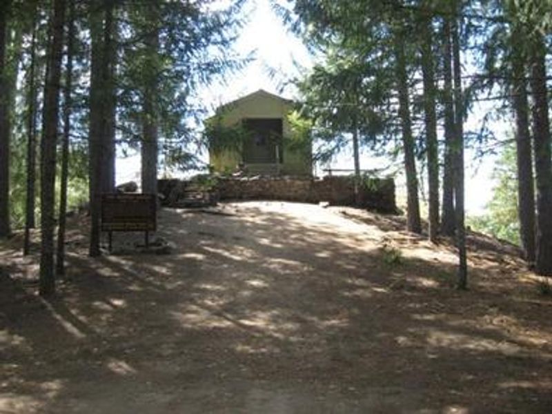
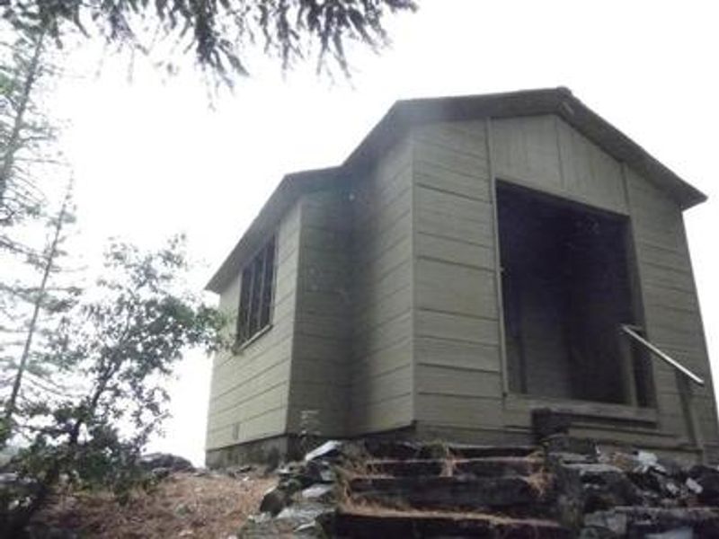
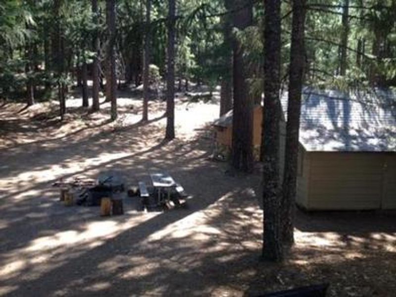
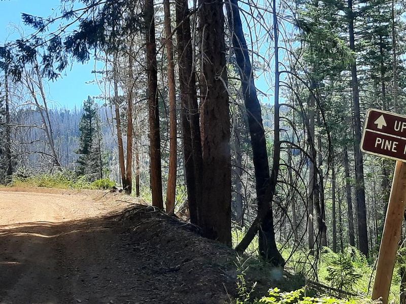
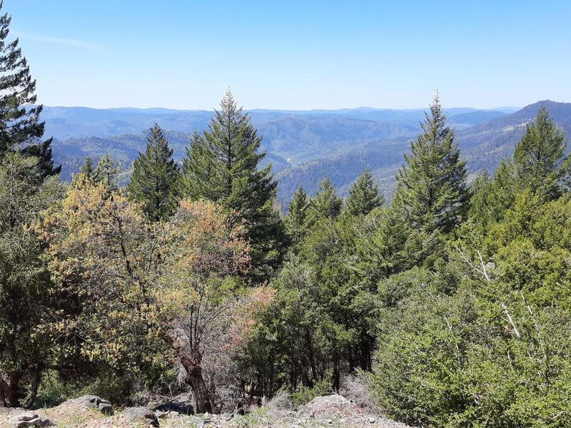
Pine Mountain Lookout was constructed in 1933 and served as a fire detection station until 1942. During World War II, it became part of California's aircraft defense monitoring system. The lookout is historically notable for offering 180-degree views rather than the typical 360-degree panorama of most fire lookouts, as it was built on the western shoulder of Pine Mountain overlooking the Van Arsdale area. The cabin sits at 4,400 feet elevation within a mixed forest of ponderosa pine, Douglas fir, black oak, and madrone. Bucknell Creek and the Eel River are the major drainages in the area. Wildlife includes eagles, hawks, owls, osprey, black bears, mountain lions, black-tailed deer, and Tule elk. Lake Pillsbury is approximately 30 minutes away for swimming and fishing. Inside, the lookout is equipped with bunk beds and four cots (no mattresses provided), touch lights, a dining table with chairs, and storage cabinets. A fire extinguisher and first aid kit are provided. Outside there is a picnic table, fire ring, and grill. A vault toilet outhouse is a short distance away. There is no electricity, running water, or trash service. Access requires high-clearance vehicles on forest roads 17N23 and 18N05, and fallen trees may block roads after winter storms.
Directions
From Upper Lake: Proceed north on M1/Elk Mountain Road past the Upper Lake Ranger Station. After several miles, turn left onto 18N05 as indicated by the sign. After a few miles, make the hairpin turn left onto 17N23. The gate will be on the right a few miles along. From Potter Valley: Turn right on Eel River Road (County Road 240B) and drive 4 miles to the Y intersection. Take the right fork signed as Cutoff Road, travel down the hill about half a mile, then proceed north on County Road 240B and cross the bridge to the north side of Eel River. Turn right toward Lake Pillsbury and proceed 14 miles to the junction with M1 at the Soda Creek Store. Turn right (south) onto M1. At the junction of M1 and M8, proceed left (uphill, following the sign for Upper Lake) to stay on M1. After approximately 6 miles, turn right onto 18N05, then make the hairpin turn left onto 17N23. Travel on M8 (south side of Eel River) is not recommended as PG&E gates are unpredictably opened and closed.
Amenities
| Water | No |
| Fires Allowed | Yes |
| Toilets | Yes |
| Dump Station | No |
| Wifi | No |
| Pets Allowed | Yes |
| Showers | No |
| Electric Hookups | — |
| Water Hookups | — |
| Sewer Hookups | — |
| Camp Store | No |
| Price | $50 |
Vehicle
| Max RV Length | — |
| Max Trailer Length | — |
| Big Rig Friendly | No |
| Pull Through Sites | No |
Contact
| Phone | +1 (707) 275-2361 |
Cell Service
| AT&T | None |
| Verizon | Yes |
| T-Mobile | None |
Availability
Photos

Community Posts
No posts yet. Be the first to share your experience!