John Day River Basin Developed Campgrounds
Open year-round, first-come, first-served only. Fire closure in effect May 13 through October 15, 2026. No campfires, propane campfires, charcoal grills, or wood pellet burning devices permitted. Liquid fuel metal cookstoves and shielded lanterns are allowed. No potable water available; campers must bring their own. Pack out all trash. No cell phone service at any campground.
Air Quality Alert issued July 20 at 7:40PM PDT by NWS Pendleton OR
Oregon Department of Environmental Quality has issued an Air Quality Advisory until 4 PM PDT Wednesday. For the Smoke Air Quality Advisory, wildfires burning in the region combined with forecasted conditions will cause air quality to reach unhealthy levels. Pollutants in smoke can cause burning eyes, runny nose, aggravate heart and lung diseases, and aggravate other serious health problems. Limit outdoor activities and keep children indoors if it is smoky. Please follow medical advice if you have a heart or lung condition. For additional information...please visit the Web site at http://www.oregon.gov/DEQ
Air Quality Alert issued July 20 at 6:03PM PDT by NWS Pendleton OR
Oregon Department of Environmental Quality has issued an Air Quality Advisory until 4 PM PDT Wednesday. For the Smoke Air Quality Advisory, wildfires burning in the region combined with forecasted conditions will cause air quality to reach unhealthy levels. Pollutants in smoke can cause burning eyes, runny nose, aggravate heart and lung diseases, and aggravate other serious health problems. Limit outdoor activities and keep children indoors if it is smoky. Please follow medical advice if you have a heart or lung condition. For additional information...please visit the Web site at http://www.oregon.gov/DEQ
Air Quality Alert issued July 20 at 3:24PM PDT by NWS Pendleton OR
Oregon Department of Environmental Quality has issued an Air Quality Advisory until 4 PM PDT Wednesday. For the Smoke Air Quality Advisory, wildfires burning in the region combined with forecasted conditions will cause air quality to reach unhealthy levels. Pollutants in smoke can cause burning eyes, runny nose, aggravate heart and lung diseases, and aggravate other serious health problems. Limit outdoor activities and keep children indoors if it is smoky. Please follow medical advice if you have a heart or lung condition. For additional information...please visit the Web site at http://www.oregon.gov/DEQ
About
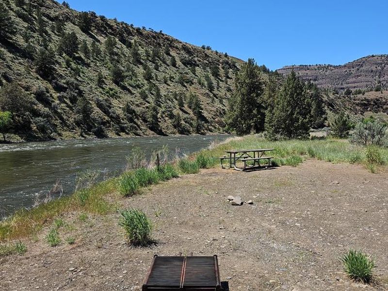
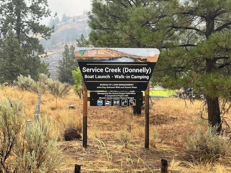
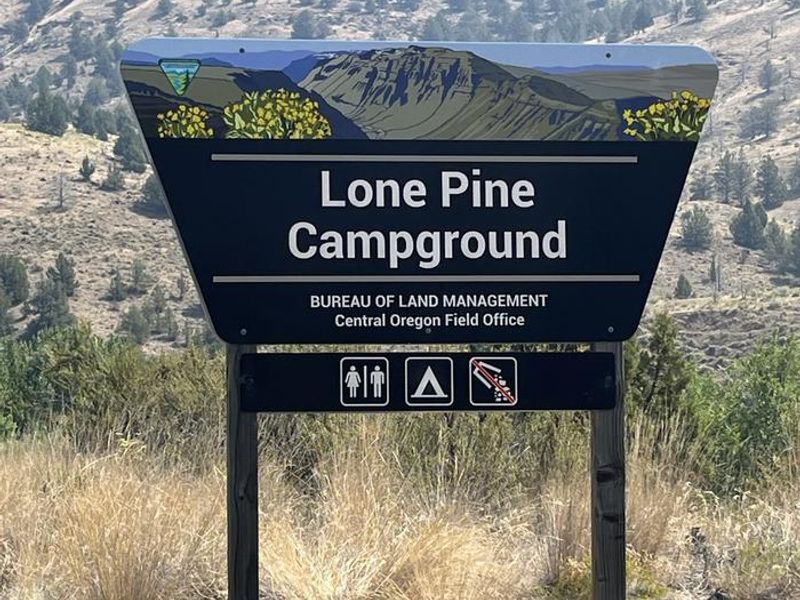
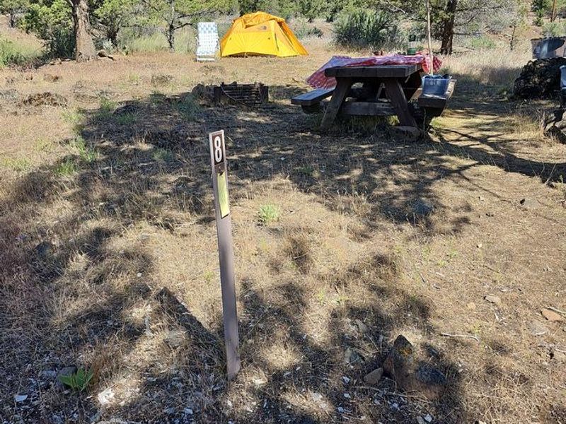
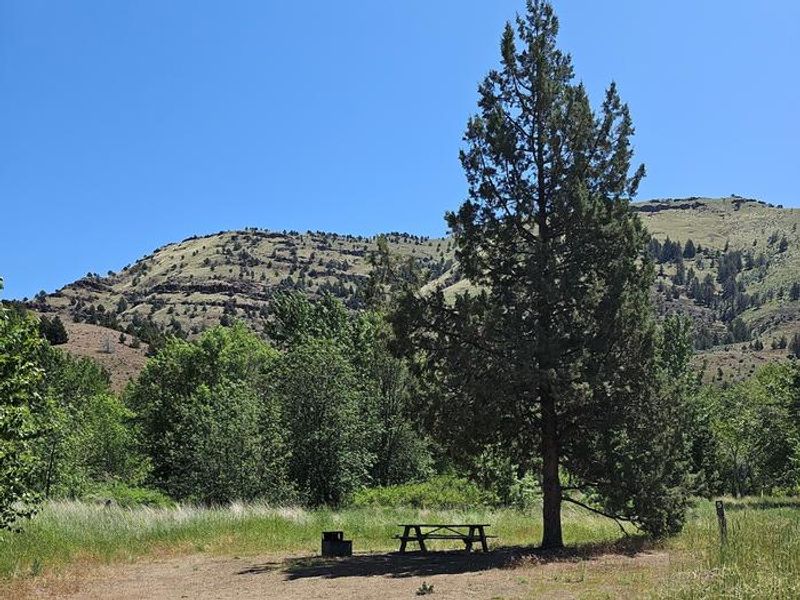
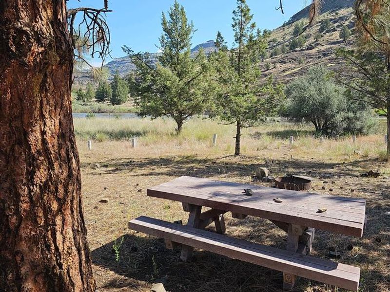
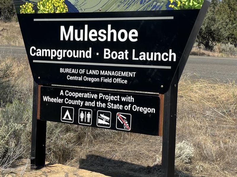
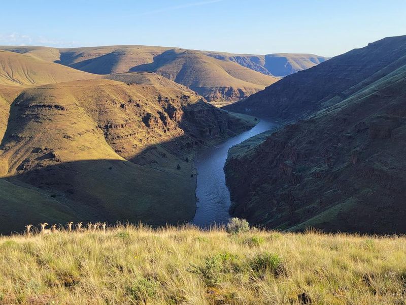
The Bureau of Land Management's Central Oregon Field Office manages four separate fee campgrounds within the John Day River Basin: Service Creek (4 walk-in sites), Muleshoe (8 sites), Lone Pine (5 sites), and Big Bend (4 sites). Service Creek and Muleshoe are located near the town of Service Creek along State Route 207 and the main John Day River, while Lone Pine and Big Bend sit along the North Fork of the John Day River and State Route 402 between Kimberly and Monument. At approximately 2,000 feet elevation, this high-desert landscape features sage, juniper, and occasional ponderosa pines, with dramatic canyon walls and exposed geological formations. The region is rural and quiet except during spring boating season and fall hunting. Weather is highly variable, especially in spring and fall, while mid-summer tends to be very hot. The river offers cooling relief in summer months. Dark night skies make for excellent stargazing. The campgrounds are well-positioned for exploring the Journey Through Time Scenic Byway and visiting John Day Fossil Beds National Monument. Service Creek and Muleshoe serve as primary launch points for rafting the Wild and Scenic section of the John Day River. Year-round permits are required to boat between Service Creek and Tumwater Falls.
Directions
Service Creek Campground: From Prineville, take US 26 east 46.5 miles to OR 207 N, turn left and drive 23.5 miles. Muleshoe Campground: Continue past Service Creek, turn right at stop sign onto OR 207 N, drive 1.9 miles. Lone Pine Campground: From Prineville, take US 26 east 77.7 miles, turn left onto OR-19 N for 18.4 miles, then right onto OR-402 E for 1.8 miles. Big Bend Campground: Same as Lone Pine but continue on OR-402 E for 3 miles total.
Amenities
| Water | No |
| Fires Allowed | No |
| Toilets | Yes |
| Dump Station | No |
| Wifi | No |
| Pets Allowed | — |
| Showers | No |
| Electric Hookups | — |
| Water Hookups | — |
| Sewer Hookups | — |
| Camp Store | No |
| Price | $5 |
Vehicle
| Max RV Length | — |
| Max Trailer Length | — |
| Big Rig Friendly | No |
| Pull Through Sites | No |
Contact
| blm_john_day_river@blm.gov | |
| Phone | +1 (541) 416-6700 |
Cell Service
| AT&T | None |
| Verizon | None |
| T-Mobile | None |
Availability
Photos
Community Posts
No posts yet. Be the first to share your experience!