White River National Forest
This order describes the prohibition of wheeled vehicles in all National Forest Wilderness Areas of the Rocky Mountain Region and any exceptions thereof.
White River National Forest
The purpose of this Order is to reduce the spread of the fungus that causes White nose syndrome and to protect bat species during critical biological periods.
White River National Forest
The Chihuahua Gulch Road (263.1) in the Dillon Ranger District is closed to all uses during weekdays until Aug 1 while crews use heavy machinery to repair severe erosion. Please respect the short closure for your safety and to allow the work to be completed efficiently.
White River National Forest
Due to current drought conditions, we request that RV/Camper owners fill their tanks before arriving at the campgrounds to best preserve the water systems. RVs should not use campground water spigots for filling. Filling small jugs is acceptable. Thank you for helping us preserve the water…
White River National Forest
The boat ramp at Green Mountain Reservoir is closed for the 2026 season for public safety due to low water.The deep mud at the end of the ramp makes it no longer safe or effective to launch and recover trailered boats. The low water levels are due to one of the worst snowpack years on record. The…
White River National Forest
PURPOSEThe purpose of this Order is to protect natural resources, wetlands, riparian areas, aquatic ecosystems, and National Forest System Trails.
White River National Forest
The purpose of this Order is to protect public health and safety and to protect National Forest System lands, resources, and facilities during the current period of high fire danger.
White River National Forest
The White River National Forest enters Stage 2 fire restrictions June 26, 2026. This means no campfires or charcoal anywhere on the forest, including developed campgrounds and recreation sites. Gas-powered stoves are allowed. More details below:
White River National Forest
The purpose of this Order is to protect public safety along the Described Road while construction, maintenance, and hauling activities are active in the area.
White River National Forest
The White River National Forest is delaying the seasonal opening of several roads for two days until Tuesday June 16 for firefighter and public safety. The Eagle-Thomasville Road (NFSR 400) will remain closed from the gate south of Sylvan Lake to the Frying Pan Road. Burnt Mountain (NFSR 506) will…
White River National Forest
Because of anticipated dam repairs, Dinkle Lake on the Aspen-Sopris Ranger District will not be filled with water this year.
White River National Forest
The popular Sapphire Point Overlook and parking area above Dillon Reservoir will be closed for public safety during renovations May 17 through June 13.Learn More
White River National Forest
In the Dillon Ranger District, the Lowry Campground, Prospector Campground, and Windy Point Group Campground will not have water available. The Lowry well, which serves Lowry Campground, Prospector Campground, and Windy Point Campground is dry. In the Blanco Ranger District, the well serving the…
White River National Forest
The purpose of this Order is to provide for natural resource protection by preventing infestation of aquatic nuisance species such as zebra and quagga mussels and provide for public safety.
White River National Forest
Access to Grizzly Creek Trail will continue to be limited while bridge replacements and other improvements are completed.
White River National Forest
The following is prohibited on the National Forest System (NFS) lands and trails in the Blanco Ranger District, White River National Forest:
White River National Forest
Always check the avalanche forecast before heading into the backcountry!Avalanche danger on the White River National Forest is real! Since the 1999/2000 winter, 52 people have died in avalanche accidents on this National Forest, and hundreds more have been in avalanches. If you are interested in…
White River National Forest
Pursuant to Title 36 CFR 261.50(a), the prohibitions listed in Order Number WRNF-2025-028, applicable to the Eagle-Holy Cross Ranger District of the White River National Forest for National Forest System Lands within the Derby Fire perimeter, dated September 26, 2025, and signed by Brian Glaspell…
White River National Forest
The following are prohibited on the National Forest System (NFS) lands in the Aspen Ranger District, White River National Forest:
White River National Forest
The septic waste dump station at Ruedi Marina day use area is closed and non-functional. The nearest dump stations are in Silt and Edwards.
White River National Forest
The following are prohibited on the National Forest System (NFS) lands in the Eagle-Holy Cross Ranger District, White River National Forest
White River National Forest
Beginning in May 2024, access to Grizzly Creek Trail will be limited while bridge replacements and other improvements are completed.
White River National Forest
The following acts are prohibited within the Collegiate Peaks Wilderness on the Leadville and Salida Ranger Districts of the Pike-San Isabel National Forests & Cimarron and Comanche National Grasslands, Gunnison Ranger District of the Grand Mesa, Uncompahgre and Gunnison National Forests, and the…
White River National Forest
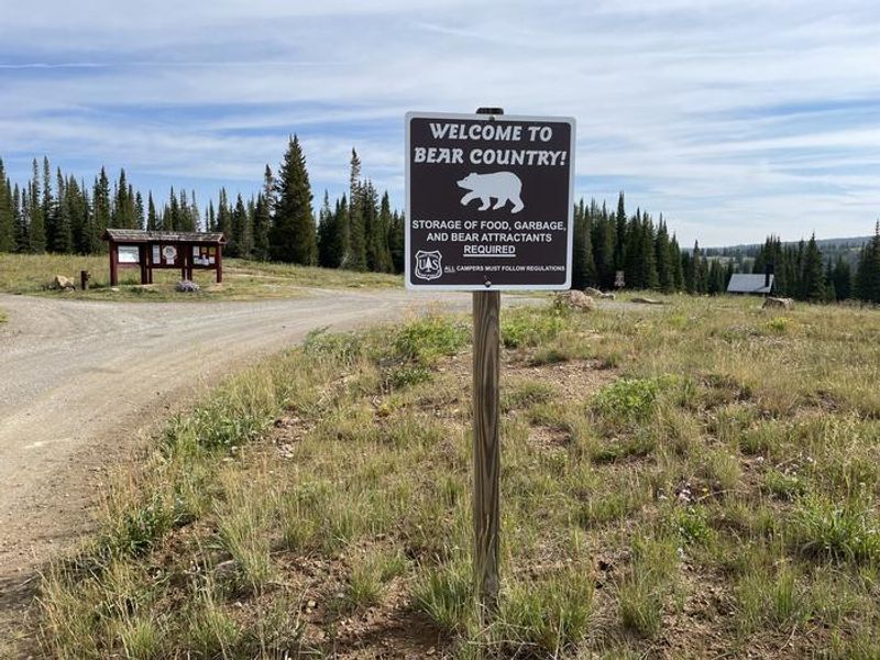
May 15 to October 1, annually: Prohibits possessing or storing food - solid or liquid substance that is or may be consumed by any person or animal (including pet and stock food and harvested fish and game but excluding water or hay without additives) - or refuse, including items that may have…
White River National Forest
The following are prohibited on the National Forest System (NFS) lands and trails within the Eagles Nest Wilderness Area, Eagle-Holy Cross and Dillon Ranger Districts, White River National Forest
White River National Forest
The following are prohibited on all National Forest Service (NFS) lands and trails within the Ptarmigan Peak Wilderness Area, Dillon Ranger District, White River National Forest
White River National Forest
Camping within the White River National Forest for more than 14-days with in any continuous 30-day period is prohibited; this begins on the first day of occupancy. 36 C.F.R. § 261.58(a)
White River National Forest
The following are prohibited within the Flat Tops Wilderness on the Blanco, Rifle, and Eagle-Holy Cross Ranger Districts of the White River National Forest, and the Yampa Ranger District of the Medicine Bow-Routt National Forest, in Eagle, Garfield, and Rio Blanco Counties, State of Colorado:
White River National Forest
The following are prohibited on the National Forest System (NFS) lands known as the “Wildwood Parcel” in the Aspen- Sopris Ranger District, White River National Forest:
White River National Forest
The following are prohibited on the National Forest System (NFS) lands and trails within the Holy Cross Wilderness in the Eagle-Holy Cross and Aspen-Sopris Ranger Districts of the White River National Forest and the Leadville Ranger District of the San Isabel National Forest:
White River National Forest
The following are prohibited within the Maroon Bells-Snowmass Wilderness of the White River and Gunnison National Forests in the Aspen, Sopris, and Gunnison Ranger Districts, including in specific zones within the Wilderness, described below and shown on the attached maps incorporated into this…
White River National Forest
The following act is prohibited in the Dillon Ranger District, White River National Forest, Summit County, State of Colorado
White River National Forest
The following are prohibited on the National Forest System (NFS) lands and trails within the Holy Cross Wilderness in the Eagle-Holy Cross and Aspen-Sopris Ranger Districts of the White River National Forest and the Leadville Ranger District of the San Isabel National Forest:
White River National Forest
The following acts are prohibited on the National Forest System (NFS) lands known as the El Jebel Administrative Parcel in the Aspen-Sopris Ranger District, White River National Forest
White River National Forest
The following acts are prohibited on the National Forest System (NFS) lands at Sweetwater Lake and vicinity in the White River National Forest, Garfield County, State of Colorado:
White River National Forest
The following acts are prohibited on the National Forest System (NFS) lands and waters in the Maroon Valley and Maroon Bells Scenic Area:
White River National Forest
The following acts are prohibited on the National Forest System (NFS) lands within the White River National Forest described below and shown on the attached maps:
White River National Forest
The following acts are prohibited on National Forest System (NFS) lands in the White River National Forest described below and shown on the attached map:
White River National Forest
The following acts are prohibited on the National Forest System (NFS) lands in the White River National Forest described below and shown on the attached maps:
White River National Forest
The following act is prohibited on the National Forest System (NFS) lands at McCoy Park in Beaver Creek Ski Area in the White River National Forest, Eagle County, State of Colorado:
White River National Forest
ls is prohibited to go into or be upon the Restricted Area when in violation of Colorado Revised Statutes Title33, Article 44, specifically including, but not limited to, Sections 105 and I 09, also known as the ColoradoSki Safety Act of 1979. 36. C.F.R 261.53(e)
White River National Forest
The following acts are prohibited on those National Forest Service lands described as the Hanging Lake National Natural Landmark Area and on all trails within the Restricted Area within the Eagle/Holy Cross Ranger District, White River National Forest:
White River National Forest
The following acts are prohibited as shown on Exhibit A of this order within the White River National Forest, Colorado:
White River National Forest
The following acts are prohibited on National Forest System lands within the Raggeds Wilderness of the White River and Grand Mesa, Uncompahgre, and Gunnison National Forests:
White River National Forest
The following acts are prohibited on National Forest lands in Township 7S and Range 80W (parts of Camp Hale)
White River National Forest
The following acts are prohibited on National Forest lands in Sections 3, 4, 9, and 10 in Township 7S and Range 80W (parts of Camp Hale)
White River National Forest
The following act is prohibited within the boundaries of the Dillon Ranger District, White River National Forest, until this Order is rescinded.
White River National Forest
The following act is prohibited, at the area surrounding the Boreas Pass Section House, {as shown on Exhibit A), within the White River National Forest
White River National Forest
Prohibitions on all National Forest system lands, roads, trails and improvements on the White River National Forest and the Dillon District of the Arapaho National Forest until further notice
White River National Forest
The following acts are prohibited on the South Platte Ranger District and Dillon Ranger District as described in this order
White River National Forest
The following acts are prohibited within the boundaries of the Aspen Ranger District, White River National Forest:
White River National Forest
To continue historic modes of travel within the Cooper Basin Drainage, operation of motorized vehicles is prohibited: