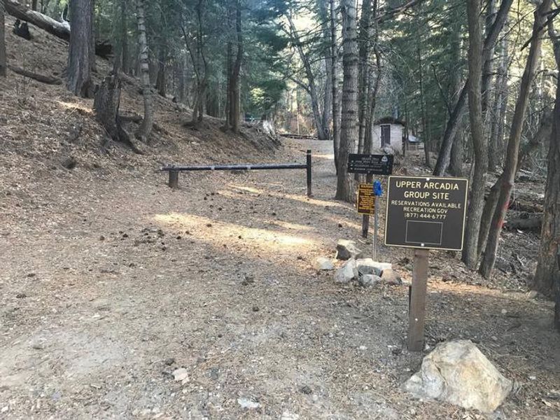
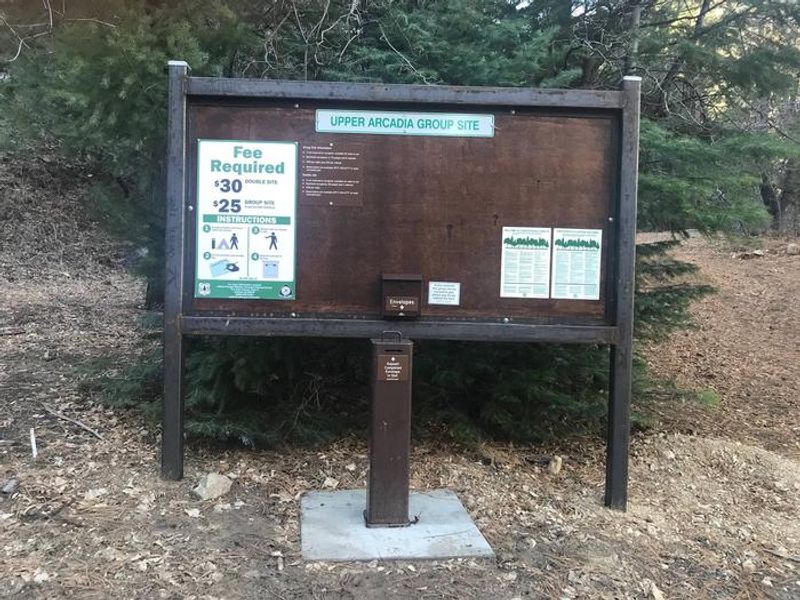
Upper Arcadia
Open year-round. Seasonal drinking water is available during warmer months and typically shut off in October when temperatures drop. This is an active black bear area; all food must be stored in bear-proof containers or locked vehicles.
Marshall Gulch Area Closure
Marshall Gulch area closed during reconstruction of picnic area and trailhead
Ski Run Road Closure
PURPOSETo protect public health and safety from potential hazards. This closure is necessary to remove hazard trees and snags overhanging the road.
Rose Canyon Lake restriction to being in or on the lake
Pursuant to 16 U.S.C. § 551 and 36 C.F.R. § 261.50(a), the following is prohibited on theNational Forest System (NFS) lands in the Santa Catalina Ranger District, CoronadoNational Forest, described below and shown on the attached map incorporated into thisOrder as Exhibit A (the "Described…
About
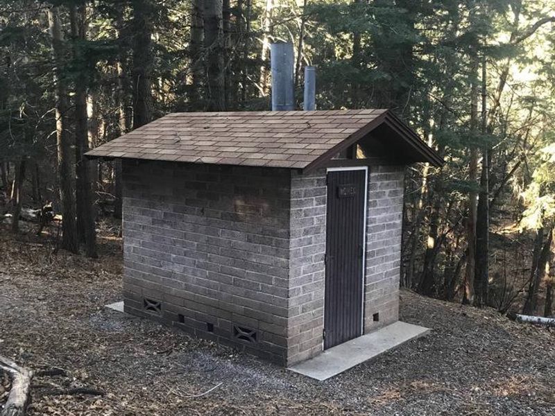
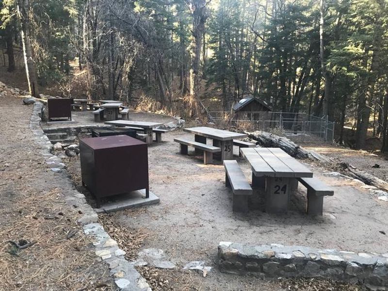
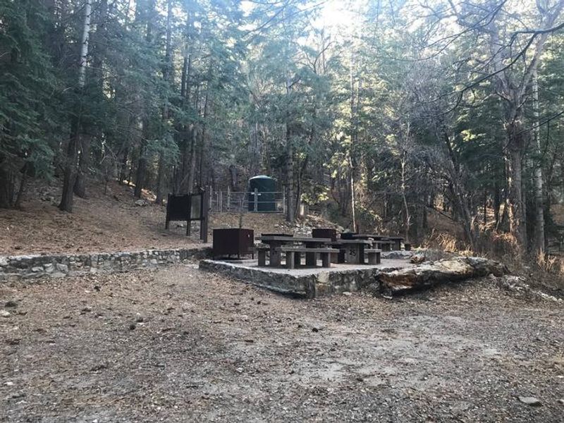
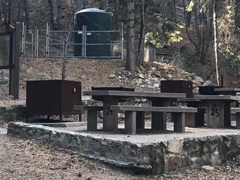
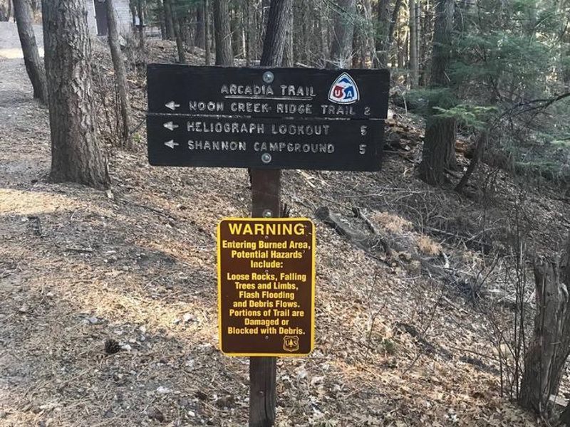
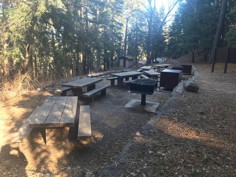
Upper Arcadia sits along the Swift Trail Scenic Drive in southeastern Arizona's Pinaleño Range, one of the Coronado National Forest's sky island mountain ranges. At 6,700 feet elevation, the campground is shaded by tall ponderosa pines interspersed with Gambel oaks and Arizona walnuts, creating excellent habitat for birding and wildlife watching. The campground serves primarily as a group camping area with double sites also available. Facilities include vault toilets with accessible restrooms, seasonal potable water from a hand pump, picnic tables, and fire rings with grills. Bear-proof food lockers and trash receptacles are provided as this is an active black bear area. No hookups, showers, or dump station are available. The Arcadia Trail #328 begins at the campground and climbs to Shannon Campground, with a 1-mile spur leading to the summit of Heliograph Peak. The Swift Trail continues up to Riggs Lake, the Columbine Visitors Center, and alpine meadows above 9,000 feet. Due to narrow switchbacks on AZ 366, trailers over 22 feet are not recommended and total vehicle length must be under 40 feet.
Directions
From Safford, take US 191 south 8 miles to AZ 366 (Swift Trail). Turn right and drive 11.6 miles to the Arcadia Campground entrance at MM 125.5, then take the next right to access Upper Arcadia.
Location
Amenities
| Water | Yes |
| Fires Allowed | Yes |
| Toilets | Yes |
| Dump Station | No |
| Wifi | — |
| Pets Allowed | Yes |
| Showers | No |
| Electric Hookups | — |
| Water Hookups | — |
| Sewer Hookups | — |
| Camp Store | — |
| Price | $25 - $30 |
Vehicle
| Max RV Length | 40ft |
| Max Trailer Length | 22ft |
| Big Rig Friendly | No |
| Pull Through Sites | No |
Contact
| Phone | +1 (928) 428-4150 |
Cell Service
| AT&T | None |
| Verizon | Yes |
| T-Mobile | Yes |
Availability
Photos


Community Posts
No posts yet. Be the first to share your experience!