Pine Point
Closed — Closed for the season. Typically operates May through September with both reservable and first-come, first-served sites available.
Wheeled Vehicles in Wilderness
This order describes the prohibition of wheeled vehicles in all National Forest Wilderness Areas of the Rocky Mountain Region and any exceptions thereof.
Weed Free Forage Products
The purpose of this Order is to prevent the introduction or spread of noxious weeds.
Cave Closure and Restrictions
The purpose of this Order is to reduce the spread of the fungus that causes White nose syndrome and to protect bat species during critical biological periods.
Falls Creek Closure Area, Camping, and Motor Vehicle Travel Restrictions
This San Juan National Forest forest order describes closure areas, as well as camping and motor vehicle travel restrictions in the Falls Creek.
Dolores River Restoration Project Closure Order
The Dolores Ranger District has issued a Forest Closure Order for Dolores River Restoration Project located on "The Beach" for the construction of instream structures and bank improvements.
West Fork Road and Bridge Closure Order
The Pagosa Ranger District's West Fork Bridge is closed by Forest Order due to damage during the October 2025 flood events. Forest Road 648 (West Fork) is closed at location identified by this order.
Multiple roads and trails damaged by flooding on SJNF
In early October, severe flooding events created ongoing safety and access concerns for Forest users on the Columbine and Pagosa Ranger Districts of the San Juan National Forest. Available forest employees are assessing the many roads, trails, bridges, and other infrastructure that was damaged or…
Lemon Reservoir Restrictions
The following act is prohibited on the National Forest System (NFS) lands and waters on the Columbine Ranger District of the San Juan National Forest:
Cascade Flume Safety Closure
Area closure: The purpose of this Order is for public health and safety during the Cascade Tacoma Flume repair. The recent failure of the flume resulted in infrastructure damage and a landslide that has destabilized the Described Area. Concerns for public safety include loose debris, continuing…
McPhee Reservoir Prohibitions
The purpose of this Order is to prevent the infestation of aquatic nuisance species.
Mancos/Dolores Camping Restrictions
The purpose of this Order is to protect public safety and natural resources.
Purgatory Ski Resort Area Vehicle Use Restrictions
From November 15 through April 30 annually, it is prohibited to use an over-snow vehicle (snowmobiles, timber sleds, and ski bikes) or mechanized vehicle that lacks a motor, such as a non-electric bicycle, on the Described Roads and Described Trails and OFF NFS roads in the Described Area. (See map…
McPhee Overlook Trail Seasonal Closure
The purpose of the seasonal closure of the McPhee Over Trail is to protect critical winter wildlife habitat.
Chicken Creek Ski Area Dog Restrictions
Dogs are not allowed in the Chicken Creek Ski Area from December 15 to March 15, annually in order to protect public safety.
La Plata Canyon Camping and Fire Restrictions
La Plata Canyon Camping and Fire Restrictions are in place to protect the natural resources in this beautiful, very popular area. Camping is prohibited outside of Forest Service designated camping areas (Darby, La Plata City, Bay City, Miners Cabin, and Madden Creek) and developed campgrounds…
Andrews Lake Camping Restrictions
Andrews Lake area is closed to camping in order to protect natural resources.
Hermosa Creek Wilderness Occupancy and Use Restrictions
In order to protect the National Forest System (NFS) lands and trails in the Hermosa Creek Wilderness, the following are prohibited:Entering or being upon a trail, campsite, or other area by a group larger than 15 people, with a maximum combination of people and stock not to exceed 25 in one…
Forest Wide Camping Stay Limits
In order to protect natural resources and to provide for public health and safety, the following are prohibited on National Forest System (NFS) lands in the San Juan National Forest:Camping, or leaving camping equipment at any location or within three (3) miles of any prior…
Chimney Rock National Monument Occupancy and Use Restrictions
The purpose of this Order is to protect the objects of the monument through implementing restrictions prescribed in the Chimney Rock National Monument (CRNM) Final Management Plan and Environmental Impact Statement (EIS).
Grizzly Peak Research Natural Area Special Closure Order
This order implements prohibitions necessary to provide protection of natural conditions and processes in order to facilitate research and education and maintain biological diversity – the purposes for which RNAs are established on National Forest System lands – within the Grizzly Peak RNA.
Lizard Head Wilderness Area Occupancy & Use
This Order is necessary to protect physical and biological resources of the Lizard Head Wilderness, and to protect the human experience of Wilderness character, solitude, and the untrammeled condition of the landscape.
Forest Orders
Visit our Forest Order page for a list of all the current Forest Orders: Closures, Fire Restrictions, and Camping, Occupancy, and Use Restrictions.Forest and Regional orders are generally temporary in nature and are designed to protect public safety and our natural resource. After review, Regional…
About
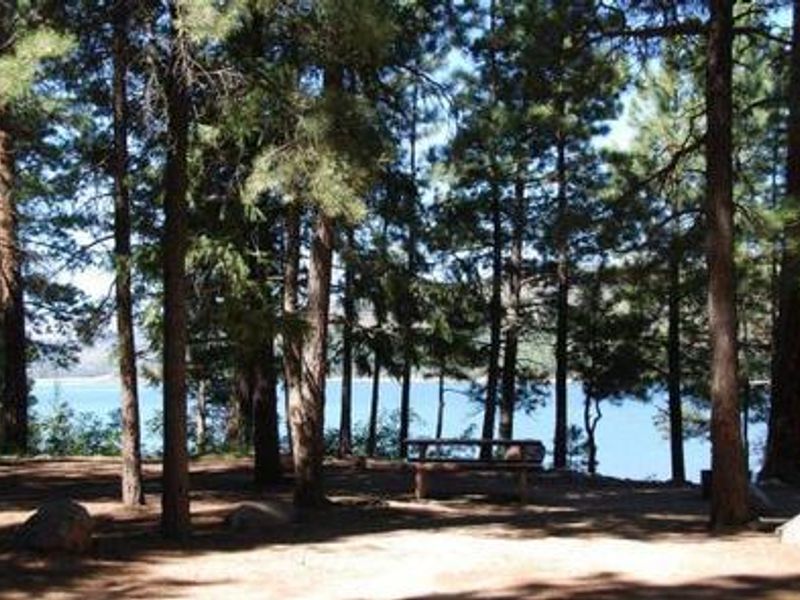
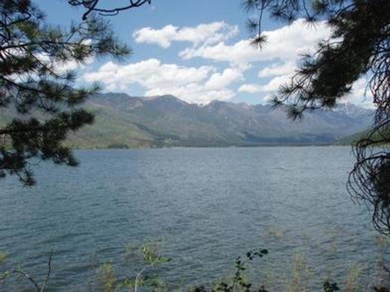
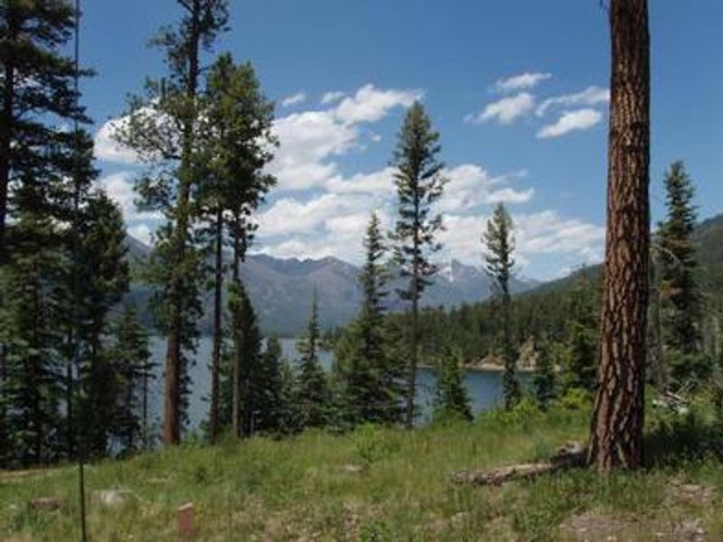
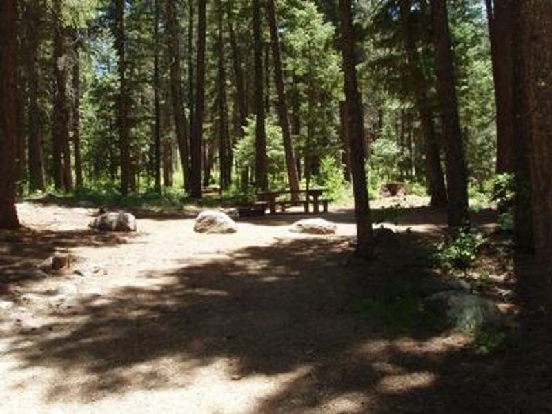
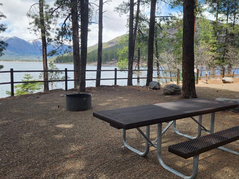
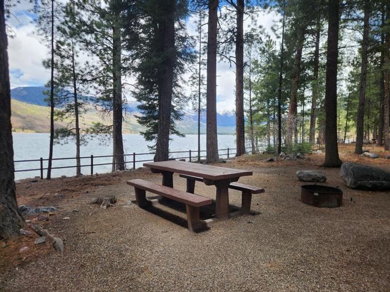
Pine Point Campground occupies a scenic location midway up the eastern shore of Vallecito Reservoir in southwestern Colorado's San Juan National Forest. Situated at 7,900 feet elevation, the campground is shaded by mature ponderosa pine forest and offers stunning views of the high San Juan Mountain peaks to the northwest. The campground provides 28 sites total, with 15 reservable sites and 13 first-come, first-served sites, including several pull-through options for larger RVs and trailers. Vallecito Reservoir is renowned for excellent fishing opportunities, with anglers targeting German brown trout, cutthroat trout, rainbow trout, kokanee salmon, and northern pike. The reservoir also supports boating, water skiing, and canoeing, with a sheltered boat area and open play space located just south of the campground. Many campsites offer lakefront access, though the shoreline is not well protected for mooring boats. Hiking and horseback riding trails radiate from the area. North Canyon Trail departs directly across from the campground, winding through ponderosa pine and aspen forests with a side trail leading to a scenic overlook of the reservoir. East Creek Trail, accessible just northeast of the campground entrance, provides access to a lightly used drainage popular with fly fishermen. The campground's location also makes it convenient for exploring other nearby Forest Service campgrounds including Middle Mountain, Graham Creek, and North Canyon.
Directions
From Bayfield, travel 14 miles north on County Road 501, then about 3 miles northeast on Forest Road 603 to the campground entrance on the left. From Durango, travel 17 miles on Florida Road (County Road 240), turn left onto County Road 501, continue 4 miles, then slight right onto Forest Road 603 for about 3 miles to the campground.
Nearby Campgrounds
Amenities
| Water | Yes |
| Fires Allowed | Yes |
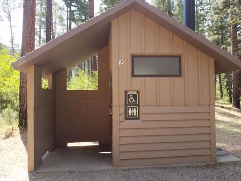
| Toilets | Yes |
| Dump Station | No |
| Wifi | No |
| Pets Allowed | Yes |
| Showers | No |
| Electric Hookups | — |
| Water Hookups | — |
| Sewer Hookups | — |
| Camp Store | No |
| Price | $39 |
Vehicle
| Max RV Length | 45ft |
| Max Trailer Length | 45ft |
| Big Rig Friendly | Yes |
| Pull Through Sites | No |
Contact
| mandy@rockymountainrec.com | |
| Phone | +1 (970) 884-2512 |
Cell Service
| AT&T | Yes |
| Verizon | Yes |
| T-Mobile | None |
Availability
Photos
Community Posts
No posts yet. Be the first to share your experience!