Spud Rock Spring
Open year-round for backcountry camping. Permits required through Recreation.gov. Water availability is seasonal; call 520-733-5153 for current conditions. Turkey Creek trailhead access road requires high-clearance 4WD and may be impassable after rain.
Wind Advisory issued October 10 at 12:17PM MST until October 11 at 11:00PM MST by NWS Tucson AZ
* WHAT...A strong weather disturbance along the West Coast will be re-inforced by a decaying tropical system this weekend resulting in strong sustained south to southwest winds 25 to 35 mph with gusts to around 45 mph. The strongest wind gusts will occur near showers and thunderstorms. * WHERE...Baboquivari Mountains, Catalina and Rincon Mountains, Southeast Pinal County, Tucson Metro Area, and Upper Santa Cruz River Valley/Altar Valley. * WHEN...From 7 AM to 11 PM MST Sunday. * IMPACTS...Gusty winds will blow around unsecured objects. Tree limbs could be blown down and a few power outages may result.
About
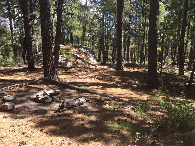
Spud Rock Spring offers solitude seekers one of the most remote backcountry camping experiences in Saguaro National Park. Located at 7,400 feet on the eastern slopes of the Rincon Mountains, this small campground features just three designated sites shaded by pines and aspens. The high-elevation setting provides cooler temperatures and a dramatically different environment from the iconic saguaro desert below. Water is available seasonally along the approach trail, though campers should always call ahead to confirm current conditions and carry a minimum of one gallon per person per day. The campground has a composting pit toilet, but facilities are rarely visited by park staff so bringing hand sanitizer is recommended. Campfires are permitted using only dead and downed wood. Reaching Spud Rock requires commitment. Access is generally from the east via Turkey Creek trailhead, which demands a lifted truck or Jeep with four-wheel drive. The road becomes muddy and treacherous after rain. All wilderness camping requires advance permits through Recreation.gov, with a maximum of 6 people per site and stays limited to 5 consecutive nights at this location.
Directions
Access is from the east via Turkey Creek trailhead. The road to the trailhead requires a lifted truck or Jeep with four-wheel drive at minimum. Check road conditions before heading out as it becomes muddy and treacherous after rain. From the trailhead, hike into the wilderness to reach the campground.
Amenities
| Water | No |
| Fires Allowed | Yes |
| Toilets | Yes |
| Dump Station | No |
| Wifi | No |
| Pets Allowed | No |
| Showers | No |
| Electric Hookups | — |
| Water Hookups | — |
| Sewer Hookups | — |
| Camp Store | No |
| Price | $4 - $8 |
Vehicle
| Max RV Length | — |
| Max Trailer Length | — |
| Big Rig Friendly | No |
| Pull Through Sites | No |
Contact
| Phone | +1 (520) 733-5153 |
Cell Service
| AT&T | Yes |
| Verizon | Yes |
| T-Mobile | None |
Photos
Community Posts
No posts yet. Be the first to share your experience!