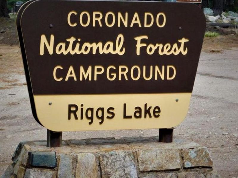
Riggs Lake
Open seasonally April 15 through November 14. Swift Trail closes November 15 to April 15 for winter; early or late snow may extend the closure. Reservations available via Recreation.gov. No potable water currently available. Fire danger is very high but no fire restrictions are in effect.
Flood Watch issued July 15 at 10:44AM MST until July 16 at 9:00PM MST by NWS Tucson AZ
* WHAT...Scattered showers and thunderstorms will be capable of producing very heavy rain in a short period of time. The excessive rain will lead to increased chances for flash flooding. The heavy rain will also lead to significant flow in area washes, creeks, and rivers. * WHERE...A portion of Southeast Arizona, including the following areas, Chiricahua Mountains, Dragoon and Mule and Huachuca and Santa Rita Mountains, Eastern Cochise County below 5000 feet, Galiuro and Pinaleno Mountains, Upper Gila River Valley and Upper San Pedro River Valley. * WHEN...From Thursday afternoon through Thursday evening. * IMPACTS...Excessive runoff may result in flooding of rivers, creeks, streams, and other low-lying and flood-prone locations. * ADDITIONAL DETAILS... - Daytime heating will combine with a very moist atmosphere to produced scattered showers and thunderstorms which will be capable of producing very heavy rain. Isolated rainfall totals of 1 to 3 inches are possible. - http://www.weather.gov/safety/flood
Marshall Gulch Area Closure
Marshall Gulch area closed during reconstruction of picnic area and trailhead
Ski Run Road Closure
PURPOSETo protect public health and safety from potential hazards. This closure is necessary to remove hazard trees and snags overhanging the road.
About
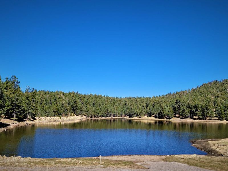
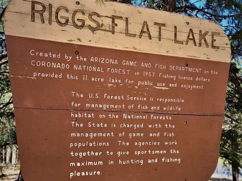
Riggs Flat Campground is located at the terminus of Swift Trail (AZ 366), a scenic mountain road winding through the Pinaleno Mountains in southeastern Arizona. The centerpiece is Riggs Flat Lake, an 11-acre impoundment created in 1957 by the Arizona Game and Fish Department for recreational trout fishing. The lake is regularly stocked with rainbow, brown, and brook trout during the open season. The campground sits at approximately 9,000 feet elevation in an alpine forest and meadow setting. West Peak is visible from the lake area, and short hikes provide overlooks of Aravaipa Valley and the Galiuro Mountains to the west. This is active black bear country, so all food must be stored in bear-proof containers or locked vehicles with windows fully closed. The access road includes 12 miles of narrow, winding switchbacks that make vehicles and trailers over 22 feet impractical. Swift Trail closes annually from November 15 through April 15 due to snow, with early or late storms potentially extending the closure period.
Directions
From Safford, drive south 8 miles on US 191 to AZ 366/Swift Trail. Turn right (southwest) onto 366 and drive 29 miles to the Columbine Visitor Center. Continue along Forest Roads 803 and 287 about 5 miles to the campground. The last 12 miles are narrow and winding with switchbacks.
Amenities
| Water | No |
| Fires Allowed | Yes |
| Toilets | Yes |
| Dump Station | No |
| Wifi | No |
| Pets Allowed | — |
| Showers | No |
| Electric Hookups | — |
| Water Hookups | — |
| Sewer Hookups | — |
| Camp Store | No |
| Price | $50 |
Vehicle
| Max RV Length | 22ft |
| Max Trailer Length | 22ft |
| Big Rig Friendly | No |
| Pull Through Sites | No |
Contact
| samantha.malone@usda.gov | |
| Phone | +1 (928) 428-4150 |
Cell Service
| AT&T | None |
| Verizon | Yes |
| T-Mobile | None |
Availability
Photos
Community Posts
No posts yet. Be the first to share your experience!