Closed

Closed for the season. The hut operates only during winter, typically mid-January through mid-March, with reservations required through Recreation.gov. An impassable collapsed bridge is located near the hut at the north section of the monument, blocking foot and bike access.

Katahdin Overlook Closure

The Katahdin Overlook is currently closed for construction. Visitors are not permitted in the overlook area due to construction hazards. It is still possible to access anything else on the loop road.

Impassable Bridge Near Big Spring Brook Hut

There is an impassable collapsed bridge near Big Spring Brook Hut located at the north section of the monument (46.0333633333, -68.7807583333). This area is impassable by foot traffic and bike.

Bridge Repairs and Closures

Seboeis River Bridge will be closed to traffic August 27-29 for repairs. This will impact travel into the Seboeis parcel via Charlie's Rd. A bridge over Ragged Brook will be closed September 2-4 for repairs and impact travel towards Philpott Bridge.

Increased Logging Activity on Swift Brook Road

Logging trucks and other large machinery will be active on Swift Brook Road for an undetermined amount of time. Please use caution when driving. Always pull over for logging trucks, and wait until dust has cleared to continue moving.

Hunting Season Begins August 23rd

Hunting season is upon us! Please stay alert and be mindful of the rights of lawful hunters. Hunting is permitted only East of the East Branch of the Penobscot River, but it is advised to wear high visibility clothing on all monument land.

Severe Thunderstorm Warning issued June 12 at 5:24PM EDT until June 12 at 6:15PM EDT by NWS Caribou ME

5:24 PM — 6:15 PM

SVRCAR The National Weather Service in Caribou Maine has issued a * Severe Thunderstorm Warning for... Southeastern Piscataquis County in north central Maine... Central Penobscot County in east central Maine... * Until 615 PM EDT. * At 523 PM EDT, a severe thunderstorm was located near Milo, or near Brownville Junction, moving east at 15 mph. HAZARD...60 mph wind gusts and penny size hail. SOURCE...Radar indicated. IMPACT...Expect damage to trees and power lines. * Locations impacted include... Dover-Foxcroft, Howland, Milo, Orneville, Lake View Plantation, Bradford, Brownville, Alton, Lagrange, Sebec, Atkinson, Argyle, Medford, Bowerbank, Maxfield, Lake View, Seboeis, Barnard, Boyd Lake, and Williamsburg. This includes State Highway 11 between Milo and Brownville.

Special Weather Statement issued June 12 at 2:21PM EDT by NWS Caribou ME

2:21 PM — June 13th, 8:00 PM

* The warm air temperatures this weekend in the low to mid 80s may cause people to underestimate the dangers of the cold water temperatures which are currently only around 60 on the lakes and around 70 on the rivers. * The cold water temperatures can quickly cause hypothermia to anyone immersed in the water. According to the Maine Warden Service, even when the water temperature is below 70 degrees, hypothermia and loss of dexterity can occur in 45 minutes or less. Anyone on small boats, canoes or kayaks should plan accordingly if recreating this weekend and use extreme caution to avoid this threat. Paddle smart from the start and always wear your life jacket!

Flood Advisory issued June 12 at 12:58PM EDT until June 12 at 7:00PM EDT by NWS Caribou ME

12:58 PM — 7:00 PM

* WHAT...Flooding caused by excessive rainfall is expected. * WHERE...Portions of east central and northern Maine, including the following counties, in east central Maine, Penobscot. In northern Maine, Aroostook. * WHEN...Until 700 PM EDT Friday. * IMPACTS...Minor flooding in low-lying and poor drainage areas. * ADDITIONAL DETAILS... - At 1258 PM EDT, Doppler radar indicated heavy rain due to thunderstorms. Minor flooding is ongoing or expected to begin shortly in the advisory area. Between 1 and 2 inches of rain have fallen. - Additional rainfall amounts of 0.5 to 1.5 inches are expected over the area. This additional rain will result in minor flooding. - Some locations that will experience flooding include... Oxbow and Moosehorn Crossing. - For flood safety visit www.weather.gov/safety/flood

About

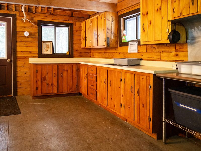
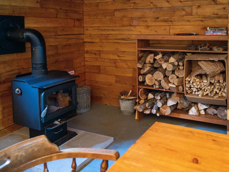
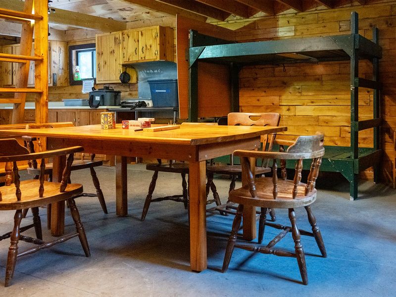
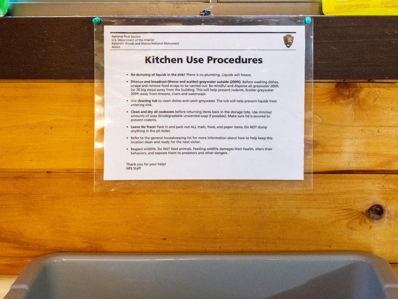
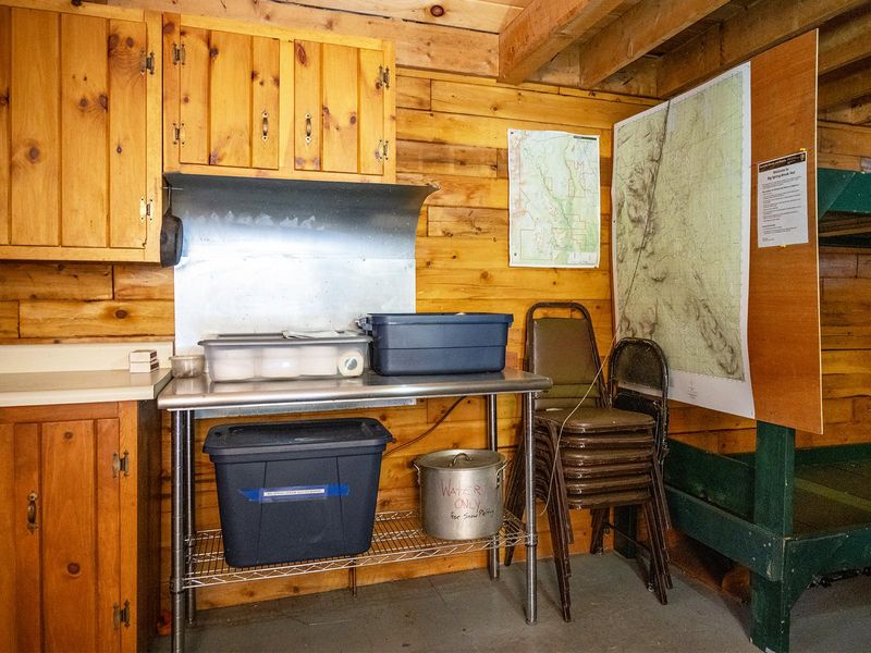
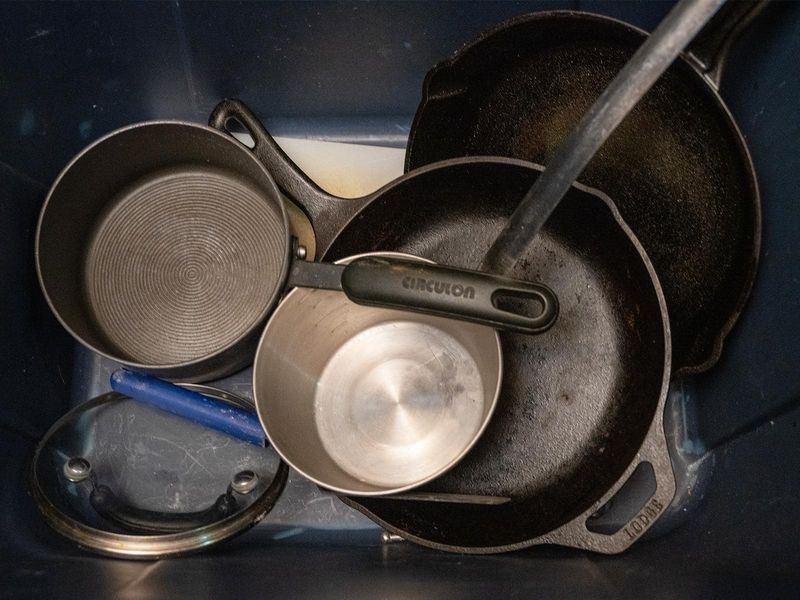
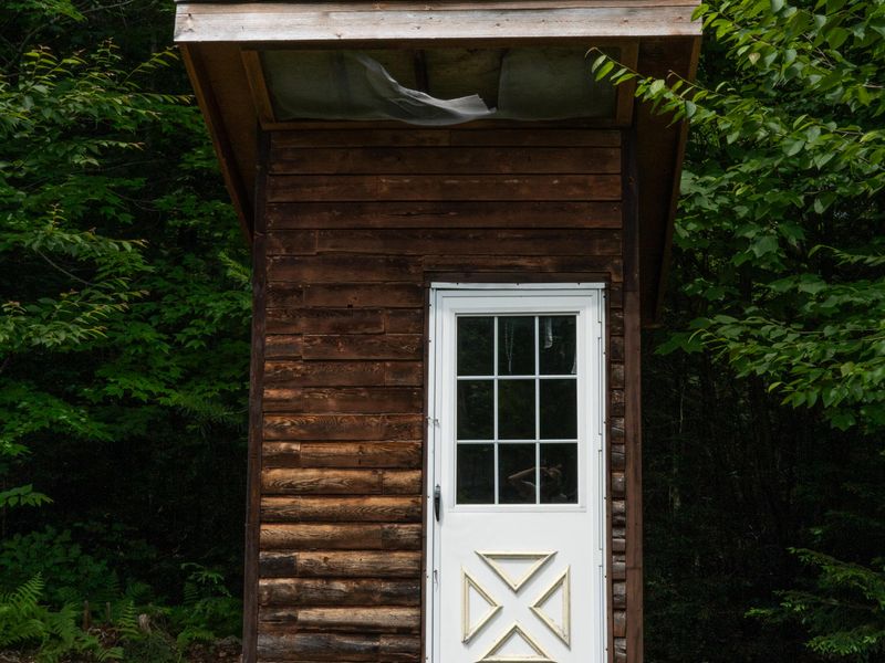
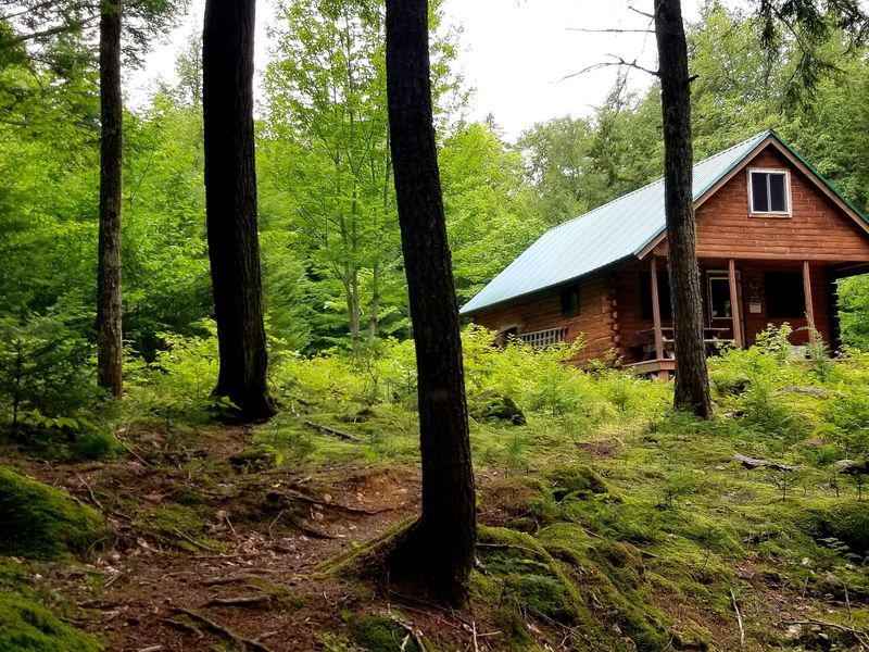
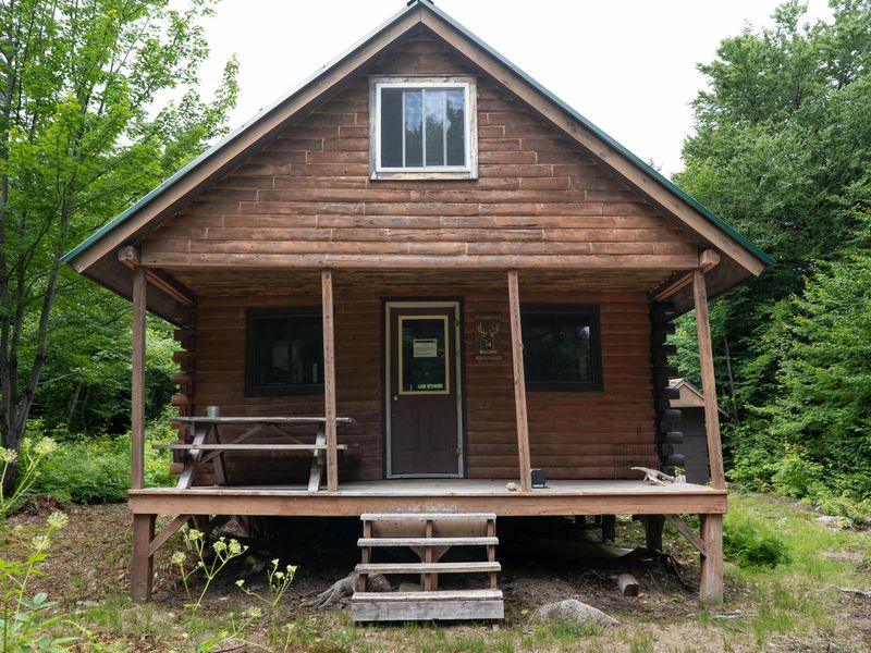
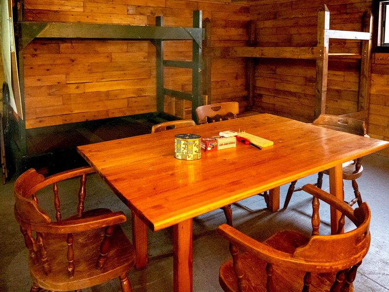
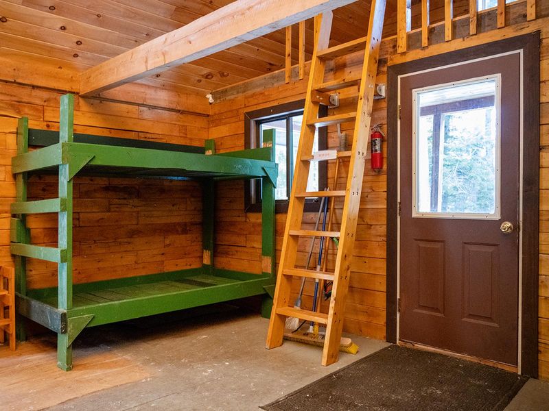
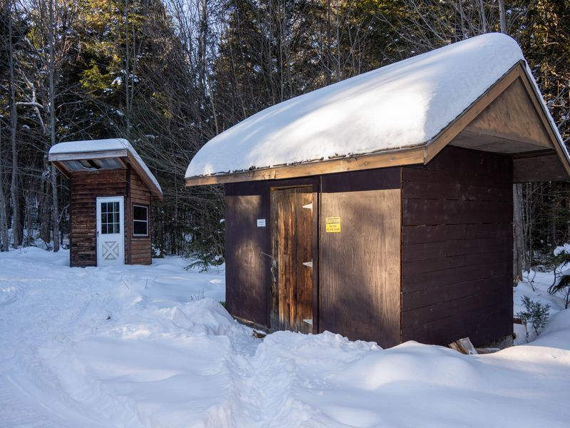
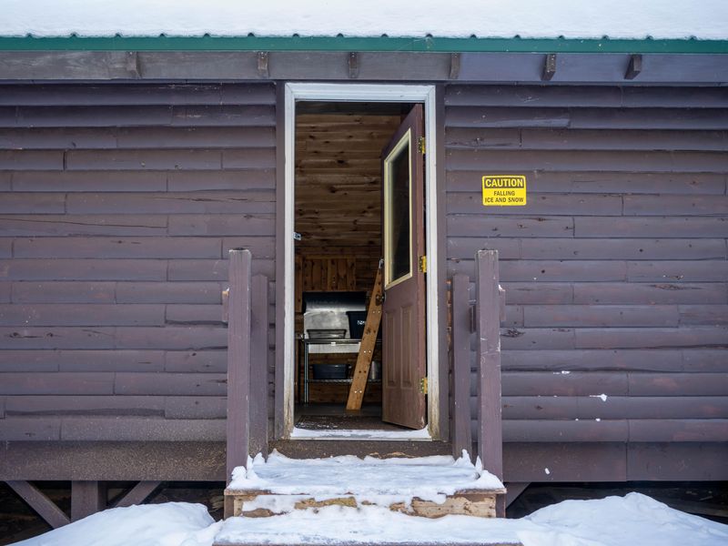
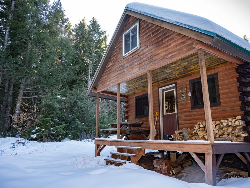
Big Spring Brook Hut offers a true backcountry winter experience in Maine's Katahdin Woods and Waters National Monument. This rustic log cabin sits approximately 9 miles south of the North Gate parking area, accessible only by cross-country skis or snowshoes during the winter season. The trail is generally groomed weekly and is not recommended for beginners or nighttime travel. The hut accommodates up to six people on four wooden bunks (no mattresses provided). Inside you'll find a woodstove with split firewood, limited pots and pans, and a small kitchen area with a table and chairs. An outdoor pit toilet with toilet paper is available. There is no potable water, electricity, lighting, or cell phone service. Campers must bring their own water filtration system, sleeping gear, and a satellite communication device for emergencies. This is a carry-in, carry-out facility. All trash, food scraps, and paper must be packed out. Pets and motorized vehicles including snowmobiles are prohibited. Check-in is at 1:00 PM and check-out is 11:00 AM.

Directions

Park at the North Gate parking lot off Swift Brook Road. From there, cross-country ski or snowshoe 9.1 miles south to reach Big Spring Brook Hut. The hut is 5.6 miles south of Haskell Gate.

Amenities

Water No
Fires Allowed Yes
Toilets Yes
Dump Station No
Wifi No
Pets Allowed No
Showers No
Electric Hookups
Water Hookups
Sewer Hookups
Camp Store No
Price $0

Vehicle

Max RV Length
Max Trailer Length
Big Rig Friendly No
Pull Through Sites No

Contact

Phone +1 (207) 456-6001

Cell Service

AT&T None
Verizon None
T-Mobile None

Photos

Community Posts

No posts yet. Be the first to share your experience!