
Standing Indian Campground
Closed — Closed for the season. Typically reopens in April when seasonal forest roads are accessible. Sites are available by reservation or first-come, first-served during the operating season.
Temporary Road Closure Alert: Curtis Creek Road
Curtis Creek Road will close starting Monday, March 30, just past the Newberry Creek Road intersection, to build a boulder wall that will stabilize the roadway following Hurricane Helene. The closure is needed to reopen Curtis Creek Campground by mid May.This 6-week repair project is a partnership…
Catawba Falls Partial Closure
A partial closure of Catawba Falls trail will take place this Wednesday and Thursday, March 25 and 26. Due to the ongoing Helene recovery work in partnership with the G5 Trail Collective, the Ridge Trail between the parking lot and upper Catawba Falls will be closed for a period of time this…
Great Lakes Boat Launch- Temporary Closure
The Great Lakes Boat Launch will be closed for the safety of the public and fire crews during Prescribed Burn operations in Jonas County on Tuesday, March 24th.
Elk River Falls Temporary Re-Closure
Temporary Closure: Elk River Falls AreaClosure Order Closure Order MapStarting March 18, the Elk River Falls Area will be temporarily closed on the Pisgah National Forest. This includes closing the Elk River Trail, Elk River Falls and Elk River Road within the closure area in Avery County. The…
Connely Creek Road (NFSR 86) Closure
Connely Creek Road (NFSR 86) on the Nantahala Ranger District will be closed until October 2026 for road improvements. The closure will extend from the intersection of Cowee Bald Road (NFSR 70) to the intersection of Barkers Creek (NFSR 7062). Access to Cowee Bald will only be available from Macon…
Prescribed Burn Croatan National Forest
The Croatan National Forest is conducting a 1,323-acre prescribed burn today, February 24, in Jones County off Holston Creek Rd and Highway 58, approximately 7 miles South of Maysville, NC and 15 miles SW of the Croatan Ranger Station. Smoke may be visible in this area throughout the day.A…
Winter Weather Alert
As North Carolina prepares for Winter Storm Gianna, the U.S. Department of Agriculture’s Forest Service urges the public to use extreme caution when visiting the state’s four national forests.Winter weather conditions can make visiting the forest unpredictable and dangerous, even for…
Cold Springs Road, Pisgah National Forest Traffic Alert
Cold Springs Road (Forest Service Road 148) on the Appalachian Ranger District in Haywood County will have traffic disruptions of up to 3 hours at a time as culvert replacement takes place beginning Monday, September 29. Work will occur Monday-Thursday between the hours of 9 a.m. -3:30 p.m.
Roan Mountain Fire Restrictions
Fire restrictions are now in effect for the Roan Mountain area of Appalachian Ranger District due to heightened fire danger caused by Hurricane Helene. The fire restriction is in effect on all National Forest System land from Hughes Gap to Doll Flats on the Appalachian Trail.This…
Joyce Kilmer Memorial Forest and Jenkins Meadows Trailheads Closed for Parking Lot Repairs
Joyce Kilmer Memorial Forest and Jenkins Meadows trailhead on the Nantahala National Forest will be temporarily closed beginning the evening of July 28, 2025 for roadwork and needed parking lot repairs. Work should take approximately 2-3 days, but could be extended by weather delays. The public…
Pisgah National Forest Driving Safety Alert
Please use caution as you travel in and around the Forest. We have a lot of heavy equipment and repair crews in the area working on roads damaged during Hurricane Helene. Up to 2,000 tons of gravel are being placed EVERY DAY on our Forest Service roads through the summer and fall. That's around 60…
Joyce Kilmer Memorial Forest and Jenkins Meadow trailheads closed
The USDA Forest Service has closed Joyce Kilmer Road (Forest Service Road 416) on the Cheoah Ranger District of the Nantahala National Forest for repairs, impacting access to both the Joyce Kilmer and Jenkins Meadow trailheads. Work should take approximately three to five days but could be extended…
Croatan Ranger's Office Closed
The Croatan Ranger's Office will be closed June 7th and 8th to visitors and staff as work for the I42 Project will begin.
Flooding on Uwharrie National Forest
Moccasin Creek Road (#576) and McLeans Creek Road (#544) are experiencing flooding due to heavy rain on Uwharrie National Forest. Recreation areas and roads remain open, however, access may be limited due to current conditions. Caution is advised.
Paint Rock Closure
Effective through May 1, 2035, certain National Forest System lands in the Paint Rock area, located on the Appalachian Ranger District of Pisgah National Forest and the Unaka Ranger District of Cherokee National Forest, will be closed to protect cultural resources.This closure is intended to…
Appalachian Trail Detour- Iron Mountain Gap
The Iron Mountain Gap detour is now in place to route hikers around the final remaining 6 miles of closed section of the Appalachian Trail from about a mile south of the destroyed Cherry Gap Shelter to about a mile north of Iron Mountain Gap (approx. NOBO mile 360.6 to 365.9). The detour is mapped…
Kings Mountain Point Fishing Pier Closure
The fishing pier at Kings Mountain Point Day Use Area on the Uwharrie National Forest is closed till further notice due to storm damage. The Day Use area remains open and the three smaller accessible fishing platforms are available for public use.
I-40 Corridor Forest Closure
For the protection and public health and safety for the Interstate 40 reconstruction, a closure is in place for National Forest Service lands and roads south of the I-40 corridor in the Appalachian Ranger District. This includes areas south of Slick Rock Branch drainage, the area west of the Pigeon…
Pisgah Camping Limitations
The following act is prohibited within 1000 feet of a road open to public vehicle travel on the Pisgah Ranger District in Buncombe, Haywood, Henderson, and Transylvania Counties in North Carolina.Camping is prohibited in any area not designated as a campsite depicted on the attached map. This…
Max Patch Restrictions
Restrictions on camping, fires, animals, aircraft and bicycles in Max Patch area.
About
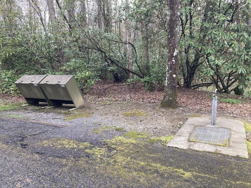
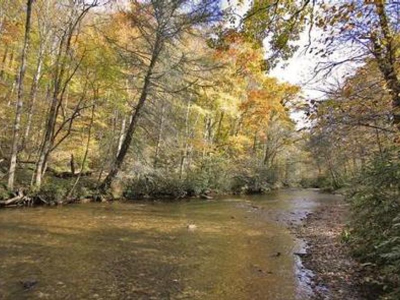
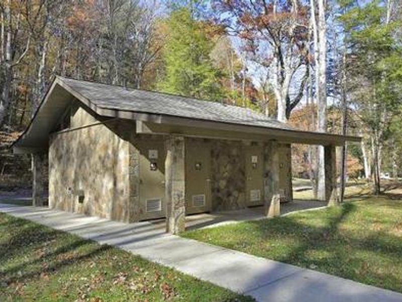
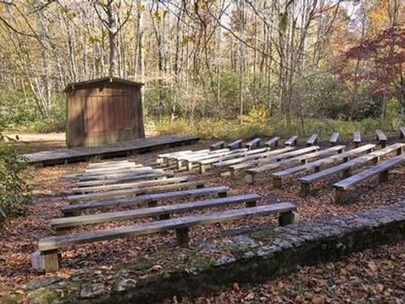
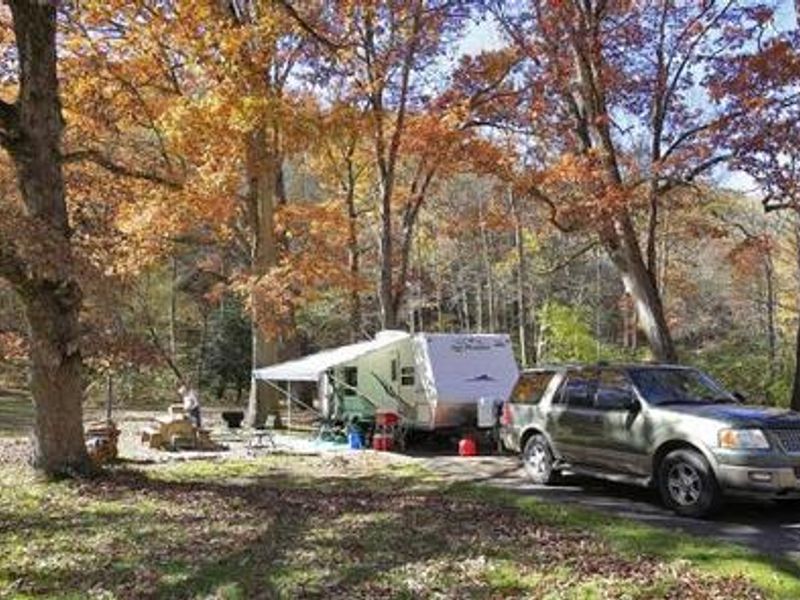
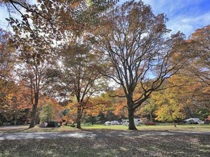
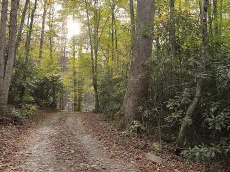
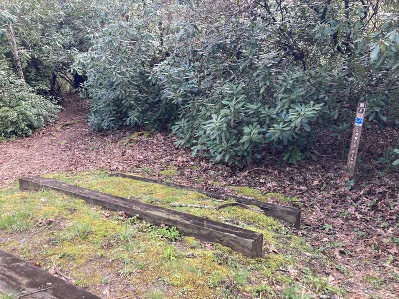
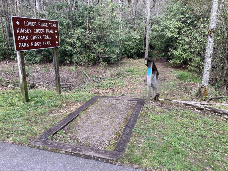
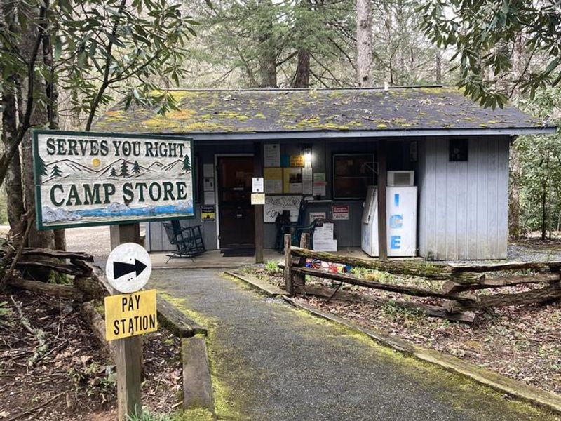
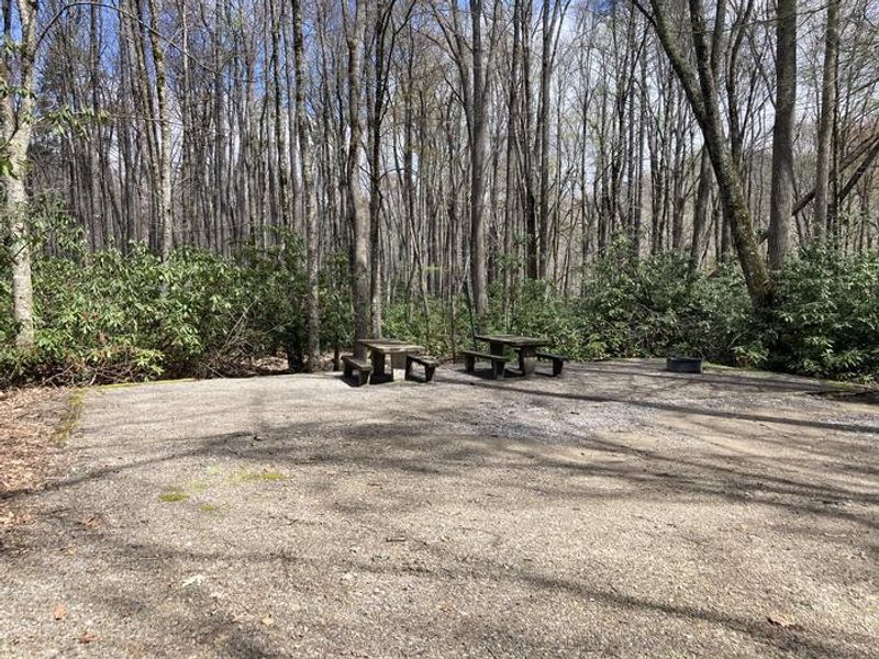
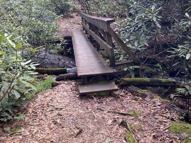
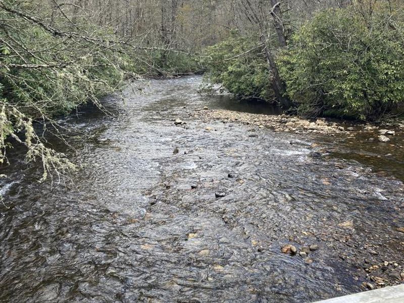
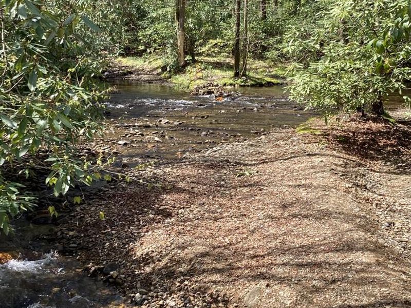
Standing Indian Campground is a premier destination in the Nantahala National Forest, located at 3,880 feet elevation in a basin surrounded by peaks exceeding 5,000 feet. The campground sits at the headwaters of the scenic Nantahala River, surrounded by lush evergreen forests and rhododendrons, with several natural trout streams running through the property. The campground features 85 sites distributed across five loops, offering a mix of reservable and first-come, first-served options. All sites include fire rings, grills, lantern posts, and picnic tables. The facility provides flush toilets, hot showers, drinking water, and a dump station. A group camping area called Kimsey Creek is also available. The campground does not offer electric, water, or sewer hookups and only accepts cash or check payment. Standing Indian Basin is renowned as a premier hiking destination, providing direct access to the Appalachian Trail and numerous other trails in the area. The Nantahala River offers excellent opportunities for whitewater rafting, kayaking, and trout fishing. The campground is located within a 20-minute drive of Franklin, North Carolina, making it an ideal base camp for exploring this scenic and historic section of the national forest.
Directions
From Franklin, North Carolina, take U.S. Highway 64 west approximately 12 miles, passing through Winding Stair Gap. Near the bottom of the mountain from the gap, turn left on West Old Murphy Road (State Route 1448) and watch for a directional sign for the campground. Go 1.9 miles and turn right on Forest Road 67 at the Standing Indian Campground sign. This is a paved road. Go 1.7 miles and turn right into the campground.
Nearby Campgrounds
- KIMSEY CREEK GROUP CAMPGROUND 0.4mi
- Hurricane Creek Horse & Primitive Camp 2.0mi
- Sandy Bottoms Rec. Area 8.2mi
- Tate Branch Campground 8.6mi
- Winesprings Horse Camp 8.2mi
- Tallulah River Campground 10mi
- Low Gap Campground 10mi
- NANTAHALA LAKE DISPERSED CAMPING SITE - LAKE ACCESS 10.0mi
- Appletree Group Campground 12mi
Amenities
| Water | Yes |
| Fires Allowed | Yes |
| Toilets | Yes |
| Dump Station | Yes |
| Wifi | No |
| Pets Allowed | Yes |
| Showers | Yes |
| Electric Hookups | No |
| Water Hookups | No |
| Sewer Hookups | No |
| Camp Store | Yes |
| Price | $52 - $100 |
Vehicle
| Max RV Length | 50ft |
| Max Trailer Length | 50ft |
| Big Rig Friendly | Yes |
| Pull Through Sites | No |
Contact
| Phone | +1 (828) 524-6441 |
Cell Service
| AT&T | None |
| Verizon | None |
| T-Mobile | None |
Availability
Photos


Community Posts
No posts yet. Be the first to share your experience!