Old Highway 86
Open seasonally from early April through late October. All 71 electric sites are reservable through Recreation.gov. Maximum stay is 14 consecutive nights per 30-day period.
Severe Thunderstorm Watch issued June 8 at 12:51AM CDT until June 8 at 8:00AM CDT by NWS Springfield MO
THE NATIONAL WEATHER SERVICE HAS ISSUED SEVERE THUNDERSTORM WATCH 286 IN EFFECT UNTIL 8 AM CDT THIS MORNING FOR THE FOLLOWING AREAS IN KANSAS THIS WATCH INCLUDES 2 COUNTIES IN SOUTHEAST KANSAS CHEROKEE CRAWFORD IN MISSOURI THIS WATCH INCLUDES 11 COUNTIES IN SOUTHWEST MISSOURI BARRY BARTON CHRISTIAN DADE GREENE JASPER LAWRENCE MCDONALD NEWTON STONE TANEY THIS INCLUDES THE CITIES OF ANDERSON, AURORA, BAXTER SPRINGS, BRANSON, CARTHAGE, CASSVILLE, CHICOPEE, CHRISTIAN CENTER, COLUMBUS, CRANE, EDGEWATER BEACH, ELSEY, FORSYTH, GOODMAN, GREENFIELD, HOLLISTER, INDIAN POINT, JOPLIN, KENOMA, KIMBERLING CITY, KIRBYVILLE, LAMAR, LOCKWOOD, LONE OAK, LOWELL, MADRY, MARIONVILLE, MEINERT, MONETT, MOUNT VERNON, NEOSHO, NEUTRAL, NIXA, NOEL, OZARK, OZARK BEACH, PINEVILLE, PITTSBURG, POWERSITE, RIVERTON, ROCKY COMFORT, SELMORE, SHERWIN, SILVER DOLLAR CITY, SOUTH WEST CITY, SPRINGFIELD, AND STIPPVILLE.
Flash Flood Warning issued June 7 at 8:29PM CDT until June 8 at 2:30AM CDT by NWS Springfield MO
FFWSGF The National Weather Service in Springfield has issued a * Flash Flood Warning for... Central Christian County in southwestern Missouri... Southeastern Greene County in southwestern Missouri... East Central Stone County in southwestern Missouri... Southwestern Webster County in southwestern Missouri... * Until 230 AM CDT Monday. * At 829 PM CDT, Doppler radar indicated thunderstorms producing heavy rain across the warned area. Between 1 and 3 inches of rain have fallen. Flash flooding is ongoing or expected to begin shortly. HAZARD...Flash flooding caused by thunderstorms. SOURCE...Radar. IMPACT...Flash flooding of small creeks and streams, urban areas, highways, streets and underpasses as well as other poor drainage and low-lying areas. * Some locations that will experience flash flooding include... Ozark, Highlandville, Rogersville, Sparta, Spokane, Christian Center, Selmore, Linden, Chestnutridge and Ponce de Leon. This includes the following low water crossings... Finley River at Johns Ford Road, Tory Creek at Highway O, Woods Fork at Woods Fork Road, Bull Creek at Center Road, Parchcorn Creek at Smyrna Road and Pedelo Creek at Highway U.
Flood Watch issued June 7 at 1:53PM CDT until June 8 at 1:00PM CDT by NWS Springfield MO
* WHAT...Flooding caused by excessive rainfall continues to be possible. * WHERE...Portions of southeast Kansas, including the following areas, Bourbon, Cherokee and Crawford and Missouri, including the following areas, Barry, Barton, Benton, Camden, Cedar, Christian, Dade, Dallas, Douglas, Greene, Hickory, Jasper, Laclede, Lawrence, McDonald, Newton, Ozark, Polk, St. Clair, Stone, Taney, Vernon, Webster and Wright. * WHEN...Through Monday afternoon. * IMPACTS...Excessive runoff may result in flooding of rivers, creeks, streams, and other low-lying and flood-prone locations. Flooding may occur in poor drainage and urban areas. Low-water crossings may be flooded. * ADDITIONAL DETAILS... - Showers and thunderstorms with rainfall rates of 2 to 3 inches per hour are expected today through Monday which may lead to flash flooding in urban and low-lying areas. Rainfall amounts of 1 to 3 inches expected with locally higher amounts up to 5 to 7 inches possible. - http://www.weather.gov/safety/flood
About
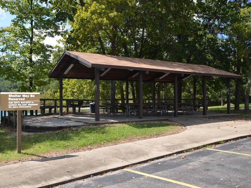
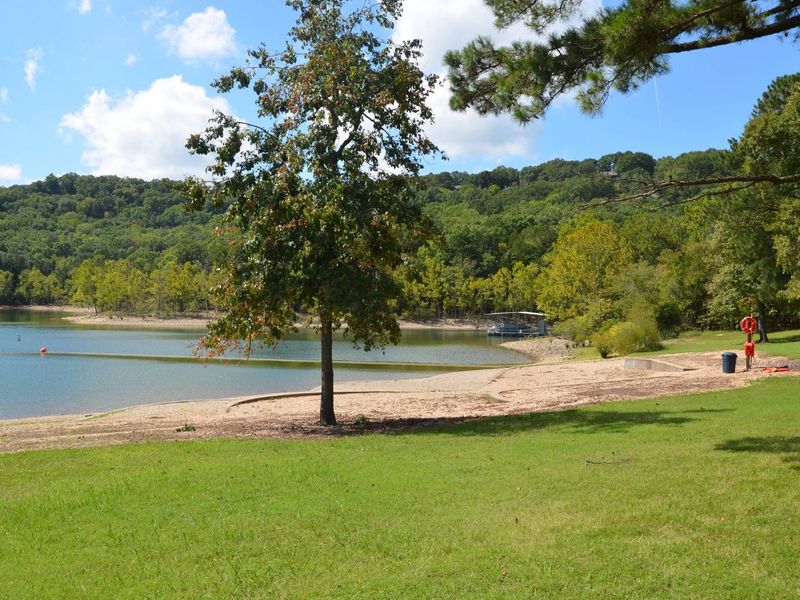
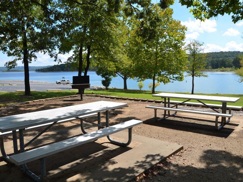
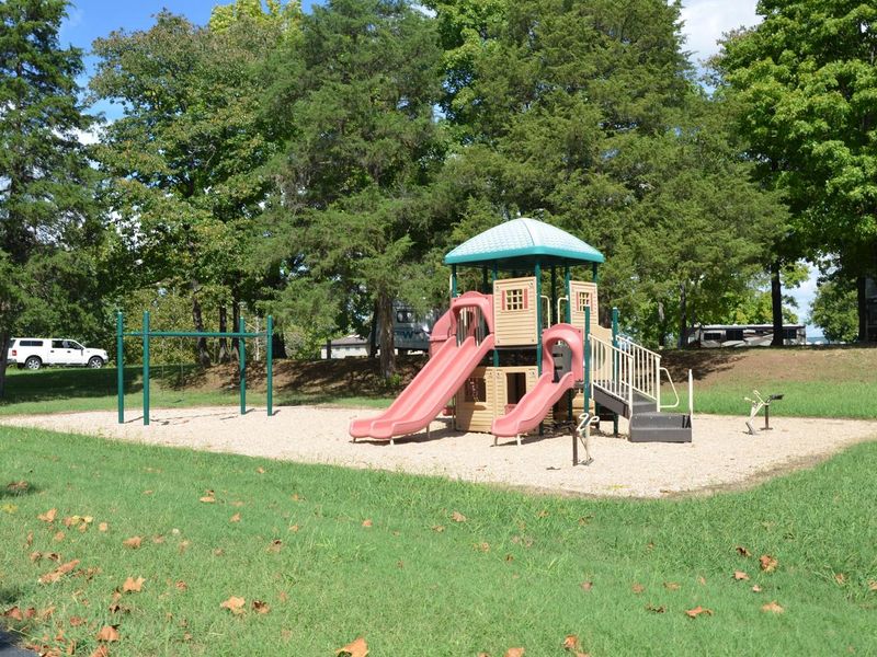
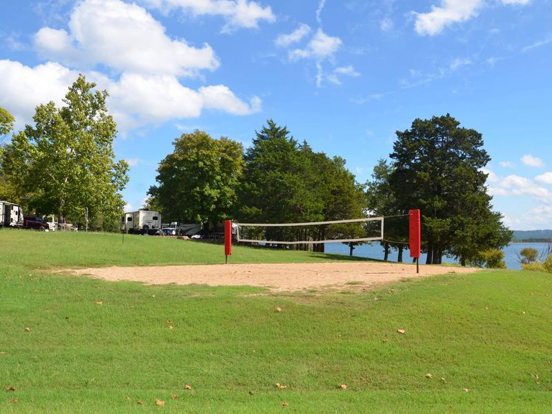
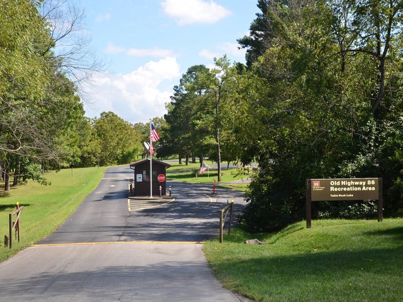
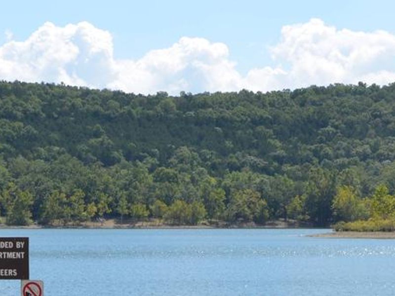
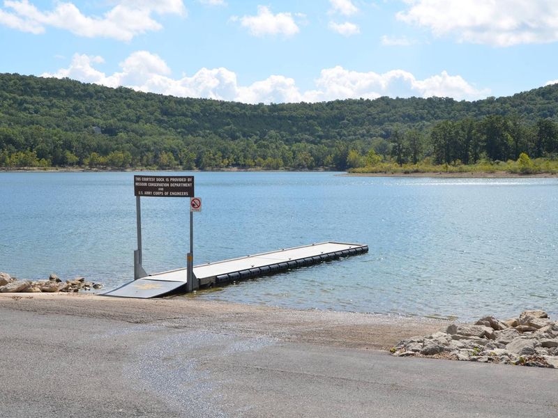
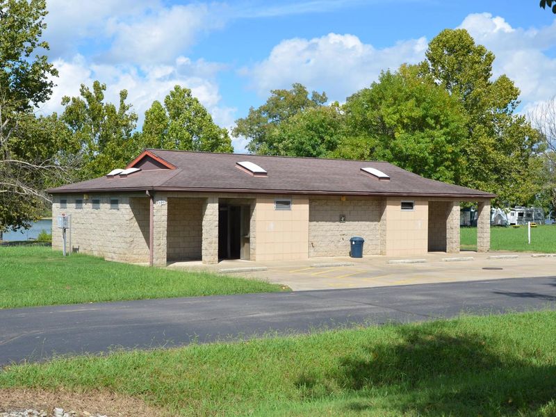
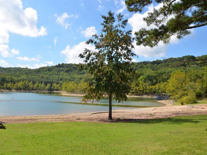
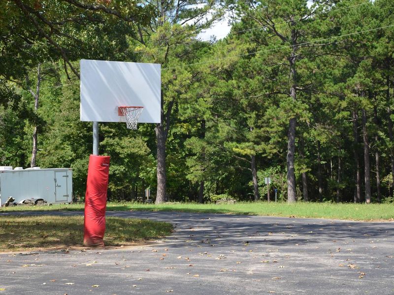
Old Highway 86 Campground occupies a scenic peninsula jutting into the White River Arm of Table Rock Lake in the Missouri Ozarks. Operated by the U.S. Army Corps of Engineers, this 71-site campground offers electric hookups with water at each site, paved driveways, and many waterfront locations with direct lake access. The peninsula configuration provides water on three sides, creating excellent shoreline fishing opportunities and easy access for boaters. Facilities include modern bathhouses with hot showers and flush toilets, a dump station, designated swimming beach, concrete boat ramp, playground, and volleyball court. The surrounding forest of oak and hickory trees provides shade while maintaining the open, sunny character that defines the campground. Table Rock Lake is acclaimed as one of the premier bass fishing lakes in the hemisphere, also offering abundant crappie, catfish, and bluegill. The campground sits about 17 miles from Branson, Missouri, providing convenient access to supplies and attractions while maintaining a quieter lakeside atmosphere. Nearby recreation includes the 2-mile Table Rock Lakeshore Trail and mountain biking opportunities in Mark Twain National Forest.
Directions
From Branson, Missouri, take Highway 65 and turn west onto Highway 86. After 6 miles turn north on Highway UU and follow signs to the campground.
Amenities
| Water | Yes |
| Fires Allowed | Yes |
| Toilets | Yes |
| Dump Station | Yes |
| Wifi | — |
| Pets Allowed | Yes |
| Showers | Yes |
| Electric Hookups | Yes |
| Water Hookups | Yes |
| Sewer Hookups | No |
| Camp Store | — |
| Price | $25 - $50 |
Vehicle
| Max RV Length | 66ft |
| Max Trailer Length | 66ft |
| Big Rig Friendly | Yes |
| Pull Through Sites | No |
Contact
| Phone | +1 (417) 779-5376 |
Cell Service
| AT&T | Yes |
| Verizon | Yes |
| T-Mobile | Yes |
Availability
Photos
Community Posts
No posts yet. Be the first to share your experience!