
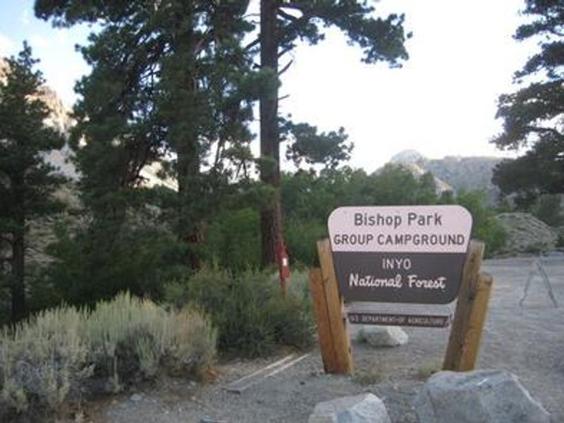
Bishop Park Group
Closed — Closed for the winter season. Typically operates from late May through late September, weather permitting. Reservations required and must be made at least 4 days in advance through Recreation.gov.
Winter Storm Warning issued February 15 at 12:57PM PST until February 18 at 10:00PM PST by NWS Las Vegas NV
* WHAT...Heavy snow possible. Total snow accumulations exceeding 3 feet above 8000 feet...1.5 to 2.5 feet above 7000 feet...and 8 to 16 inches down to 6000 feet. Winds could gust as high as 70 mph. * WHERE...Eastern Sierra Slopes. * WHEN...From 4 AM Monday to 10 PM PST Wednesday. * IMPACTS...Travel could be very difficult to impossible. Widespread blowing snow could significantly reduce visibility. Very strong winds could cause extensive tree damage. * ADDITIONAL DETAILS...Snowfall rates will likely decrease for a period from late Monday night into Tuesday morning, only to increase once again by mid-day Tuesday.
Avalanche Watch issued February 15 at 7:36AM PST by NWS Las Vegas NV
AVAVEF The Eastern Sierra Avalanche Center in Mammoth Lakes has issued a Backcountry Avalanche Watch for the following areas: the Eastern Sierra in Mono County and the Eastern Sierra in Inyo County * WHAT...The avalanche danger is expected to rise to HIGH by tomorrow afternoon and remain elevated into mid-week. * WHERE...The eastern slopes of the Sierra Nevada mountain range between Virgina Lakes on the north to Bishop Creek on the south. * WHEN...In effect from Sun 07:00 PST to Mon 07:00 PST. * IMPACTS...|Heavy snow and extreme winds will create widespread areas of unstable snow.
Monache Meadows Area Seasonal Road Closure
To provide for public safety and protection of natural resources during snowy and muddy conditions.
ESCCRP PANORAMA PROJECT AREA CLOSURE
To provide for public safety while contractors perform forest health and fuels reduction work for the Panorama Project.
PACK FIRE AREA CLOSURE
The Pack Fire boundary near McGee Creek area remains closed for public safety.
Stay Limits, Parking, and Developed Recreation Site Use
This forest order was put in place to protect natural resources and promote public safety.
Reds Meadow Road Reconstruction Project
www.fs.usda.gov/r05/inyo/projects/reds-meadow-road-reconstruction
Wilderness Use Restrictions
This Forest Order prohibits recreating within the portions of the John Muir, Ansel Adams, Hoover, and Golden Trout Wildernesses located in the Inyo National Forest. Please click on the PDF version for all Exhibit maps B - G. The website will not allow for more JPG formats to be uploaded than…
Mount Whitney Zone Access Restrictions
This forest order prohibits recreating in the Mount Whitney Zone to provide for public safety and protect natural resources.
Ansel Adams and John Muir Wilderness Campfire Restrictions
This forest order prohibits campfires in portions of Ansel Adams and John Muir Wilderness Areas that are located on the Inyo National Forest, as shown on the Exhibits.Please click on the PDF version for all Exhibit maps B - S. The website will not allow for more JPG formats to be uploaded than what…
Golden Trout and Hoover Wilderness Campfire Restrictions
This forest order prohibits campfires in portions of Golden Trout and Hoover Wilderness Areas that are located on the Inyo National Forest, as shown in the Exhibits.
ESCCRP Project Area Closure
This forest order prohibits access to roads affected by the ESCRRP project to provide for public safety while contractors perform forest health and fuels reduction work surrounding the Town of Mammoth Lakes and beyond.The closure orders are dynamic and contractor work moves frequently to different…
Hot Creek Closure Order
This Forest Order prohibits recreating in Hot Creek within the Mammoth Ranger District.
Goat Prohibition Order
This Forest Order prohibits possessing or storing a goat within the Inyo National Forest Goat Prohibition Area.
Mammoth Mill Site Area and Trail Closure
This Forest Order prohibits recreating, entering or being in the Mammoth Mill Site Closure Area and the Mammoth Stamp Mill Trail.
B&B Mine Closure Order
This Forest Order prohibits recreating within the B&B Mine and Mill Site Closure Area.
Food and Refuse Storage Restrictions
This Forest Order prohibits food and refuse in locations in Exhibits A and C-J, unless stored in a bear-resistant container. Food and refuse in locations shown in Exhibit B must be stored in a bear-resistant container OR counter-balanced at least 15 feet above the ground and 10 feet horizontally…
About
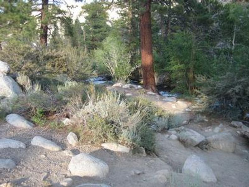
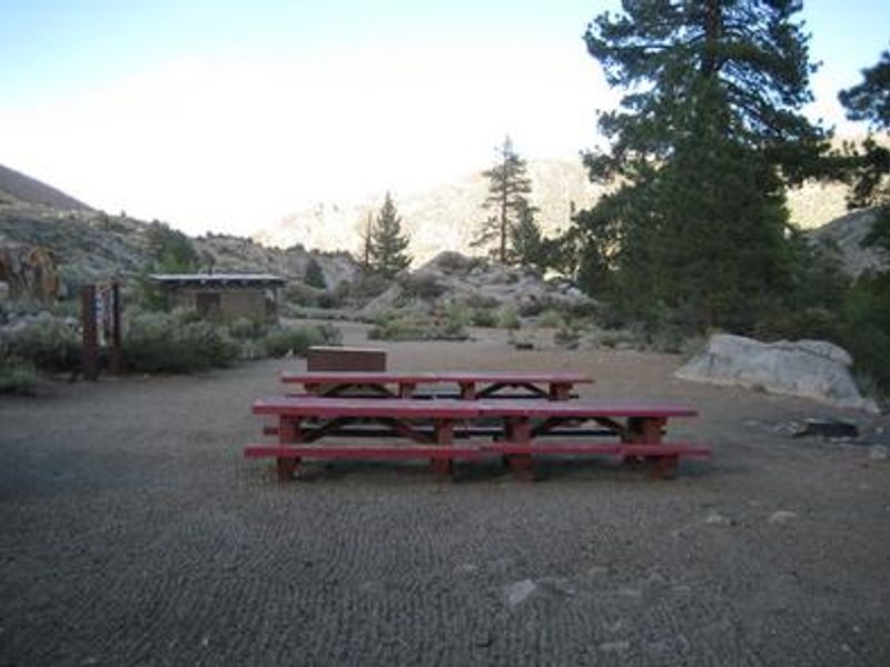
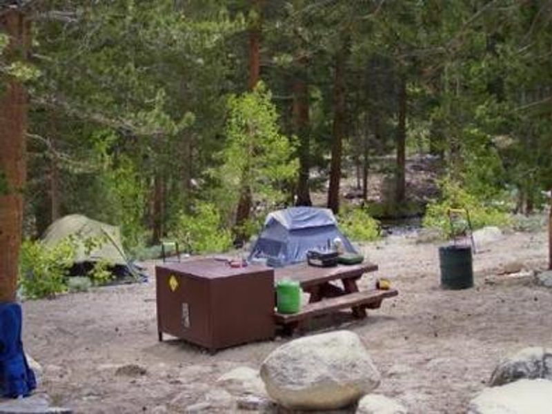
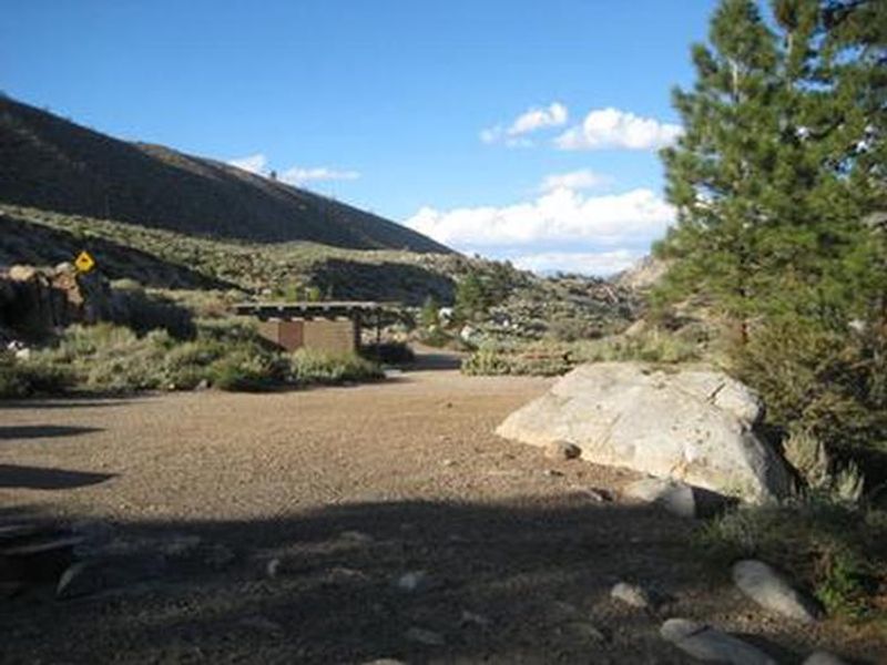
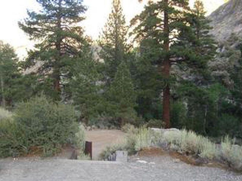
Bishop Park Group campground offers families, friends, and special interest groups a serene setting along the North Fork of Bishop Creek in the Eastern Sierra. Located at approximately 7,500 feet elevation in Inyo National Forest, this tent-only group site accommodates up to 25 people with parking for 8 vehicles maximum. The level, dirt-surfaced campsites border the creek, allowing anglers to fish from the comfort of their campsite for stocked rainbow, brown, brook, and Alpers trout. Similar fishing opportunities exist just upstream in Intake Lake II. The campground is shaded by aspens, cottonwoods, Jeffrey pines, and lodgepole pines, providing a cool retreat during summer months. Each group site includes picnic tables, fire rings with cooking grills, and two bear-proof food storage lockers. Flush toilets and hand-pump drinking water are available. The area is frequented by bears, and all food must be secured in provided containers when not attended. Bishop Park Group serves as an ideal base for exploring the Bishop Creek area and accessing John Muir Wilderness trailheads. Popular activities include horseback riding, wildlife viewing, hiking to nearby glaciers and alpine lakes, and backcountry fishing. The campground is located near the communities of Aspendell and Lake Sabrina, with a nearby resort providing limited groceries, fishing supplies, and internet access. RVs and trailers are not suitable for this site due to the tent-only configuration and limited parking.
Directions
From Highway 395 in the center of Bishop, turn west on Line Street (Highway 168) and drive approximately 15 miles. The campground is on the left, about 2 miles past the South Lake road junction.
Nearby Campgrounds
Amenities
| Water | Yes |
| Fires Allowed | Yes |
| Toilets | Yes |
| Dump Station | No |
| Wifi | No |
| Pets Allowed | Yes |
| Showers | No |
| Electric Hookups | — |
| Water Hookups | — |
| Sewer Hookups | — |
| Camp Store | No |
| Price | $94 |
Vehicle
| Max RV Length | — |
| Max Trailer Length | — |
| Big Rig Friendly | No |
| Pull Through Sites | No |
Contact
| AliceA@camprrm.com | |
| Phone | +1 (760) 872-4552 |
Cell Service
| AT&T | None |
| Verizon | None |
| T-Mobile | None |
Availability
Photos
Community Posts
No posts yet. Be the first to share your experience!