South Core Banks -- Beach Camping
Open for camping. Restrooms are open at three locations. Drinking water is available March through November at facilities near the lighthouse and Great Island. Vehicle ferry service from Davis is operating weather-dependent. ORV permits required for beach driving are available through Recreation.gov.
Beach Hazards Statement issued September 24 at 5:02AM EDT until September 24 at 8:00PM EDT by NWS Newport/Morehead City NC
* WHAT...For the Coastal Flood Advisory, up to 1 to 2 feet of inundation above ground level in low-lying areas near shorelines and tidal waterways. For the Beach Hazards Statement, dangerous rip currents, large breaking waves, and strong longshore currents in the surf zone. * WHERE...For the Coastal Flood Advisory, areas adjacent to the Southern Pamlico Sound and adjacent tidal creeks. This would include areas extending from Cedar Island to Merrimon including South River. Areas adjacent to Core Sound could possibly see some elevated water levels as well impacting areas from Marshallberg to Atlantic. For the Beach Hazards Statement, beaches north of Cape Lookout. * WHEN...For the Coastal Flood Advisory, until 11 AM EDT Friday. For the first Beach Hazards Statement, until 8 PM EDT this evening. For the second Beach Hazards Statement, from Thursday morning through Thursday evening. * IMPACTS...Up to 1 to 2 feet of inundation above ground level is possible in low-lying areas near shorelines and tidal waterways resulting in a low threat of property damage. Some roads and low lying property including parking lots, parks, lawns, and homes adjacent to the waterfront will experience shallow flooding. Rip currents can sweep even the best swimmers away from shore into deeper water. Dangerous shore break can throw a swimmer or surfer head first into the bottom causing neck and back injuries. Strong longshore currents will create dangerous swimming conditions. * ADDITIONAL DETAILS...The most likely time for strong rip currents to occur is a couple hours either side of low tide, which will occur around Thursday 12:12 PM Thursday.
Wind Advisory issued September 24 at 2:07AM EDT until September 25 at 2:00AM EDT by NWS Newport/Morehead City NC
* WHAT...Northeast winds 25 to 35 mph with gusts 40 to 50 mph. * WHERE...East Carteret and Mainland Dare Counties, and Hatteras Island, Northern Outer Banks, and Ocracoke Island. The strongest winds are expected for areas adjacent to bodies of water. * WHEN...Until 2 AM EDT Friday. * IMPACTS...Gusty winds will blow around unsecured objects. Tree limbs could be blown down and a few power outages may result. * ADDITIONAL DETAILS...A strong coastal low will develop offshore east of the Carolinas and move north towards the New England coast by this weekend. A period of moderate to strong winds is expected to impact portions of the coast Thursday. These strong winds may last longer depending on the track of the low.
Coastal Flood Advisory issued September 24 at 5:02AM EDT until September 25 at 11:00AM EDT by NWS Newport/Morehead City NC
* WHAT...For the Coastal Flood Advisory, up to 1 to 2 feet of inundation above ground level in low-lying areas near shorelines and tidal waterways. For the Beach Hazards Statement, dangerous rip currents, large breaking waves, and strong longshore currents in the surf zone. * WHERE...For the Coastal Flood Advisory, areas adjacent to the Southern Pamlico Sound and adjacent tidal creeks. This would include areas extending from Cedar Island to Merrimon including South River. Areas adjacent to Core Sound could possibly see some elevated water levels as well impacting areas from Marshallberg to Atlantic. For the Beach Hazards Statement, beaches north of Cape Lookout. * WHEN...For the Coastal Flood Advisory, until 11 AM EDT Friday. For the first Beach Hazards Statement, until 8 PM EDT this evening. For the second Beach Hazards Statement, from Thursday morning through Thursday evening. * IMPACTS...Up to 1 to 2 feet of inundation above ground level is possible in low-lying areas near shorelines and tidal waterways resulting in a low threat of property damage. Some roads and low lying property including parking lots, parks, lawns, and homes adjacent to the waterfront will experience shallow flooding. Rip currents can sweep even the best swimmers away from shore into deeper water. Dangerous shore break can throw a swimmer or surfer head first into the bottom causing neck and back injuries. Strong longshore currents will create dangerous swimming conditions. * ADDITIONAL DETAILS...The most likely time for strong rip currents to occur is a couple hours either side of low tide, which will occur around Thursday 12:12 PM Thursday.
About
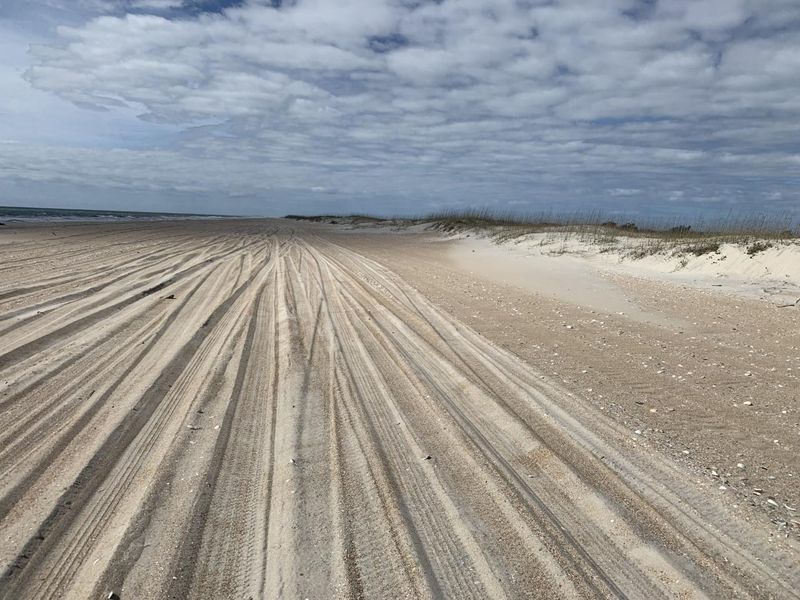
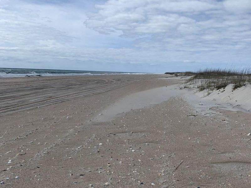
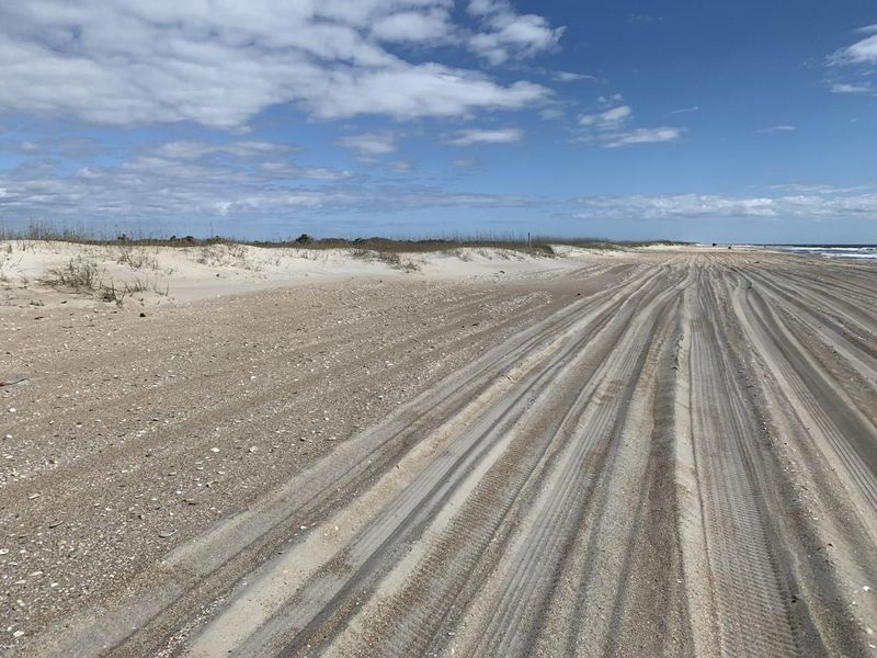
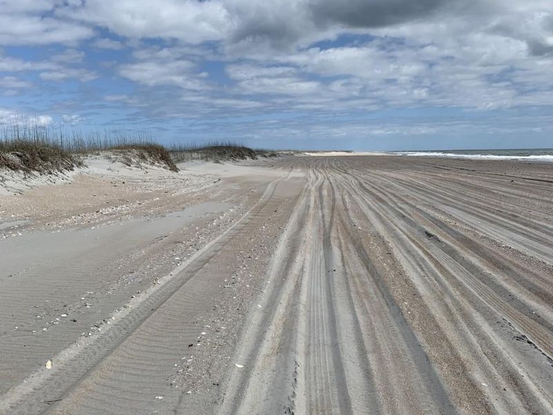
South Core Banks is a 21-mile barrier island within Cape Lookout National Seashore offering dispersed primitive beach camping in a true backcountry setting. There are no designated campsites or improved camping areas. Campers set up directly on the ocean beach, seaward of the primary dunes, or tents may be pitched among the dunes on the sound side. The island is accessible only by boat, with vehicle ferry service from Davis, NC, delivering campers and their 4x4s to Great Island on South Core Banks. This is a self-sufficient camping experience. Seasonal restrooms with public showers and drinking water are available at three locations, including near the Cape Lookout Lighthouse and Great Island Cabin Camp, from approximately March through November. Dump stations for vehicle campers are located at Great Island and near Cape Point. However, there are no trash receptacles; all garbage must be packed out. No hookups are available, and the soft sand conditions make this unsuitable for RVs or trailers. Campfires are permitted only below the high tide line in damp sand, with a maximum diameter of three feet. Pets must remain on a 6-foot leash at all times. An Off-Road Vehicle permit ($75 for the main season) is required for anyone driving on the beach and must be purchased through Recreation.gov before arrival. Maximum stay is 14 consecutive days. No camping permit is required for groups under 25 people.
Directions
Take the vehicle ferry from Davis, NC to Great Island on South Core Banks. The ferry operates weather-dependent. Alternatively, passenger ferry service is available from Harkers Island. The barrier islands of Cape Lookout National Seashore are only accessible by boat.
Amenities
| Water | Yes |
| Fires Allowed | Yes |
| Toilets | Yes |
| Dump Station | Yes |
| Wifi | No |
| Pets Allowed | Yes |
| Showers | Yes |
| Electric Hookups | — |
| Water Hookups | — |
| Sewer Hookups | — |
| Camp Store | — |
| Price | $0 |
Vehicle
| Max RV Length | — |
| Max Trailer Length | — |
| Big Rig Friendly | No |
| Pull Through Sites | No |
Contact
| calo_vc@nps.gov | |
| Phone | +1 (252) 728-2250 |
Cell Service
| AT&T | Yes |
| Verizon | Yes |
| T-Mobile | Yes |
Photos
Community Posts
No posts yet. Be the first to share your experience!