Frazier Group Campground
Open year-round. Reservations required via Recreation.gov at least 4 days in advance, available up to 12 months ahead. Stage 1 Fire Restrictions currently in effect with Very High fire danger. 14-day stay limit enforced.
Flash Flood Warning issued September 15 at 5:48PM MST until September 15 at 8:00PM MST by NWS Flagstaff AZ
At 548 PM MST, the public reported flash flooding across the warned area, including Ft. Apache Road. Up to 3 inches of rain have fallen. Flash flooding is ongoing or expected to begin shortly. HAZARD...Life threatening flash flooding. Thunderstorms producing flash flooding. SOURCE...Public reported. IMPACT...Life threatening flash flooding of creeks and streams, normally dry washes, urban areas, highways, streets and underpasses. Some locations that will experience flash flooding include... Fort Apache, Seven Mile, Whiteriver Airport, Turkey Creek, Whiteriver, Canyon Day and East Fork. This includes State Route 73 between mile markers 334 and 340. This includes the following creeks, washes and rivers... Turkey Creek, East Fork White River, West Turkey Creek, Nash Creek and Firebox Creek.
Flood Watch issued September 15 at 10:34AM MST until September 16 at 11:00PM MST by NWS Phoenix AZ
* WHAT...Flooding caused by excessive rainfall is possible. * WHERE...A portion of south central Arizona, including the following areas, Aguila Valley, Apache Junction/Gold Canyon, Buckeye/Avondale, Cave Creek/New River, Central Phoenix, Deer Valley, Dripping Springs, East Valley, Fountain Hills/East Mesa, Gila Bend, Globe/Miami, Mazatzal Mountains, New River Mesa, North Phoenix/Glendale, Northwest Pinal County, Northwest Valley, Pinal/Superstition Mountains, Rio Verde/Salt River, San Carlos, Scottsdale/Paradise Valley, Sonoran Desert Natl Monument, South Mountain/Ahwatukee, Southeast Gila County, Southeast Valley/Queen Creek, Superior, Tonopah Desert, Tonto Basin and West Pinal County. * WHEN...From late tonight through Wednesday evening. * IMPACTS...Excessive runoff may result in flooding of rivers, creeks, streams, and other low-lying and flood-prone locations. * ADDITIONAL DETAILS... - The combination of abundant moisture and a weather system moving into the region will produce several rounds of showers and thunderstorms late tonight through Wednesday. Moderate to heavy rainfall with rainfall rates in excess of 1-2 inches per hour will be likely at times. - http://www.weather.gov/safety/flood
Canyon Lake Drawdown Public Safety Closure
Due to the Canyon Lake drawdown all recreational sites around Canyon Lake including the marina and the lakebed will be closed. Apache Trail (SR 88) will remain open.
About
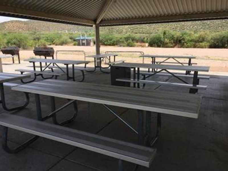
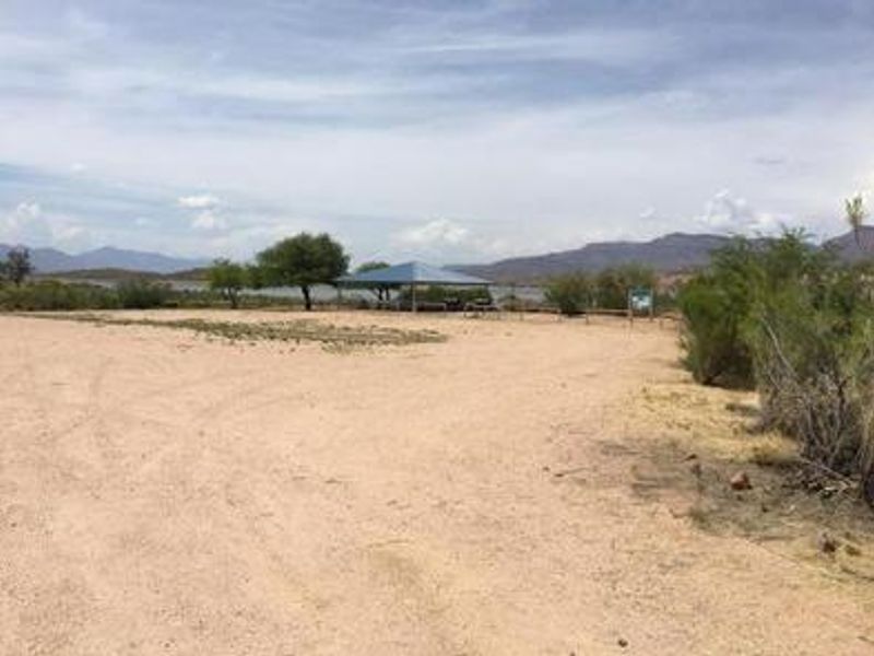
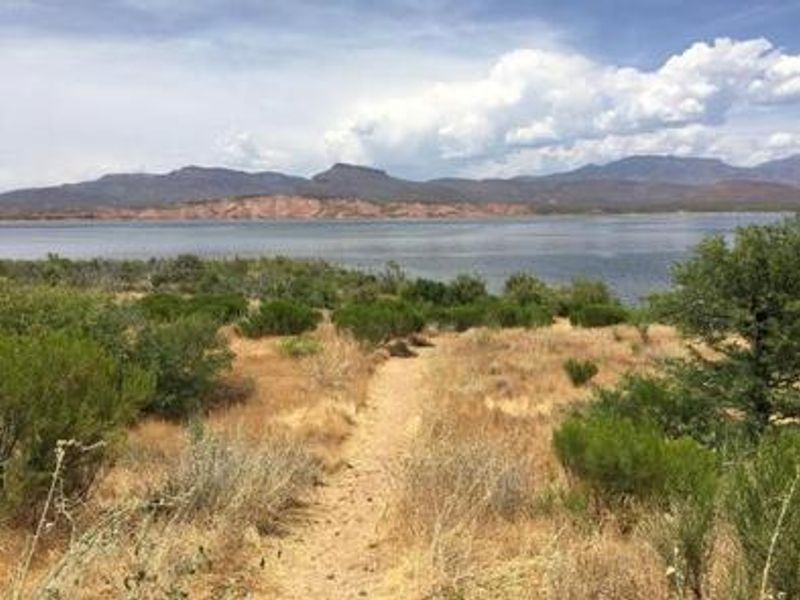
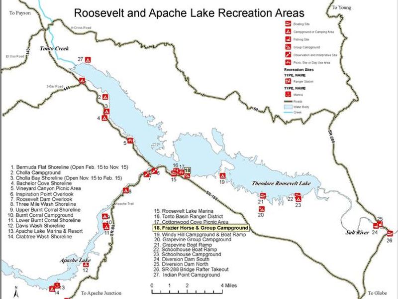
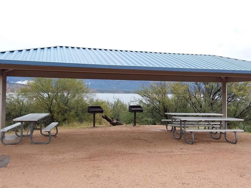
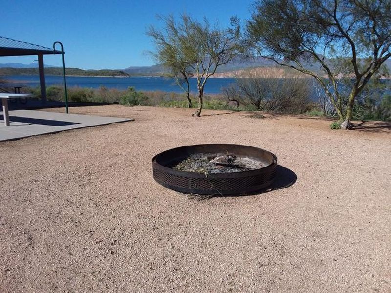
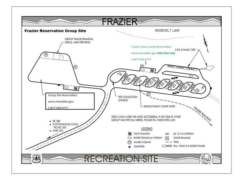
Frazier Group Campground sits at approximately 2,200 feet elevation overlooking Roosevelt Lake, the largest of four reservoirs within a two-hour drive of Phoenix. The Sonoran Desert setting offers striking views of blue water against three mountainous wilderness areas. This is a single 100-person group site with a ramada shelter, group-sized picnic tables, grills, and a large group fire ring. The campground is notable for its equestrian infrastructure, including horse corrals and watering tanks, making it one of the few lakeside horse camps in the Southwestern Region. Trail users access the 800-mile Arizona National Scenic Trail via the adjacent Frazier Trail. The large open parking area accommodates multiple trailers with a 200-foot pull-through gravel driveway suitable for vehicles up to 45 feet. Potable water is available via hand pump and hydrants, though RVs and trailers cannot connect directly per ADEQ regulations. Vault toilets are provided. The site operates on a pack-it-in, pack-it-out trash policy. Nearby attractions include Tonto National Monument cliff dwellings, the Apache Trail Historic Road, and the Tonto Basin Visitor Center.
Directions
From Mesa: Take SR 87 (Beeline Highway) north approximately 60 miles to the SR 188 junction. Turn right onto SR 188 and continue 35 miles to the campground, located 2 miles southeast of Roosevelt Dam. From Globe: Take SR 188 north for 28 miles. All routes are paved.
Amenities
| Water | Yes |
| Fires Allowed | Yes |
| Toilets | Yes |
| Dump Station | — |
| Wifi | No |
| Pets Allowed | Yes |
| Showers | No |
| Electric Hookups | — |
| Water Hookups | — |
| Sewer Hookups | — |
| Camp Store | No |
| Price | $75 |
Vehicle
| Max RV Length | 45ft |
| Max Trailer Length | 32ft |
| Big Rig Friendly | Yes |
| Pull Through Sites | No |
Contact
| Phone | +1 (602) 225-5395 |
Cell Service
| AT&T | Yes |
| Verizon | Yes |
| T-Mobile | None |
Availability
Photos
Community Posts
No posts yet. Be the first to share your experience!