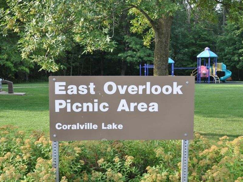
East Overlook Day Use Area
This is a day-use only facility. Overnight camping is not permitted. All shelters and facilities must be vacated by sunset. Unreserved shelters are available free on a first-come, first-served basis. Group shelters may be reserved in advance through Recreation.gov.
Flood Warning issued June 18 at 8:28PM CDT until June 20 at 6:12AM CDT by NWS Quad Cities IA IL
...The Flood Warning continues for the following rivers in Iowa... Iowa River at Wapello affecting Louisa County. Iowa River near Lone Tree affecting Washington, Johnson and Louisa Counties. Iowa River at Oakville affecting Louisa County. English River at Kalona affecting Washington and Johnson Counties. Iowa River at Marengo affecting Benton and Iowa Counties. * WHAT...Moderate flooding is occurring and moderate flooding is forecast. * WHERE...English River at Kalona. * WHEN...Until Saturday morning. * IMPACTS...At 17.0 feet, Water begins going over several county roads, including 13th St, Kiwi Ave, Orange Ave and Poplar Ave. * ADDITIONAL DETAILS... - At 8:00 PM CDT Thursday the stage was 17.2 feet and falling. - Forecast...The river is expected to fall below flood stage late tomorrow evening and continue falling to 6.7 feet Thursday, June 25. - Flood stage is 14.0 feet.
Flood Warning issued June 18 at 8:28PM CDT until June 20 at 10:00AM CDT by NWS Quad Cities IA IL
...The Flood Warning continues for the following rivers in Iowa... Iowa River at Wapello affecting Louisa County. Iowa River near Lone Tree affecting Washington, Johnson and Louisa Counties. Iowa River at Oakville affecting Louisa County. English River at Kalona affecting Washington and Johnson Counties. Iowa River at Marengo affecting Benton and Iowa Counties. * WHAT...Minor flooding is forecast. * WHERE...Iowa River near Lone Tree. * WHEN...From late tonight to late Saturday morning. * IMPACTS...At 16.0 feet, Flood waters affect parts of Lola Lane and Y Avenue. River Junction Access Park is closed. * ADDITIONAL DETAILS... - At 8:00 PM CDT Thursday the stage was 15.3 feet and rising. - Forecast...The river is expected to rise above flood stage late tonight to a crest of 16.7 feet early tomorrow afternoon. It will then fall below flood stage early Saturday morning. - Flood stage is 16.0 feet.
About
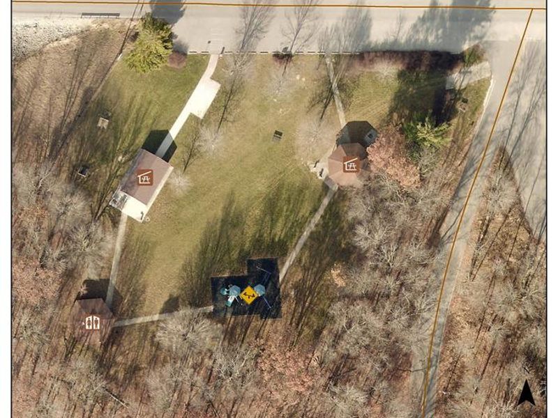
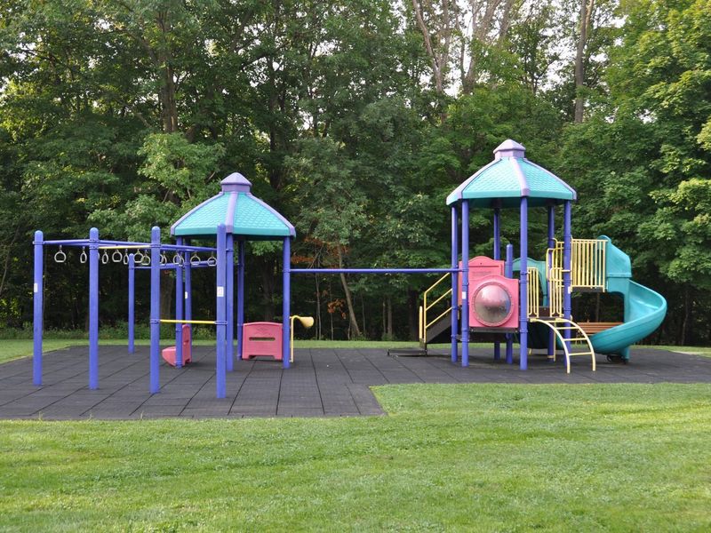
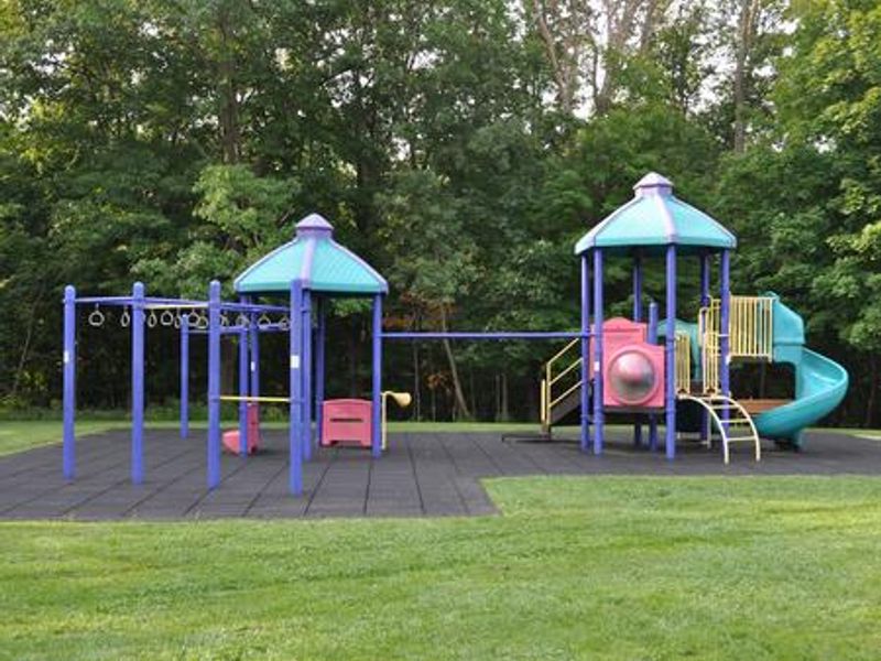
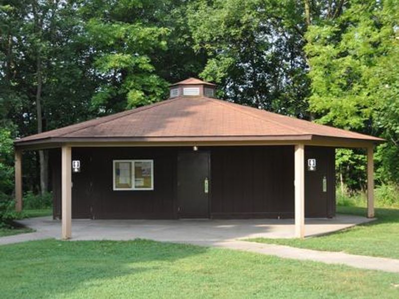
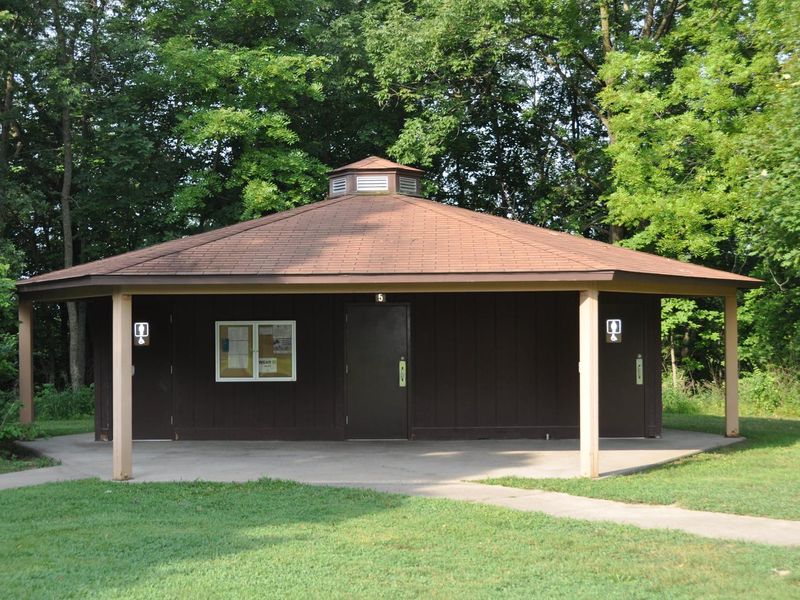
East Overlook Day Use Area is a day-use facility managed by the U.S. Army Corps of Engineers, located on the east side of the Coralville Lake Dam in Johnson County, Iowa. The area sits among a heavily wooded forest of mixed hardwood species and offers two large group picnic shelters with water and electric hookups available for reservation. Amenities include flush toilets, a playground, horseshoe pit, and access to the barrier-free Veterans Trail. The nearby Devonian Fossil Gorge below the dam provides a unique opportunity to explore a 375-million-year-old sea floor with fossil remains of ancient sea life. This is strictly a day-use facility. Overnight camping is not permitted, and all shelters must be cleaned and vacated by sunset. Unreserved shelters are available free of charge on a first-come, first-served basis.
Directions
From I-80 in Iowa City, take Exit 244 toward Dubuque St./North Liberty. Travel north on Dubuque St. for 3 miles and turn right onto West Overlook Rd. NE. Continue 1.1 miles to the second stop sign, then turn right onto Prairie Du Chien Rd. NE. Travel east 0.7 miles across the Coralville Lake Dam. The East Overlook Day Use Area is on the right.
Amenities
| Water | Yes |
| Fires Allowed | — |
| Toilets | Yes |
| Dump Station | — |
| Wifi | — |
| Pets Allowed | — |
| Showers | No |
| Electric Hookups | — |
| Water Hookups | — |
| Sewer Hookups | — |
| Camp Store | — |
| Price | $50 |
Vehicle
| Max RV Length | — |
| Max Trailer Length | — |
| Big Rig Friendly | — |
| Pull Through Sites | No |
Contact
| Phone | +1 (319) 338-3543 |
Cell Service
| AT&T | Yes |
| Verizon | Yes |
| T-Mobile | Yes |
Availability
Photos
Community Posts
No posts yet. Be the first to share your experience!