Meadowview Campground
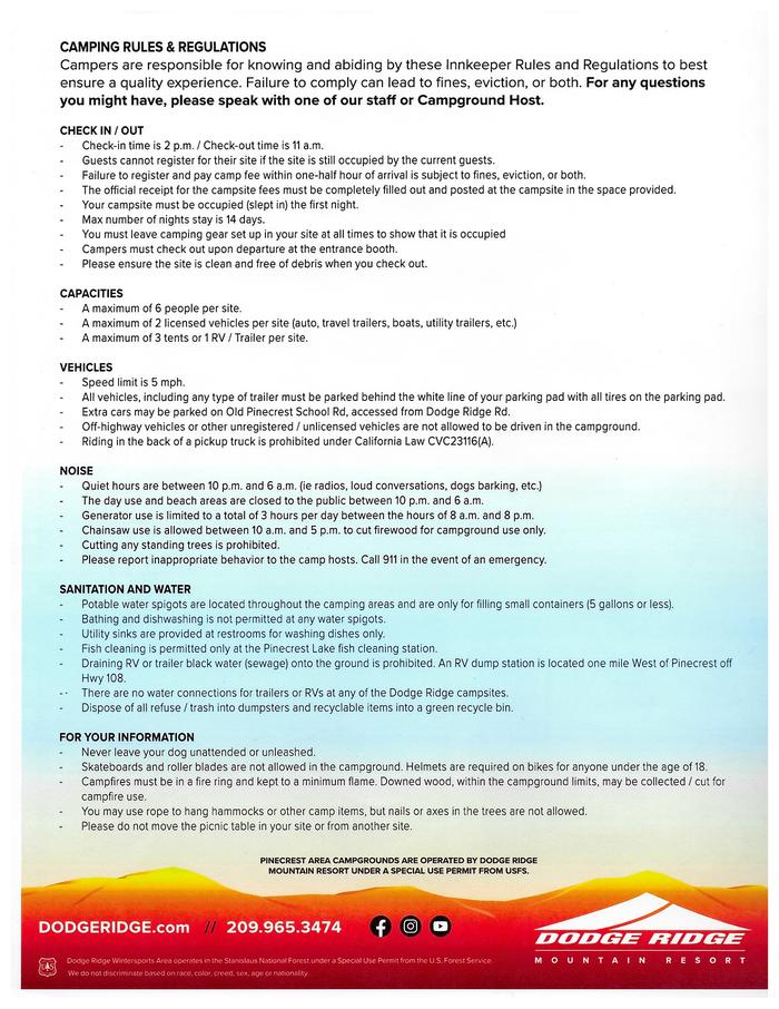
Open for the 2026 season. Beginning Summer 2026, all campsites require advance reservations through Recreation.gov during peak season (Memorial Day through Labor Day). Outside peak season, Loops 100-200 remain first-come, first-served. The campground operates May through October. Maximum 14-day stay limit.
National Forest System Roads
Follow California Vehicle Code on National Forest System Roads
Fireworks and Explosives are always Prohibited
Fireworks and explosives (including explosive targets) are always prohibited on national forest lands. The prohibition of fireworks and exploding targets on national forest system lands is part of a set of permanent fire safety regulations in the Code of Federal Regulations (CFR), listed below.…
Woodcut/PAL Information
For woodcut day/PAL information, please call 209-532-5601
About
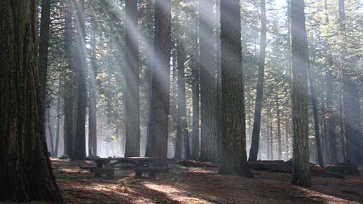
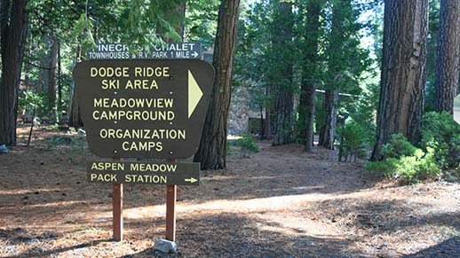
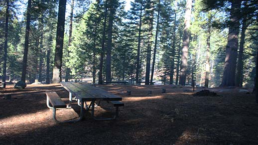
Meadowview Campground is situated in the scenic Pinecrest Basin of the Stanislaus National Forest, approximately 30 miles east of Sonora along Highway 108. At an elevation of 5,600 feet, the campground provides easy access to Pinecrest Lake and the surrounding Sierra Nevada wilderness. The forested setting offers shade and relative privacy across four loops (100-400) with approximately 100 individual campsites. Each site includes a paved parking pad, metal fire ring/stove, and picnic table. Potable water is available from hydrants serving multiple sites, and all restrooms have flush toilets with sinks. The campground accommodates tents, trailers, and RVs, with a maximum of six people, two vehicles, and either three tents or one RV plus one tent per site. Check-in is at 2 PM and checkout at 11 AM, with quiet hours from 10 PM to 6 AM. Pinecrest Lake is within walking distance and offers a swimming beach, boat rentals, fishing, and trailheads for spectacular hiking. A small shopping center, coffee shop, amphitheater with summer movies, and visitor center are located in the Pinecrest Lake area. A dump station is available along Highway 108 for a $10 fee.
Directions
From Sonora, take Highway 108 east for 30 miles. Take the Pinecrest exit onto Pinecrest Lake Road (Dodge Ridge Road) and continue to the campground, located near Pinecrest Campground within the Pinecrest Recreation Area.
Amenities
| Water | Yes |
| Fires Allowed | Yes |
| Toilets | Yes |
| Dump Station | No |
| Wifi | — |
| Pets Allowed | Yes |
| Showers | No |
| Electric Hookups | — |
| Water Hookups | — |
| Sewer Hookups | — |
| Camp Store | No |
| Price | $34 - $38 |
Vehicle
| Max RV Length | — |
| Max Trailer Length | — |
| Big Rig Friendly | — |
| Pull Through Sites | — |
Contact
| Phone | +1 (209) 965-3474 |
Cell Service
| AT&T | None |
| Verizon | Yes |
| T-Mobile | None |
Photos
Community Posts
No posts yet. Be the first to share your experience!