Idlewild
Malheur National Forest
Loading
57%
of Campflare users received a notification for Idlewild
Campalytics™ Beta
Summary
Idlewild Campground is situated along Highway 395 north of Burns, Oregon, providing the perfect space for large gatherings. Visitors can take advantage of various outdoor activities such as camping, picnicking, hiking, mountain biking and more in the Malheur National Forest. There is an accessible group day-use picnic shelter and individual sites for overnight camping available.
Overview
Idlewild Campground is the perfect place for large gatherings in any weather. In sun, rain or snow, there are plenty of ways to enjoy the outdoors while spending time with friends and family.The campground is situated along Highway 395 north of Burns, Oregon. In the summer, it is popular with hikers and mountain bikers. In the winter, visitors can snowmobile and cross-country ski.
Recreation
Idlewild offers opportunities for camping, picnicking, hiking and mountain biking. Devine Summit Trail begins within the campground. Snowmobiling and cross-country skiing bring visitors to the area in the winter.Facilities
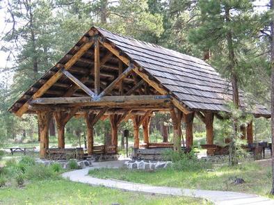
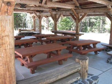
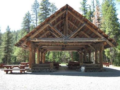
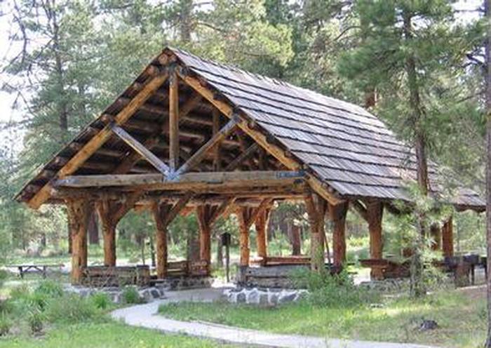
Idlewild contains one accessible, group day-use picnic shelter available for reservations for up to 75 people. It is equipped with picnic tables, a campfire ring and grills. Vault toilets and drinking water are provided. Individual sites for overnight camping are available on a first-come, first-served basis.Natural Features
The campground is situated at an elevation of 5,000 feet in a large stand of Ponderosa pines. The group shelter sits near a meadow within Idlewild Campground. The Malheur National Forest encompasses 1.46 million acres in the Blue Mountains of eastern Oregon. The forest's dramatic landscapes include the Strawberry Mountain Wilderness, with 9,038' Strawberry Mountain, which extends east to west through the heart of the forest, and the Monument Rock Wilderness along the eastern boundary.Nearby Attractions
The campground is located a short drive from Burns, Oregon. There are horse trails and equestrian camping within 10 miles of Idlewild.
Show More ▾
Photos
Campground Matrix
Set alerts at more campgrounds to increase your odds of getting a place to stay! Below is a list of the closest campgrounds supported on Campflare. Or, view all campgrounds in Malheur National Forest.
| Nearby Campgrounds | Distance | Notification Rate |
|
Teepee
Clyde Holliday State Recreation Site
|
31.0mi | — |
|
Main
Clyde Holliday State Recreation Site
|
31.0mi | — |
|
Deer Creek Guard Station Cabin
Malheur National Forest
|
31.5mi | — |
|
Fall Mountain Lookout Cabin
Malheur National Forest
|
34.3mi | 72% |
|
Murderers Creek Guard Station
Malheur National Forest
|
34.9mi | — |
|
Short Creek Guard Station
Malheur National Forest
|
43.7mi | — |