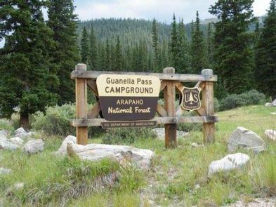
Guanella Pass
Arapaho & Roosevelt National Forests Pawnee Ng
Loading
78%
of Campflare users received a notification for Guanella Pass
Campalytics™ Beta
Summary
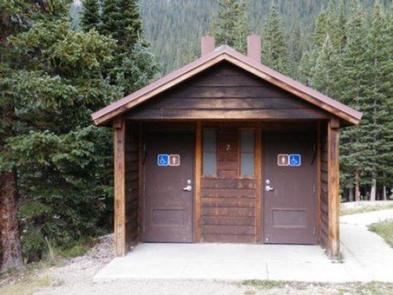
Guanella Pass Campground is located in the Arapaho Roosevelt National Forest, 7 miles south of Georgetown, CO. Visitors can go trout fishing, hike to Silver Dollar Lake, and explore historic Georgetown and several nearby ghost towns. Facilities include 18 sites with picnic tables, fire rings, and charcoal grills. Hand pumps, vault toilets and dumpsters are also provided.
Overview
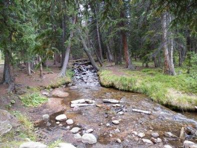
Guanella Pass Campground is located about 7 miles south of Georgetown on the South Fork of Clear Creek on the Guanella Pass Scenic Byway. Located at an elevation of 10,900 feet on the Arapaho Roosevelt National Forest, visitors to the campground can also enjoy hiking and fishing in the area.The Guanella Pass Scenic and Historic Byway follows an old wagon route that linked the mining towns of Georgetown and Grant, Colorado.
Recreation
Visitors can go trout fishing on the South Fork of Clear Creek. Silver Dollar Lake is nearby, but cannot be reached by car. Instead, the Silver Dollar Lake Trail leads hikers above treeline to the scenic lake.Facilities
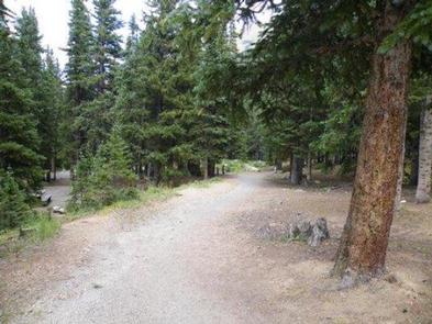
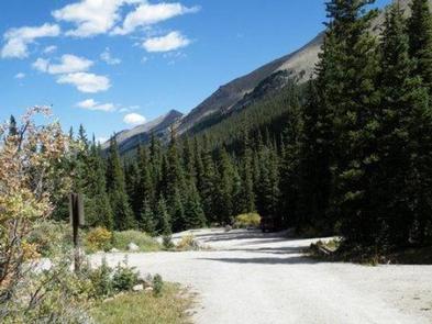
The campground is split into two loops by the county road and South Clear Creek. There are 18 sites in the campground. Eleven are suitable for RV camping and seven are more suitable for tents. Large RVs are not recommended on the byway. Most of the sites are in the open with some tent sites located among some spruce trees. Each site has a tent pad, picnic table, fire ring and charcoal grill. The roads through the campground are gravel. This facility provides hand pumps with potable water, vault toilets and trash dumpsters.Natural Features
The Arapaho and Roosevelt National Forests and Pawnee National Grassland sit along the foothills and Rockies of Colorado. The forests and grassland cover 1.5 million acres and extend north to the Wyoming border, south to Mount Evans and west across the Continental Divide.The area includes mountains, lakes and five scenic byways, designated by Congress for their scenery, wildlife or history, including the highest road in North America. Mount Evans Road, also known as Colorado Highway 5, allows visitors to drive from 10,500' to 14,130' above sea level in just 14 miles.
Nearby Attractions
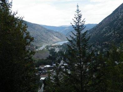
Visitors enjoy touring historic Georgetown, a former mining town of about 1,000 residents. Additional ghost towns dot the region.
Show More ▾
Photos
Campground Matrix
Set alerts at more campgrounds to increase your odds of getting a place to stay! Below is a list of the closest campgrounds supported on Campflare. Or, view all campgrounds in Arapaho & Roosevelt National Forests Pawnee Ng.
| Nearby Campgrounds | Distance | Notification Rate |
|
West Chicago Creek
Arapaho & Roosevelt National Forests Pawnee Ng
|
5.5mi | 79% |
|
Geneva Park
Psicc
|
5.9mi | 76% |
|
Burning Bear
Psicc
|
6.8mi | 73% |
|
Echo Lake
Arapaho & Roosevelt National Forests Pawnee Ng
|
7.1mi | 77% |
|
Handcart
Psicc
|
10.1mi | 79% |
|
Hall Valley
Psicc
|
10.2mi | 81% |