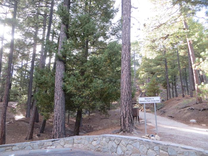
Showers Point Group Site
Coronado National Forest
Loading
Summary
Showers Point Group Site, located in the Coronado National Forest, provides a scenic overlook of Palisade Canyon and is a great destination for groups wanting to relax in the shade of tall ponderosa pines and take part in activities such as hiking, mountain biking, fishing and scenic drives. Visitors can also explore the nearby attractions of Catalina Highway, Saguaro National Park, Sabino Canyon and Colossal Cave.
Overview
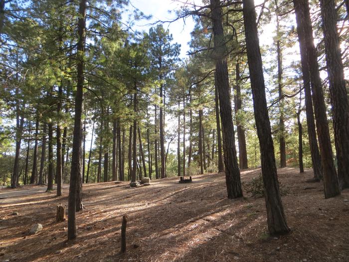
The cool shade of tall ponderosa pines and an overlook of Palisade Canyon from the campgrounds edge make Showers Point Group Site a popular place for groups to spend a weekend or an afternoon. Visitors can relax in shaded campsites, picnic at nearby Rose Canyon, hike and mountain bike on nearby trails or take a scenic drive on Catalina Highway.Recreation
Within easy walking distance from Showers Point is one of the most scenic overlooks in the Santa Catalinas. From this towering bluff visitors can see the lower slopes of the Santa Catalina Range and the Santa Cruz Valley stretching toward Mexico. Tall, pyramid-shaped Mt. Wrightson of the Santa Rita Mountains stands prominent on the horizon.Visitors enjoy hiking through the Santa Catalina backcountry, via the Palisade Trail that departs near the campground. The trail drops down the southwestern slopes of the mountain range to the popular Sabino Canyon Recreation Area.
Fishing is also available at the nearby six-acre Rose Canyon Lake. A day-use fee is applicable at Rose Canyon
Facilities
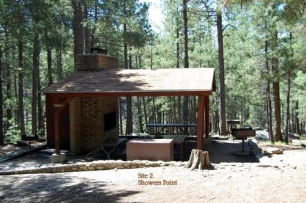
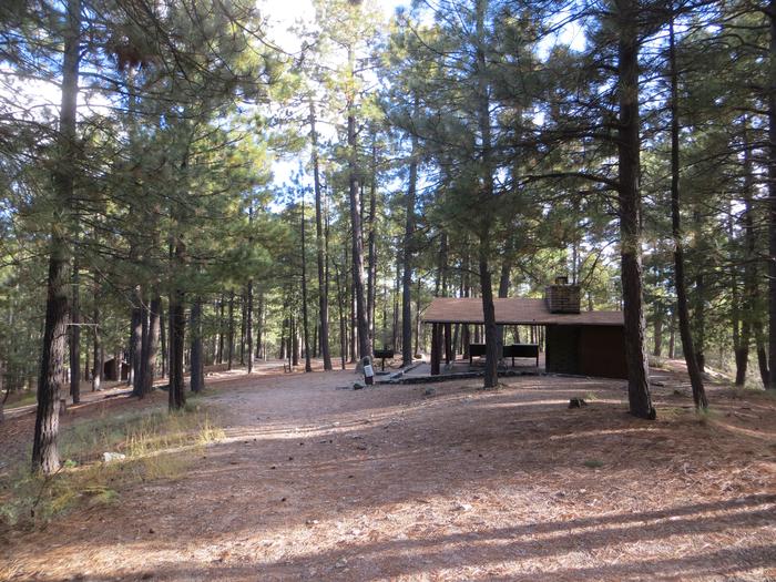
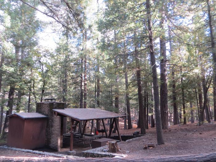
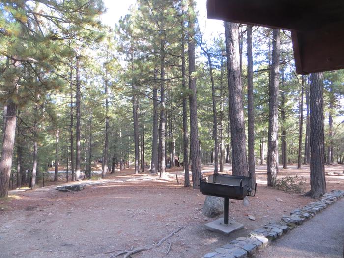
The three group campsites at Showers Point are well spread out over this spacious location and include large, leveled tent pads and picnic shelters. Each site is tent-only for up to 25 guests. The facility is equipped with water faucets and toilets.Natural Features
Showers Point Group Campground sits high on the slopes of the Santa Catalina Mountains at 7,700 feet. Because of its elevation, it can be much cooler than the lower-elevation campgrounds in the area. The campsites are spacious and spread out among stands of big ponderosa pines and clusters of Gambel oak.The Coronado National Forest covers 1.78 million acres of southeastern Arizona and southwestern New Mexico. Elevations range from 3,000 to 10,720 feet in 12 widely scattered mountain ranges, or "sky islands," that rise dramatically from the desert floor, supporting biologically diverse plant communities.
contact_info
For facility specific information, please call (520) 314-0069.Nearby Attractions
Catalina Highway, also known as General Hitchcock Highway and Sky Island Scenic Byway, is the only paved road that leads to the upper reaches of Mt. Lemmon and the Santa Catalina Range. It is one of the most scenic highways in the southwest and provides a popular day trip.Other notable attractions include Saguaro National Park, Sabino Canyon and Colossal Cave.
Show More ▾
Photos
Campground Matrix
Set alerts at more campgrounds to increase your odds of getting a place to stay! Below is a list of the closest campgrounds supported on Campflare. Or, view all campgrounds in Coronado National Forest.
| Nearby Campgrounds | Distance | Notification Rate |
|
Palisades Ranger Residence Cabin
Coronado National Forest
|
0.3mi | — |
|
Whitetail
Coronado National Forest
|
0.7mi | 50% |
|
Rose Canyon
Coronado National Forest
|
1.9mi | 64% |
|
Molino
Coronado National Forest
|
5.3mi | — |
|
Sabino Canyon Recreation Area Cactus Ramada 2
Coronado National Forest
|
8.3mi | 63% |
|
Sabino Canyon Recreation Area Cactus Ramada 1
Coronado National Forest
|
8.3mi | — |