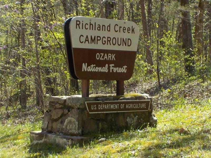
Richland Creek Campground
The campground is listed as open year-round. No potable water is available November through March. First-come, first-served only with no advance reservations. The availability system currently shows closed status, which may indicate a temporary closure or reflect the non-reservable FCFS nature of the campground.
Tornado Watch issued June 7 at 2:33PM CDT until June 7 at 7:00PM CDT by NWS Little Rock AR
THE NATIONAL WEATHER SERVICE HAS ISSUED TORNADO WATCH 284 IN EFFECT UNTIL 7 PM CDT THIS EVENING FOR THE FOLLOWING AREAS IN ARKANSAS THIS WATCH INCLUDES 4 COUNTIES IN NORTH CENTRAL ARKANSAS BOONE MARION NEWTON SEARCY THIS INCLUDES THE CITIES OF BULL SHOALS, FLIPPIN, HARRISON, JASPER, LESLIE, MARSHALL, SUMMIT, WESTERN GROVE, AND YELLVILLE.
About
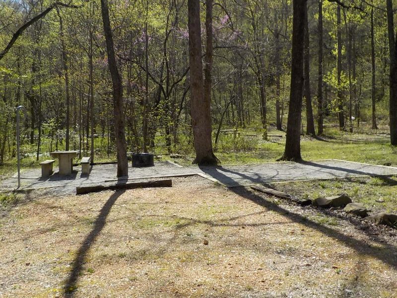
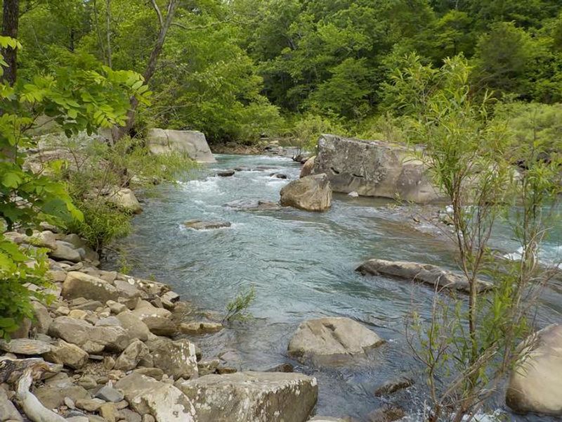
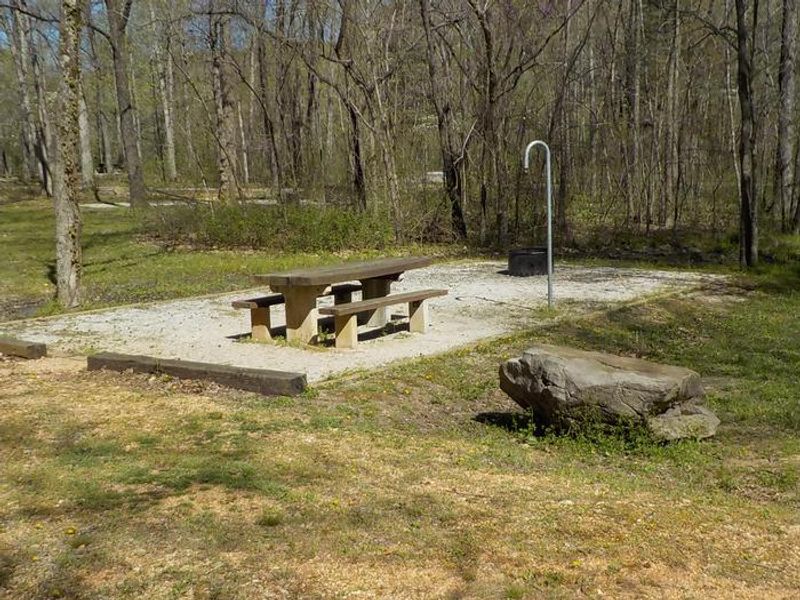
Richland Creek Campground sits at the edge of the Richland Creek Wilderness in the Ozark-St. Francis National Forest, offering direct access to one of Arkansas's most scenic wild rivers. The 11-site campground serves as a basecamp for exploring the 11,801-acre wilderness area, which was established by the 1984 Arkansas Wilderness Act and contains dramatic waterfalls, rock formations, and forested bluffs characteristic of the Boston Mountains. The campground is primitive with vault toilets but no potable water. Campers must bring their own drinking water and pack out all trash. Sites cost $10 per night and are available strictly first-come, first-served; there are no reservations. Once on-site, payment may be possible via QR code using the Recreation.gov mobile app if cellular service permits. Access requires traveling 9 miles on Forest Service Road 1205, a rough gravel road that makes the campground unsuitable for camping trailers or large RVs. The remote setting rewards tent campers and those with high-clearance vehicles who seek solitude and direct wilderness access.
Directions
From Russellville, take Arkansas Highway 7 north for 37 miles to Pelsor. Turn right (east) on Arkansas Highway 16 and go 10 miles. Turn left (north) on Forest Service Road 1205 (gravel), located about 1.5 miles south of Ben Hur. Take FS Road 1205 north 9 miles to Richland Creek Campground.
Amenities
| Water | No |
| Fires Allowed | — |
| Toilets | Yes |
| Dump Station | No |
| Wifi | No |
| Pets Allowed | — |
| Showers | No |
| Electric Hookups | — |
| Water Hookups | — |
| Sewer Hookups | — |
| Camp Store | No |
| Price | $10 |
Vehicle
| Max RV Length | — |
| Max Trailer Length | — |
| Big Rig Friendly | No |
| Pull Through Sites | No |
Contact
| Phone | +1 (479) 284-3150 |
Cell Service
| AT&T | None |
| Verizon | None |
| T-Mobile | None |
Availability
Photos
Community Posts
No posts yet. Be the first to share your experience!