Tyee Lookout
Closed for the season. The lookout is accessible by vehicle mid-June through mid-October, weather and road conditions permitting. Reservations required through Recreation.gov with a 2-night minimum stay.
Fire Weather Watch issued July 30 at 10:44AM PDT until August 1 at 11:00PM PDT by NWS Spokane WA
...FIRE WEATHER WATCH FOR STRONG WINDS AND LOW HUMIDITY SATURDAY ACROSS THE INLAND NORTHWEST... * Affected Area: Northern and Central Idaho Panhandle (Zone 101), East Washington Central Cascades (Zone 696), East Portion of North Cascades National Park/Lake Chelan National Recreation Area (Zone 697), East Washington North Cascades (Zone 698), Okanogan Highlands and Kettle Mountains (Zone 699), Selkirk Mountains of Northeast Washington (Zone 700), Foothills of Northeast Washington (Zone 701), Colville Reservation (Zone 702), Okanogan Valley (Zone 703), Methow Valley (Zone 704), Foothills of Central Washington Cascades (Zone 705), Waterville Plateau (Zone 706), Western Columbia Basin (Zone 707), Eastern Columbia Basin -Palouse -Spokane Area (Zone 708) and Lower Palouse -Snake River (Zone 709). * Winds: West/Southwest winds 15 to 30 mph with gusts of 30 to 50 mph. Highest wind speeds over the Waterville Plateau, Columbia Basin, West Plains, Blue Mountains, and Lewiston-Clarkston Valley. * Relative Humidities: 15 to 25 percent, except 30 to 45 percent near the Cascade crest. * Impacts: Strong winds, warm temperatures, and low humidity may result in extreme fire behavior and rapid fire growth.
Air Quality Alert issued July 30 at 11:57AM PDT by NWS Spokane WA
An Air Quality Alert has been issued by the following agencies: Washington Department of Ecology Colville Confederated Tribes An Air Quality Alert has been issued for Asotin, Chelan, Douglas, Ferry, Okanogan, and Stevens Counties until further notice due to current and expected wildfire smoke from regional fires. Areas immediately downwind of active and emerging fires in Washington and Oregon may reach Unhealthy levels of particulate matter (PM2.5). When air quality is unhealthy, everyone should reduce exposure. Limit time outside, avoid strenuous outdoor activity, and follow tips for cleaner indoor air.
About
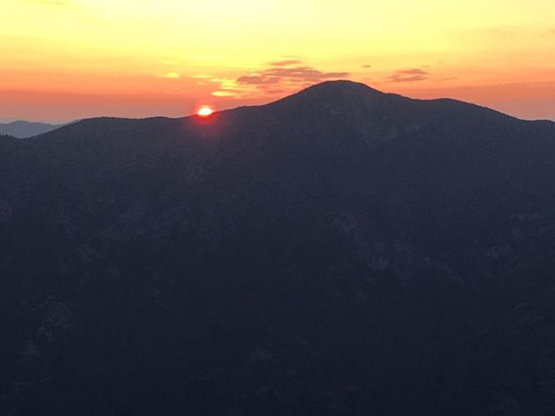
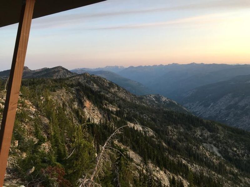
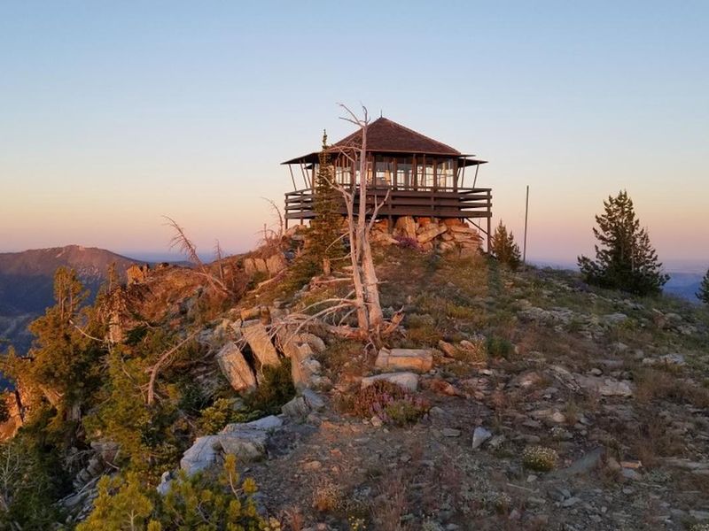
Tyee Lookout sits atop a rocky outcrop at 6,654 feet in the Entiat Ranger District of the Okanogan-Wenatchee National Forest. Built in the 1950s for fire detection, the lookout served Forest Service personnel until the 1990s and has since been converted to a rental cabin. The 16x16 structure sleeps four on foam mattresses and offers LED lighting, a bench, and basic cleaning supplies. A portable toilet is located 30 yards away behind a privacy screen. This is a challenging destination. The final 3.6 miles of Forest Road 5713 are narrow, steep, sandy, and rocky with two rock ledges requiring a high-clearance 4WD vehicle with quality tires. Alternatively, guests can park at the 0.6-mile mark and hike the remaining distance. The exposed summit is frequently windy and significantly cooler than the valleys below, with steep drop-offs on two sides. Guests must bring all water for drinking, cooking, and washing, as well as bedding, cookware, flashlights, first aid supplies, and trash bags for pack-out. The surrounding area offers hiking and biking on the Tyee Ridge and Billy Ridge trails, and the remote location provides excellent stargazing. The rocky outcrop is home to whitebark pine, a declining species deserving protection.
Directions
From the junction of Entiat River Road and Highway 97A, drive 10.1 miles on Entiat River Road. Turn left on County Road 119A and cross the Entiat River. Drive 2.1 miles to the junction of FS Road 5700 and FS Road 5800, continue straight on FS Road 5700. The road becomes single-lane paved and climbs steeply. Drive 13.9 miles to the unmarked junction with FS Road 5713 and turn right. Without a high-clearance vehicle, park at the 0.6-mile mark near the large parking area and pine tree. The final 3.6 miles to the lookout require a high-clearance 4WD vehicle with good tires.
Location
Amenities
| Water | No |
| Fires Allowed | No |
| Toilets | Yes |
| Dump Station | No |
| Wifi | No |
| Pets Allowed | No |
| Showers | No |
| Electric Hookups | — |
| Water Hookups | — |
| Sewer Hookups | — |
| Camp Store | No |
| Price | $95 |
Vehicle
| Max RV Length | — |
| Max Trailer Length | — |
| Big Rig Friendly | No |
| Pull Through Sites | No |
Contact
| Phone | +1 (509) 860-4267 |
Cell Service
| AT&T | None |
| Verizon | None |
| T-Mobile | None |
Availability
Photos

Community Posts
No posts yet. Be the first to share your experience!