Wade Lake
Open mid-May through mid-September, weather dependent. Reservations through Recreation.gov. Drinking water available May through September. Garbage service operates May 15 to September 15; pack out trash outside those dates. Food storage order in effect requiring bear-proof containers.
Northern Region Camping & Target Restrictions, Pallet Prohibition
This order defines the maximum length of occupation at a single location or cumulatively at any number of locations within a calendar year, within the states of Montana, North Dakota, South Dakota, and Idaho
Weed Free Forage & Mulch Products Order for the Northern Region
It is illegal to possess, store or transport straw, hay, grain, seed or other forage or mulch products on Forest Service lands without documentation that the product is certified as “weed free” by a state certification process that meets or exceeds the North American Weed Free Forage standards.
R1-2023-02 - NCDE Food and Wildlife Attractant Storage Order
Northern Continental Divide Ecosystem Food/Wildlife Attractant Storage Order for the Flathead, Lolo, Kootenai, Helena-Lewis and Clark, and Beaverhead-Deerlodge National Forests within the Northern Continental Divide Ecosystem.
About
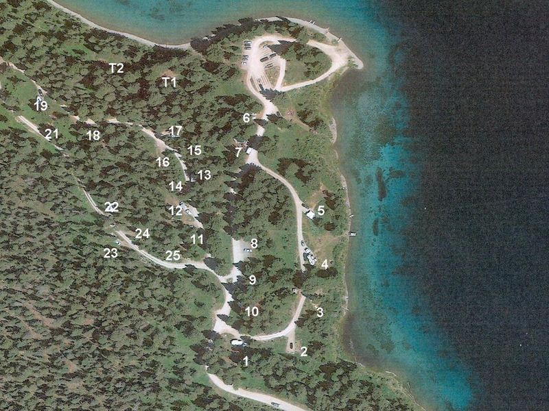
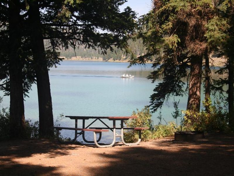
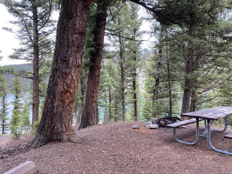
Wade Lake Campground is located in southwestern Montana at the southern end of the Gravelly Range, about 35 miles west of Yellowstone National Park. The spring-fed 200-acre lake is known for its beautiful clear aquamarine water and offers fishing for rainbow and brown trout, boating, canoeing, and swimming. The campground sits on a steep hillside in dense Douglas Fir forest, with many sites having limited flat tent space outside the parking driveway. The campground includes 25 sites with two group sites and two walk-in tent sites. Each site has a picnic table and fire ring. Five vault toilets and drinking water taps are provided throughout the two camping loops. Water is available May through September. An undeveloped natural-surface boat launch provides lake access with a no-wake speed limit in effect. Boats can also be rented at nearby Wade Lake Resort. Reservations are made through Recreation.gov with staggered booking windows: most sites open six months in advance, sites 6, 13, 17, 20, and 25 open two weeks in advance, and sites 2, 9, 14, and 22 open four days in advance. The campground enforces a food storage order requiring bear-proof containers. Garbage service operates May 15 through September 15; pack out trash outside those dates. Cellular service is unavailable at the campground but may be found 1.5 miles away near the forest boundary.
Directions
Located about 37 miles south of Ennis on Highway 287. Turn west at Wade and Cliff Lakes signs, then take Forest Road 241 west for 5 miles.
Amenities
| Water | Yes |
| Fires Allowed | Yes |
| Toilets | Yes |
| Dump Station | — |
| Wifi | No |
| Pets Allowed | — |
| Showers | No |
| Electric Hookups | — |
| Water Hookups | — |
| Sewer Hookups | — |
| Camp Store | — |
| Price | $15 - $30 |
Vehicle
| Max RV Length | 24ft |
| Max Trailer Length | 24ft |
| Big Rig Friendly | No |
| Pull Through Sites | No |
Contact
| Phone | +1 (406) 682-4253 |
Cell Service
| AT&T | None |
| Verizon | Yes |
| T-Mobile | None |
Useful Links
| View on Recreation.gov | |
| USFS - Wade Lake Campground |
Availability
Photos
Community Posts
No posts yet. Be the first to share your experience!